TopoQuest Logo
Do you find TopoQuest useful?
Help keep TopoQuest running and adding new maps/features by donating!
Bitcoin:  19c7KJd3qBynnjoSw5npx9KScwjBe4ifkT
Litecoin:  LXs6TkuXGGXo1vDsWCkWVdjQX94eUKd6ui
Home View Maps Find Maps Find Places Resources & Links


Hamburg, Connecticut Topographic Map

USGS Map Title: Hamburg, CT
USGS Map MRC: 41072D3
DRG (GeoTIFF) Download: o41072d3.tif


Neighboring USGS Topographic Map Quads:


  Moodus, CT  
41072E4
 

  Colchester, CT  
41072E3
 

  Fitchville, CT  
41072E2
 

  Deep River, CT  
41072D4
 

  Hamburg, CT  
41072D3
 

  Palmertown, CT  
41072D2
 

  Essex, CT  
41072C4
 

  Old Lyme, CT  
41072C3
 

  Niantic, CT  
41072C2


Map MRC Location:

N42°
W73°
N42°
W72°
H8 H7 H6 H5 H4 H3 H2 H1
G8 G7 G6 G5 G4 G3 G2 G1
F8 F7 F6 F5 F4 F3 F2 F1
E8 E7 E6 E5 E4 E3 E2 E1
D8 D7 D6 D5 D4 D3 D2 D1
C8 C7 C6 C5 C4 C3 C2 C1
B8 B7 B6 B5 B4 B3 B2 B1
A8 A7 A6 A5 A4 A3 A2 A1
N41°
W73°
N41°
W72°

Hamburg, CT USGS 1:24K Topographic Map Preview:
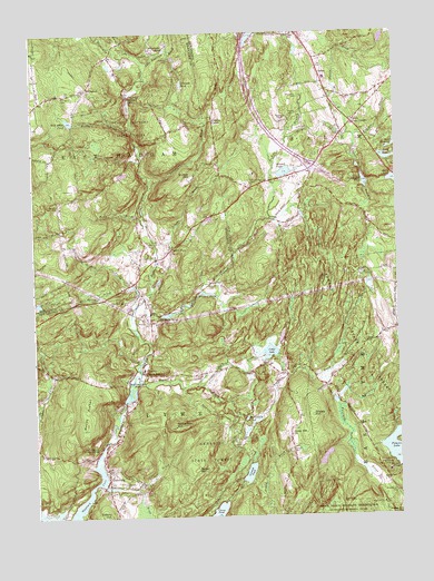
Hamburg, CT USGS Topographic Map
Click on map above to begin viewing in our Map Viewer.

This topographic map contains these locations and features:
Feature Name Type Latitude Longitude GNIS ID View Map
Alexander PondLakeN41.4955°W72.3287°205059View Map
Beaver BrookStreamN41.4073°W72.3426°205367View Map
Beebe CemeteryCemeteryN41.4114°W72.2889°205405View Map
Beebe CornerLocaleN41.4118°W72.2906°1930619View Map
Blackwells PondLakeN41.4005°W72.3026°205578View Map
Bond ReservoirReservoirN41.4712°W72.2501°205636View Map
Brown HillSummitN41.3870°W72.3201°205767View Map
Burnhams BrookStreamN41.4598°W72.3342°205853View Map
Candlewood LedgeCliffN41.3929°W72.3534°206011View Map
Cedar HillSummitN41.4182°W72.3054°1930701View Map
Cedar LakeLakeN41.4173°W72.2940°206084View Map
Cedar Pond BrookStreamN41.4090°W72.3173°206093View Map
Chapman FallsFallsN41.4834°W72.3406°206185View Map
Chapman RidgeRidgeN41.4348°W72.2756°206190View Map
Congregational Church of Salem CemeteryCemeteryN41.4833°W72.2665°1930762View Map
Coult CemeteryCemeteryN41.4144°W72.2954°206478View Map
Cranberry Meadow BrookStreamN41.4290°W72.3401°206498View Map
Crowley CornerPopulated PlaceN41.4773°W72.3112°212439View Map
Devils Hopyard FieldAirportN41.4440°W72.3390°213036View Map
Devils Hopyard State ParkParkN41.4762°W72.3412°206676View Map
Dodson PondReservoirN41.3902°W72.2760°1770500View Map
Dodson Pond DamDamN41.3918°W72.2745°1770499View Map
Dolbia HillSummitN41.4632°W72.3195°206715View Map
E A Whitford PondReservoirN41.4216°W72.2900°1771008View Map
E A Whitford Pond DamDamN41.4201°W72.2912°1771007View Map
Early BrookStreamN41.4945°W72.3384°206777View Map
East Branch Eightmile RiverStreamN41.4312°W72.3367°206784View Map
Ed Bills PondLakeN41.4276°W72.3283°206891View Map
Falls BrookStreamN41.3751°W72.3362°207018View Map
Fetske Seaplane BaseAirportN41.3751°W72.3740°213047View Map
Foxtown CemeteryCemeteryN41.4934°W72.3271°207190View Map
Fraser BrookStreamN41.4737°W72.2659°207201View Map
Gillett CemeteryCemeteryN41.3915°W72.2866°207304View Map
Grassy HillSummitN41.4009°W72.2798°207415View Map
Grassy Hill (historical)Populated PlaceN41.3962°W72.2879°1930938View Map
Grassy Hill ChurchChurchN41.3959°W72.2870°207418View Map
Griffin CemeteryCemeteryN41.4114°W72.3199°207517View Map
HamburgPopulated PlaceN41.3845°W72.3501°207627View Map
Hamburg BridgeBridgeN41.3943°W72.3506°1930986View Map
Hamburg Bridge Historic DistrictParkN41.3943°W72.3506°1930987View Map
Harris BrookStreamN41.4726°W72.2865°207682View Map
Hedge BrookStreamN41.4507°W72.3351°207766View Map
Honey HillSummitN41.3948°W72.3640°1931007View Map
Horse PondLakeN41.4618°W72.2508°207964View Map
Jewitt CornerPopulated PlaceN41.4357°W72.3404°1923923View Map
Lake Hayward BrookStreamN41.4923°W72.3354°208354View Map
Lyme Ambulance AssociationBuildingN41.3809°W72.3494°2660928View Map
Lyme Consolidated SchoolSchoolN41.4134°W72.3376°1931157View Map
Lyme Public LibraryBuildingN41.4134°W72.3370°1931160View Map
Lyme Town HallBuildingN41.4134°W72.3370°1931161View Map
Lyme Volunteer Fire DepartmentBuildingN41.3808°W72.3493°2419966View Map
Malt House BrookStreamN41.4345°W72.3412°208686View Map
MillingtonPopulated PlaceN41.4859°W72.3554°212506View Map
Millington CemeteryCemeteryN41.4842°W72.3646°208936View Map
Mitchell PondLakeN41.4639°W72.2881°208975View Map
Mitchell Pond DamDamN41.4645°W72.2867°1771325View Map
Morgan CemeteryCemeteryN41.4785°W72.2859°209040View Map
Moulsons PondLakeN41.4103°W72.3389°209071View Map
Mount ArcherSummitN41.4034°W72.3584°205116View Map
Muddy BrookStreamN41.4762°W72.3390°209120View Map
Nehantic State ForestForestN41.4193°W72.2609°209206View Map
Nickerson HillSummitN41.3982°W72.3267°209286View Map
North LymePopulated PlaceN41.4120°W72.3367°209361View Map
North PlainLocaleN41.4443°W72.3267°209368View Map
North Plain CemeteryCemeteryN41.4456°W72.3343°209369View Map
Norwich PondLakeN41.3862°W72.3018°209411View Map
Pleasant View CemeteryCemeteryN41.4258°W72.3340°209850View Map
Powers LakeReservoirN41.3932°W72.2503°209973View Map
Powers Lake DamDamN41.3873°W72.2504°1770493View Map
SalemPopulated PlaceN41.4904°W72.2754°212562View Map
Salem CemeteryCemeteryN41.4997°W72.2851°210604View Map
Salem Congregational ChurchChurchN41.4918°W72.2762°1931503View Map
Salem Elementary SchoolSchoolN41.4884°W72.2737°1931504View Map
Salem Four CornersLocaleN41.4770°W72.2642°210606View Map
Salem Historical Society BuildingBuildingN41.4862°W72.2751°1931505View Map
Salem Post OfficePost OfficeN41.4748°W72.2626°1931506View Map
Salem Resident State Patrol OfficeBuildingN41.4928°W72.2766°2754679View Map
Salem Town HallBuildingN41.4926°W72.2765°1931507View Map
Shingle Mill BrookStreamN41.4734°W72.2637°210830View Map
Shingle Mill PondLakeN41.4613°W72.2608°210832View Map
Shingle Mill Pond DamDamN41.4618°W72.2604°1771331View Map
Sisson CemeteryCemeteryN41.4348°W72.3148°210882View Map
Square RanchLocaleN41.4773°W72.2881°211114View Map
Sterling CemeteryCemeteryN41.3809°W72.3378°211161View Map
Sterling CityPopulated PlaceN41.3837°W72.3392°1931556View Map
Strongs BrookStreamN41.4420°W72.3317°211262View Map
Tater HillSummitN41.4601°W72.3612°1924133View Map
Tater Hill CemeteryCemeteryN41.4556°W72.3662°211364View Map
Tiffany HillSummitN41.3751°W72.3506°211467View Map
Tisdale BrookStreamN41.3823°W72.3398°211476View Map
Town of LymeCivilN41.3965°W72.3438°213453View Map
Town of SalemCivilN41.4853°W72.2663°213499View Map
Urbanik PondLakeN41.4871°W72.3231°211711View Map
Wagner PondLakeN41.4327°W72.3164°211760View Map
Wheatfield RidgeRidgeN41.4812°W72.2720°1931711View Map
Whistletown CemeteryCemeteryN41.3805°W72.2516°212069View Map
Whittlesey CemeteryCemeteryN41.4832°W72.2829°212106View Map
Will Cone PondReservoirN41.4775°W72.3619°212135View Map
Witch Meadow PondReservoirN41.4990°W72.2996°1771454View Map
Woodbridge CemeteryCemeteryN41.4610°W72.2997°212236View Map
Yale Engineering CampLocaleN41.3865°W72.2537°212299View Map
Zemko PondReservoirN41.4982°W72.2543°1770916View Map
Zemko Pond DamDamN41.4968°W72.2562°1770915View Map

Note: Coordinates in the location and feature list above are referenced to NAD83 datum.


Copyright (C) 2008-2025 Ryan Niemi / Sunset Dynamics ... All Rights Reserved