TopoQuest Logo
Do you find TopoQuest useful?
Help keep TopoQuest running and adding new maps/features by donating!
Bitcoin:  19c7KJd3qBynnjoSw5npx9KScwjBe4ifkT
Litecoin:  LXs6TkuXGGXo1vDsWCkWVdjQX94eUKd6ui
Home View Maps Find Maps Find Places Resources & Links


Fitchville, Connecticut Topographic Map

USGS Map Title: Fitchville, CT
USGS Map MRC: 41072E2
DRG (GeoTIFF) Download: o41072e2.tif


Neighboring USGS Topographic Map Quads:


  Columbia, CT  
41072F3
 

  Willimantic, CT  
41072F2
 

  Scotland, CT  
41072F1
 

  Colchester, CT  
41072E3
 

  Fitchville, CT  
41072E2
 

  Norwich, CT  
41072E1
 

  Hamburg, CT  
41072D3
 

  Palmertown, CT  
41072D2
 

  Uncasville, CT  
41072D1


Map MRC Location:

N42°
W73°
N42°
W72°
H8 H7 H6 H5 H4 H3 H2 H1
G8 G7 G6 G5 G4 G3 G2 G1
F8 F7 F6 F5 F4 F3 F2 F1
E8 E7 E6 E5 E4 E3 E2 E1
D8 D7 D6 D5 D4 D3 D2 D1
C8 C7 C6 C5 C4 C3 C2 C1
B8 B7 B6 B5 B4 B3 B2 B1
A8 A7 A6 A5 A4 A3 A2 A1
N41°
W73°
N41°
W72°

Fitchville, CT USGS 1:24K Topographic Map Preview:
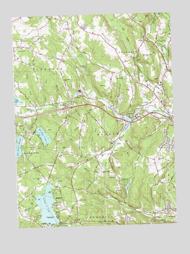
Fitchville, CT USGS Topographic Map
Click on map above to begin viewing in our Map Viewer.

This topographic map contains these locations and features:
Feature Name Type Latitude Longitude GNIS ID View Map
Austin BrookStreamN41.5434°W72.1904°205159View Map
Avery CornerPopulated PlaceN41.5990°W72.2109°212412View Map
Ayers MountainSummitN41.6230°W72.1461°205179View Map
Bargy LedgesSummitN41.5195°W72.1681°1930606View Map
BargytownPopulated PlaceN41.5126°W72.1651°1930607View Map
Bashon HillSummitN41.5612°W72.1992°205294View Map
Bear HillSummitN41.5343°W72.1701°205341View Map
Bentley BrookStreamN41.5637°W72.1317°205449View Map
Birchard Plain (historical)LocaleN41.6129°W72.1342°1930634View Map
Bishop PondReservoirN41.5292°W72.1742°205530View Map
Blue HillSummitN41.5848°W72.1792°205593View Map
Blue Slope Country MuseumBuildingN41.5879°W72.1734°1930641View Map
Bourn HillSummitN41.6226°W72.2120°205655View Map
Bozrah Center Congregational ChurchChurchN41.5565°W72.1648°1930648View Map
Bozrah Rural CemeteryCemeteryN41.5705°W72.1749°1930646View Map
Bozrah StreetLocaleN41.5493°W72.1715°205663View Map
Bozrah Town HallBuildingN41.5632°W72.1587°1930649View Map
Bozrah Volunteer Fire Company Station 26BuildingN41.5639°W72.1589°2419983View Map
Brush HillSummitN41.5798°W72.1567°205780View Map
Camp Cadaho TohaciLocaleN41.5123°W72.2209°205939View Map
Camp Cadaho Tohaci (historical)LocaleN41.5143°W72.2198°1930685View Map
Camp Juanita AdajuanLocaleN41.5098°W72.2201°205956View Map
Camp Juanita Adajuan (historical)LocaleN41.5104°W72.2212°1930686View Map
Camp MooweenLocaleN41.5565°W72.2259°1930687View Map
Camp MooweenLocaleN41.5559°W72.2242°205969View Map
Camp OdetahLocaleN41.5593°W72.1581°205970View Map
Camp Odetah (historical)LocaleN41.5593°W72.1587°1930690View Map
Camp TadmaLocaleN41.5215°W72.1640°205980View Map
Camp TrupinLocaleN41.5012°W72.2262°205985View Map
Camp WakenahLocaleN41.5020°W72.2287°1930691View Map
Camp WetonawLocaleN41.5095°W72.2326°205991View Map
Camp WinnapawLocaleN41.5132°W72.2340°205992View Map
Camp WinnepawLocaleN41.5090°W72.2323°1930692View Map
Dark SwampSwampN41.5370°W72.1523°206599View Map
Deep RiverStreamN41.5709°W72.2362°206651View Map
Deep River Reservoir DamDamN41.5540°W72.2445°1770861View Map
Driscoll BrookStreamN41.5670°W72.1365°206737View Map
Fernwood PlaygroundLocaleN41.5479°W72.1281°1930850View Map
Fields Memorial Elementary SchoolSchoolN41.5632°W72.1540°1930852View Map
FitchvillePopulated PlaceN41.5648°W72.1540°207090View Map
Fitchville Baptist ChurchChurchN41.5640°W72.1548°1930868View Map
Fitchville PondReservoirN41.5569°W72.1623°207091View Map
Fitchville Pond DamDamN41.5637°W72.1551°1771177View Map
Four-H Club CampLocaleN41.5890°W72.1648°207168View Map
Fox CemeteryCemeteryN41.5063°W72.2359°1930884View Map
FranklinPopulated PlaceN41.6090°W72.1459°212462View Map
Franklin Congregational ChurchChurchN41.6093°W72.1462°1930888View Map
Franklin StationLocaleN41.5987°W72.1529°207200View Map
Franklin Town HallBuildingN41.6118°W72.1462°1930895View Map
Gager FieldAirportN41.5648°W72.1973°213015View Map
Gardner BrookStreamN41.5545°W72.1631°207249View Map
Gardner CemeteryCemeteryN41.5147°W72.2018°207252View Map
Gardner LakeLakeN41.5122°W72.2265°207253View Map
Gardner Lake Airport (historical)AirportN41.5090°W72.2441°213024View Map
Gardner Lake DamDamN41.5107°W72.2267°1771181View Map
Gardner Lake ParkParkN41.5026°W72.2317°1930916View Map
Gardner Lake Volunteer Fire Company Station 27BuildingN41.5098°W72.2489°1930918View Map
Gardner-Bulkeley CemeteryCemeteryN41.5151°W72.2018°1930915View Map
Gillette BrookStreamN41.5701°W72.2262°207305View Map
GilmanPopulated PlaceN41.5770°W72.1992°212464View Map
Gilman PondReservoirN41.5801°W72.1995°1771452View Map
Gilman Post OfficePost OfficeN41.5790°W72.1974°1930925View Map
Goldmine BrookStreamN41.5037°W72.1345°207345View Map
Goshen BrookStreamN41.5709°W72.2306°207375View Map
Goshen CemeteryCemeteryN41.5996°W72.2476°207376View Map
Goshen ChurchChurchN41.5962°W72.2342°207378View Map
Goshen HillSummitN41.6070°W72.2434°207380View Map
Hinckley BrookStreamN41.6134°W72.2184°207852View Map
Hopemead State ParkParkN41.5173°W72.2176°1931008View Map
Hoxie BrookStreamN41.6059°W72.2029°207990View Map
Interchange 22CrossingN41.5701°W72.2087°1931029View Map
Johnnycake BrookStreamN41.5787°W72.1345°1931071View Map
Johnson CemeteryCemeteryN41.5721°W72.1744°208182View Map
Kahn BrookStreamN41.5665°W72.1709°208217View Map
Kahn PondsLakeN41.5873°W72.1629°208218View Map
Lake MarieReservoirN41.5418°W72.1379°1770572View Map
Lake Marie DamDamN41.5418°W72.1379°1770571View Map
Lathrop CemeteryCemeteryN41.5118°W72.2494°1931092View Map
Lebanon Country ClubLocaleN41.5690°W72.2365°212944View Map
Lebanon Road SchoolSchoolN41.5884°W72.1587°208426View Map
Lebanon Road School (historical)SchoolN41.5890°W72.1598°1931106View Map
Leffingwell (historical)Populated PlaceN41.5059°W72.1417°1931118View Map
Leffingwell Baptist ChurchChurchN41.5059°W72.1420°1931119View Map
Leffingwell SchoolSchoolN41.5059°W72.1417°208441View Map
Leffingwell School (historical)SchoolN41.5059°W72.1417°1931122View Map
Mahoney PondLakeN41.6234°W72.1344°208675View Map
Mason HillSummitN41.6095°W72.1762°208756View Map
McGrath DamDamN41.5734°W72.2045°1771259View Map
Meeting House HillSummitN41.6029°W72.1440°208817View Map
Mineral Spring BrookStreamN41.5465°W72.1712°208954View Map
Minnie IslandIslandN41.5058°W72.2219°208958View Map
Minnie Island State ParkParkN41.5059°W72.2220°1931201View Map
Misery HillSummitN41.5859°W72.1398°208970View Map
New CemeteryCemeteryN41.6171°W72.2047°209225View Map
Our Lady of Lakes ChurchChurchN41.5015°W72.2145°1931358View Map
Parker CemeteryCemeteryN41.5421°W72.1831°209623View Map
Paugwaunk ChurchChurchN41.5079°W72.2476°209651View Map
Paugwaunk Church (historical)ChurchN41.5082°W72.2476°1931373View Map
Pearson BrookStreamN41.5437°W72.1881°209636View Map
Pease BrookStreamN41.5795°W72.1854°209669View Map
Pequot LedgeBenchN41.5054°W72.2190°209710View Map
Pitchers PondLakeN41.6234°W72.2254°209829View Map
Plains CemeteryCemeteryN41.6150°W72.1336°209833View Map
Polly BrookStreamN41.5751°W72.2020°209890View Map
Red Cedar LakeReservoirN41.5543°W72.2279°210137View Map
Red Cedar Lake DamDamN41.5598°W72.2295°1771268View Map
Round BrookStreamN41.5162°W72.1809°210309View Map
Savin LakeReservoirN41.5718°W72.2495°1771261View Map
Savin LakeLakeN41.5757°W72.2490°210660View Map
Savin Lake DamDamN41.5718°W72.2495°1771260View Map
Scott HillSummitN41.5468°W72.2134°210708View Map
Scott Hill CemeteryCemeteryN41.5481°W72.2361°210710View Map
Seymour Gravel PitMineN41.5547°W72.1644°2709864View Map
Sherman BrookStreamN41.5673°W72.2426°210815View Map
Smith CornerPopulated PlaceN41.5915°W72.1290°212567View Map
Standish HillSummitN41.5851°W72.2098°211132View Map
Sucker BrookStreamN41.5140°W72.2345°211273View Map
Susquetonscut BrookStreamN41.5657°W72.1329°211305View Map
Tadma PondLakeN41.5225°W72.1622°211330View Map
Tadma Pond DamDamN41.5212°W72.1629°1771179View Map
Town of BozrahCivilN41.5453°W72.1749°213394View Map
Town of FranklinCivilN41.6158°W72.1431°213431View Map
Waterman BrookStreamN41.5740°W72.2101°211860View Map
Wawecus HillSummitN41.5379°W72.1390°211878View Map
Way CemeteryCemeteryN41.5291°W72.2317°211879View Map
WEDN-TV (Norwich)TowerN41.5198°W72.1673°213309View Map
West Plains CemeteryCemeteryN41.5054°W72.1311°211971View Map
Whittle BrookStreamN41.5001°W72.2129°212104View Map
WNPR-FM (Norwich)TowerN41.5198°W72.1673°213290View Map
Yantic River DamDamN41.5801°W72.1995°1771451View Map

Note: Coordinates in the location and feature list above are referenced to NAD83 datum.


Copyright (C) 2008-2024 Ryan Niemi / Sunset Dynamics ... All Rights Reserved