TopoQuest Logo
Do you find TopoQuest useful?
Help keep TopoQuest running and adding new maps/features by donating!
Bitcoin:  19c7KJd3qBynnjoSw5npx9KScwjBe4ifkT
Litecoin:  LXs6TkuXGGXo1vDsWCkWVdjQX94eUKd6ui
Home View Maps Find Maps Find Places Resources & Links


Hamlet, Oregon Topographic Map

USGS Map Title: Hamlet, OR
USGS Map MRC: 45123G6
DRG (GeoTIFF) Download: o45123g6.tif


Neighboring USGS Topographic Map Quads:


  Necanicum Junction, OR  
45123H7
 

  Saddle Mountain, OR  
45123H6
 

  Vinemaple, OR  
45123H5
 

  Soapstone Lake, OR  
45123G7
 

  Hamlet, OR  
45123G6
 

  Elsie, OR  
45123G5
 

  Foley Peak, OR  
45123F7
 

  Cook Creek, OR  
45123F6
 

  Rogers Peak, OR  
45123F5


Map MRC Location:

N46°
W124°
N46°
W123°
H8 H7 H6 H5 H4 H3 H2 H1
G8 G7 G6 G5 G4 G3 G2 G1
F8 F7 F6 F5 F4 F3 F2 F1
E8 E7 E6 E5 E4 E3 E2 E1
D8 D7 D6 D5 D4 D3 D2 D1
C8 C7 C6 C5 C4 C3 C2 C1
B8 B7 B6 B5 B4 B3 B2 B1
A8 A7 A6 A5 A4 A3 A2 A1
N45°
W124°
N45°
W123°

Hamlet, OR USGS 1:24K Topographic Map Preview:
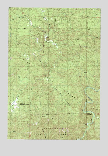
Hamlet, OR USGS Topographic Map
Click on map above to begin viewing in our Map Viewer.

This topographic map contains these locations and features:
Feature Name Type Latitude Longitude GNIS ID View Map
Beaver EddyRapidsN45.7776°W123.6473°1117444View Map
Cole MountainSummitN45.8384°W123.7332°1119133View Map
Cougar MountainSummitN45.8337°W123.6318°1119383View Map
Cronin CreekStreamN45.7715°W123.6346°1162925View Map
Fall CreekStreamN45.8159°W123.6951°1120599View Map
Gods ValleyValleyN45.7924°W123.7345°1132218View Map
Gods Valley CreekStreamN45.8048°W123.7332°1121186View Map
HamletPopulated PlaceN45.8462°W123.7007°1136352View Map
Hamlet GrangeBuildingN45.8574°W123.7132°1121539View Map
Hamlet Post Office (historical)Post OfficeN45.8462°W123.7007°1165362View Map
Little North Fork Nehalem RiverStreamN45.8484°W123.7001°1123242View Map
Lost CreekStreamN45.8032°W123.7171°1123489View Map
Morrison EddyRapidsN45.7646°W123.6432°1124373View Map
North Fork FallsFallsN45.8109°W123.7499°1162745View Map
Owens Post Office (historical)Post OfficeN45.7826°W123.7393°1164572View Map
Rector CreekStreamN45.7554°W123.7318°1132182View Map
Rector LookoutTowerN45.7659°W123.7119°1132283View Map
Rector RidgeRidgeN45.7709°W123.7014°1125863View Map
Salmonberry Guard StationLocaleN45.7501°W123.6493°1126518View Map
Sweet Home CreekStreamN45.8079°W123.7001°1127829View Map
Yunkers High BridgeBridgeN45.7976°W123.6335°1129404View Map

Note: Coordinates in the location and feature list above are referenced to NAD83 datum.


Copyright (C) 2008-2024 Ryan Niemi / Sunset Dynamics ... All Rights Reserved