TopoQuest Logo
Do you find TopoQuest useful?
Help keep TopoQuest running and adding new maps/features by donating!
Bitcoin:  19c7KJd3qBynnjoSw5npx9KScwjBe4ifkT
Litecoin:  LXs6TkuXGGXo1vDsWCkWVdjQX94eUKd6ui
Home View Maps Find Maps Find Places Resources & Links


Hammond Draw NW, Montana Topographic Map

USGS Map Title: Hammond Draw NW, MT
USGS Map MRC: 45106H4
DRG (GeoTIFF) Download: o45106h4.tif


Neighboring USGS Topographic Map Quads:


  McKerlich Creek, MT  
46106A5
 

  Mitchell Coulee, MT  
46106A4
 

  Crain Place, MT  
46106A3
 

  Colstrip East, MT  
45106H5
 

  Hammond Draw NW, MT  
45106H4
 

  John Hen Creek, MT  
45106H3
 

  Colstrip SE, MT  
45106G5
 

  Hammond Draw SW, MT  
45106G4
 

  Hammond Draw, MT  
45106G3


Map MRC Location:

N46°
W107°
N46°
W106°
H8 H7 H6 H5 H4 H3 H2 H1
G8 G7 G6 G5 G4 G3 G2 G1
F8 F7 F6 F5 F4 F3 F2 F1
E8 E7 E6 E5 E4 E3 E2 E1
D8 D7 D6 D5 D4 D3 D2 D1
C8 C7 C6 C5 C4 C3 C2 C1
B8 B7 B6 B5 B4 B3 B2 B1
A8 A7 A6 A5 A4 A3 A2 A1
N45°
W107°
N45°
W106°

Hammond Draw NW, MT USGS 1:24K Topographic Map Preview:
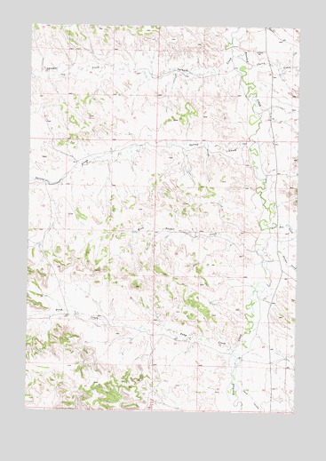
Hammond Draw NW, MT USGS Topographic Map
Click on map above to begin viewing in our Map Viewer.

This topographic map contains these locations and features:
Feature Name Type Latitude Longitude GNIS ID View Map
01N41E03AABB01 WellWellN45.8778°W106.4839°813009View Map
02N42E23CCCA01 WellWellN45.9144°W106.4817°813336View Map
02N42E25ACBA01 WellWellN45.9006°W106.4506°813207View Map
02N42E36DDDB01 WellWellN45.8769°W106.4434°813001View Map
02N43E04ACAA01 WellWellN45.9572°W106.3842°813563View Map
02N43E04ACAD01 WellWellN45.9564°W106.3847°813560View Map
02N43E04ACDD01 WellWellN45.9558°W106.3850°813557View Map
02N43E04CDAA01 WellWellN45.9517°W106.3897°813527View Map
02N43E04D___01 WellWellN45.9506°W106.3842°813519View Map
02N43E05AAAA01 WellWellN45.9611°W106.4003°813581View Map
02N43E06BABA01 WellWellN45.9611°W106.4347°813582View Map
02N43E16AA__01 WellWellN45.9314°W106.3820°813429View Map
02N43E16DABB01 WellWellN45.9261°W106.3833°813395View Map
02N43E17AACC01 WellWellN45.9306°W106.4047°813421View Map
02N43E18AAAC01 WellWellN45.9311°W106.4217°813428View Map
02N43E20CABB01 WellWellN45.9108°W106.4150°813306View Map
02N43E27CCBC01 WellWellN45.8922°W106.3792°813138View Map
02N43E28ABBD01 WellWellN45.9028°W106.3878°813221View Map
02N43E28CAAC01 WellWellN45.8958°W106.3922°813176View Map
02N43E28CCBC01 WellWellN45.8925°W106.3992°813141View Map
02N43E29DDAA01 WellWellN45.8928°W106.4011°813146View Map
02N43E30BDDA01 WellWellN45.8989°W106.4320°813197View Map
02N43E32CAAD01 WellWellN45.8786°W106.4106°813014View Map
03N42E34DBBC01 WellWellN45.9681°W106.4914°813624View Map
03N43E20____01 WellWellN45.9989°W106.4103°813718View Map
03N43E21BDDD01 WellWellN45.9994°W106.3900°813722View Map
03N43E34BCBB01 WellWellN45.9736°W106.3789°813644View Map
Cherry CreekStreamN45.9875°W106.3978°769791View Map
Harris Post Office (historical)Post OfficeN45.9258°W106.3783°1716687View Map
John Hen CreekStreamN45.9347°W106.3878°772843View Map
Philbrick School (historical)SchoolN45.9111°W106.3872°1716553View Map
Pony CreekStreamN45.8944°W106.4042°775359View Map
Sand CouleeValleyN45.8853°W106.4014°776168View Map
Snider CreekStreamN45.9275°W106.3839°776701View Map
Sprague CreekStreamN45.9906°W106.4036°776946View Map
Spring CreekStreamN45.9631°W106.3981°777063View Map
West Snider CreekStreamN45.9278°W106.3928°778312View Map

Note: Coordinates in the location and feature list above are referenced to NAD83 datum.


Copyright (C) 2008-2025 Ryan Niemi / Sunset Dynamics ... All Rights Reserved