TopoQuest Logo
Do you find TopoQuest useful?
Help keep TopoQuest running and adding new maps/features by donating!
Bitcoin:  19c7KJd3qBynnjoSw5npx9KScwjBe4ifkT
Litecoin:  LXs6TkuXGGXo1vDsWCkWVdjQX94eUKd6ui
Home View Maps Find Maps Find Places Resources & Links


Hampton, Connecticut Topographic Map

USGS Map Title: Hampton, CT
USGS Map MRC: 41072G1
DRG (GeoTIFF) Download: o41072g1.tif


Neighboring USGS Topographic Map Quads:


  Westford, CT  
41072H2
 

  Eastford, CT  
41072H1
 

  Putnam, CT  
41071H8
 

  Spring Hill, CT  
41072G2
 

  Hampton, CT  
41072G1
 

  Danielson, CT  
41071G8
 

  Willimantic, CT  
41072F2
 

  Scotland, CT  
41072F1
 

  Plainfield, CT  
41071F8


Map MRC Location:

N42°
W73°
N42°
W72°
H8 H7 H6 H5 H4 H3 H2 H1
G8 G7 G6 G5 G4 G3 G2 G1
F8 F7 F6 F5 F4 F3 F2 F1
E8 E7 E6 E5 E4 E3 E2 E1
D8 D7 D6 D5 D4 D3 D2 D1
C8 C7 C6 C5 C4 C3 C2 C1
B8 B7 B6 B5 B4 B3 B2 B1
A8 A7 A6 A5 A4 A3 A2 A1
N41°
W73°
N41°
W72°

Hampton, CT USGS 1:24K Topographic Map Preview:
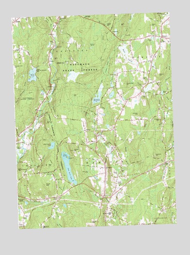
Hampton, CT USGS Topographic Map
Click on map above to begin viewing in our Map Viewer.

This topographic map contains these locations and features:
Feature Name Type Latitude Longitude GNIS ID View Map
AbingtonPopulated PlaceN41.8607°W72.0067°205033View Map
Abington CemeteryCemeteryN41.8603°W72.0122°1924565View Map
Abington Congregational ChurchChurchN41.8579°W72.0084°1924202View Map
Abington Social LibraryBuildingN41.8579°W72.0084°1924203View Map
Allen HillSummitN41.8670°W72.0142°205070View Map
Alworth HillSummitN41.7912°W72.0151°205079View Map
AshfordPopulated PlaceN41.8732°W72.1215°212409View Map
Ashford AcademySchoolN41.8737°W72.1212°1924218View Map
Babcock CemeteryCemeteryN41.8733°W72.1242°1924228View Map
Baker PondLakeN41.8278°W72.0077°205207View Map
Bear HillSummitN41.7865°W72.1001°205255View Map
Beaupres PondReservoirN41.8649°W72.0429°1771318View Map
Beaupres Pond DamDamN41.8634°W72.0429°1771317View Map
Beaverdam BrookStreamN41.8359°W72.0931°205385View Map
Benson CemeteryCemeteryN41.8495°W72.0149°1924245View Map
Bigelow BrookStreamN41.8637°W72.0901°205497View Map
Black Spruce PondReservoirN41.7987°W72.0963°1771584View Map
Black Spruce Pond DamDamN41.7968°W72.0979°1771583View Map
Burnham-Hibbard HouseBuildingN41.7784°W72.0556°1924280View Map
Catden SwampSwampN41.8452°W72.0506°206062View Map
Cedar SwampSwampN41.7939°W72.0865°206102View Map
Cedar Swamp BrookStreamN41.7562°W72.0470°206108View Map
Cherry HillSummitN41.7851°W72.0220°1924317View Map
Chewink CemeteryCemeteryN41.7566°W72.1213°206257View Map
Clark CemeteryCemeteryN41.7759°W72.1177°1924327View Map
Clark HillSummitN41.7757°W72.1026°212370View Map
Clarks CornerPopulated PlaceN41.7682°W72.0926°206309View Map
Easter HillSummitN41.8382°W72.0101°206872View Map
ElliottsPopulated PlaceN41.8334°W72.0117°212453View Map
Elliotts BrookStreamN41.8318°W72.0054°206929View Map
Elliotts SchoolSchoolN41.8404°W72.0234°206931View Map
Elliotts School (historical)SchoolN41.8404°W72.0237°1924386View Map
Fernow BirdgeBridgeN41.8412°W72.0923°1924397View Map
Fletcher Memorial LibraryBuildingN41.7845°W72.0554°1924407View Map
Frog RockPillarN41.8690°W72.0520°1924413View Map
Frog Rock Roadside ParkParkN41.8690°W72.0520°1924414View Map
Fuller BrookStreamN41.8004°W72.0556°207221View Map
Gathering in Christ ChurchChurchN41.7868°W72.0620°1924420View Map
Goodwin BrookStreamN41.8248°W72.0965°207354View Map
Governors IslandIslandN41.7918°W72.0842°207389View Map
Grow CemeteryCemeteryN41.8278°W72.0214°1924434View Map
Grow HillSummitN41.8232°W72.0056°1924435View Map
Halls PondReservoirN41.8408°W72.1097°1771346View Map
Halls Pond North DamDamN41.8434°W72.1062°1771345View Map
Halls Pond South DikeDamN41.8372°W72.1074°1770943View Map
HamptonPopulated PlaceN41.7840°W72.0548°207649View Map
Hampton BrookStreamN41.8045°W72.0567°207650View Map
Hampton Chaplin Ambulance CorporationBuildingN41.7815°W72.0596°2660908View Map
Hampton Congregational ChurchChurchN41.7851°W72.0556°1924442View Map
Hampton Elementary SchoolSchoolN41.7923°W72.0595°1924444View Map
Hampton Fire CompanyBuildingN41.7814°W72.0595°2656252View Map
Hampton HillSummitN41.7837°W72.0584°1924445View Map
Hampton Hill Historic DistrictParkN41.7845°W72.0548°1924446View Map
Hampton Post OfficePost OfficeN41.7823°W72.0546°1924447View Map
Hampton ReservoirReservoirN41.8259°W72.0591°207651View Map
Hampton Reservoir DamDamN41.8251°W72.0579°1771274View Map
Hampton StationLocaleN41.8076°W72.0681°207652View Map
Hampton Station (historical)LocaleN41.8076°W72.0692°1924448View Map
HamptonvillePopulated PlaceN41.7968°W72.0467°1924449View Map
Holt BrookStreamN41.7676°W72.0601°1924460View Map
Howard ValleyBasinN41.7645°W72.0470°207983View Map
James L Goodwin Conservation CenterBuildingN41.7748°W72.0820°1924483View Map
James L Goodwin State ForestForestN41.8043°W72.0954°1924484View Map
Kimball HillSummitN41.8154°W72.0267°208295View Map
Litchfield CemeteryCemeteryN41.7755°W72.0463°208498View Map
Lyon HillSummitN41.8687°W72.0376°208652View Map
Maple SwampSwampN41.8518°W72.0352°208708View Map
Murphy BrookStreamN41.7793°W72.0440°209149View Map
Natchaug (historical)Populated PlaceN41.8101°W72.1142°1924560View Map
Nathaniel Lyon Memorial ParkParkN41.8473°W72.0820°209189View Map
Nickerson ParkParkN41.8201°W72.1056°1924574View Map
North CemeteryCemeteryN41.7952°W72.0495°209339View Map
Old Ashford CemeteryCemeteryN41.8733°W72.1241°1924595View Map
Our Lady of Lourdes ChurchChurchN41.7845°W72.0587°1924609View Map
Paine HillSummitN41.8362°W72.0234°209590View Map
Peppertree CampgroundLocaleN41.8648°W72.0917°1924617View Map
Pine Acres LakeLakeN41.7838°W72.0837°209756View Map
Pine Acres Lake DamDamN41.7759°W72.0776°1771481View Map
Pumpkin HillSummitN41.8451°W72.1237°210015View Map
RawsonPopulated PlaceN41.8070°W72.0692°212554View Map
Reeds PondReservoirN41.8306°W72.1019°210157View Map
Sharpe HillSummitN41.8118°W72.0104°210784View Map
Sharpe Hill VineyardLocaleN41.8126°W72.0437°1924728View Map
Shaw HillSummitN41.7526°W72.0670°210788View Map
Silvermine BrookStreamN41.8368°W72.0776°210869View Map
Slovik BrookStreamN41.8498°W72.0948°210908View Map
Snow HillSummitN41.8320°W72.1209°1924748View Map
South CemeteryCemeteryN41.7661°W72.0577°210971View Map
Sprague HillSummitN41.8662°W72.0704°1924761View Map
Spring BrookStreamN41.7904°W72.0373°1924762View Map
Stepping Stone MinistriesChurchN41.7870°W72.0595°1924764View Map
Stetson CemeteryCemeteryN41.7860°W72.0083°1924776View Map
Stetson CornerPopulated PlaceN41.7862°W72.0076°211166View Map
Still RiverStreamN41.8637°W72.0901°211190View Map
Stones BrookStreamN41.8740°W72.0945°211208View Map
Sunset HillSummitN41.7954°W72.0790°211296View Map
Town of HamptonCivilN41.7841°W72.0584°213441View Map
Trowbridge HillSummitN41.8337°W72.0359°211575View Map
Turner BrookStreamN41.7976°W72.1183°211611View Map
Wade BrookStreamN41.8268°W72.0084°211756View Map
Whitman BrookStreamN41.8204°W72.1034°212094View Map

Note: Coordinates in the location and feature list above are referenced to NAD83 datum.


Copyright (C) 2008-2024 Ryan Niemi / Sunset Dynamics ... All Rights Reserved