TopoQuest Logo
Do you find TopoQuest useful?
Help keep TopoQuest running and adding new maps/features by donating!
Bitcoin:  19c7KJd3qBynnjoSw5npx9KScwjBe4ifkT
Litecoin:  LXs6TkuXGGXo1vDsWCkWVdjQX94eUKd6ui
Home View Maps Find Maps Find Places Resources & Links


Spring Hill, Connecticut Topographic Map

USGS Map Title: Spring Hill, CT
USGS Map MRC: 41072G2
DRG (GeoTIFF) Download: o41072g2.tif


Neighboring USGS Topographic Map Quads:


  Stafford Springs, CT  
41072H3
 

  Westford, CT  
41072H2
 

  Eastford, CT  
41072H1
 

  Coventry, CT  
41072G3
 

  Spring Hill, CT  
41072G2
 

  Hampton, CT  
41072G1
 

  Columbia, CT  
41072F3
 

  Willimantic, CT  
41072F2
 

  Scotland, CT  
41072F1


Map MRC Location:

N42°
W73°
N42°
W72°
H8 H7 H6 H5 H4 H3 H2 H1
G8 G7 G6 G5 G4 G3 G2 G1
F8 F7 F6 F5 F4 F3 F2 F1
E8 E7 E6 E5 E4 E3 E2 E1
D8 D7 D6 D5 D4 D3 D2 D1
C8 C7 C6 C5 C4 C3 C2 C1
B8 B7 B6 B5 B4 B3 B2 B1
A8 A7 A6 A5 A4 A3 A2 A1
N41°
W73°
N41°
W72°

Spring Hill, CT USGS 1:24K Topographic Map Preview:
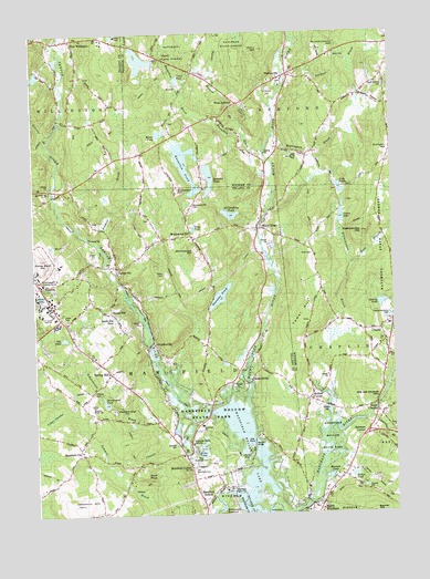
Spring Hill, CT USGS Topographic Map
Click on map above to begin viewing in our Map Viewer.

This topographic map contains these locations and features:
Feature Name Type Latitude Longitude GNIS ID View Map
Ames BrookStreamN41.7593°W72.1506°205083View Map
Ashford Post OfficePost OfficeN41.8623°W72.1884°2783253View Map
Ashford Volunteer Fire Department Station 20BuildingN41.8675°W72.1600°2420031View Map
AtwoodvillePopulated PlaceN41.7848°W72.1745°205154View Map
Atwoodville CemeteryCemeteryN41.7877°W72.1784°205155View Map
Babcock LibraryBuildingN41.8570°W72.1765°1924229View Map
Bassett BridgeBridgeN41.7690°W72.1737°205300View Map
Bebbington BrookStreamN41.8476°W72.1665°205390View Map
Bedlam CemeteryCemeteryN41.7778°W72.1490°205399View Map
Bedlam CornerPopulated PlaceN41.7798°W72.1545°205400View Map
Bucket HillSummitN41.8662°W72.1348°1924274View Map
Buttonball BrookStreamN41.7754°W72.1337°205900View Map
Byles BrookStreamN41.8717°W72.1576°2675057View Map
Camp ConnriLocaleN41.8695°W72.2104°1924287View Map
ChaffeevillePopulated PlaceN41.7948°W72.2084°206161View Map
Chapins PondLakeN41.7727°W72.2009°206181View Map
ChaplinPopulated PlaceN41.7948°W72.1273°206182View Map
Chaplin CemeteryCemeteryN41.7988°W72.1275°206183View Map
Chaplin Elementary SchoolSchoolN41.7907°W72.1398°1924310View Map
Chaplin Historic DistrictParkN41.7959°W72.1287°1924311View Map
Chaplin MuseumBuildingN41.7926°W72.1279°1924312View Map
Chaplin Post OfficePost OfficeN41.7593°W72.1434°1924313View Map
Chaplin Town HallBuildingN41.8015°W72.1254°1924314View Map
Chaplin Volunteer Fire Department Station 9BuildingN41.7759°W72.1311°2656241View Map
Chestnut HillSummitN41.7526°W72.2340°206244View Map
Church Farm HomesteadLocaleN41.8429°W72.1745°1924326View Map
Colts PondLakeN41.8337°W72.1423°206388View Map
Darling PondLakeN41.8046°W72.1290°206600View Map
Earl W Smith Senior CenterBuildingN41.8626°W72.1673°1924367View Map
East Branch Stonehouse BrookStreamN41.8143°W72.1401°206795View Map
East WillingtonPopulated PlaceN41.8737°W72.2370°212451View Map
Echo LakeLakeN41.7671°W72.1920°206887View Map
Eldredge BrookStreamN41.8462°W72.2451°212625View Map
Fenton RiverStreamN41.7698°W72.1776°207057View Map
Fishers BrookStreamN41.8201°W72.2276°207078View Map
Fox SwampSwampN41.8481°W72.2065°1924409View Map
Gardner BrookStreamN41.8645°W72.1615°207250View Map
Goss BrookStreamN41.8729°W72.1576°207383View Map
GurleyvillePopulated PlaceN41.8143°W72.2212°212468View Map
Hanks HillLocaleN41.8029°W72.2237°207660View Map
Hanks Hill PondLakeN41.8015°W72.2222°207661View Map
Hansens PondLakeN41.8067°W72.1851°207668View Map
Hansens Pond DamDamN41.8035°W72.1890°1770577View Map
Happy Acres DamDamN41.8668°W72.2079°1771086View Map
Happy Acres PondReservoirN41.8679°W72.2121°1771087View Map
Hillside CemeteryCemeteryN41.7818°W72.2298°207847View Map
Josias Byles SanctuaryReserveN41.8670°W72.1545°1924486View Map
Knowlton BrookStreamN41.8504°W72.1776°208328View Map
Knowlton HillSummitN41.8348°W72.2001°208329View Map
Knowlton PondReservoirN41.8409°W72.1964°208330View Map
Leander PondLakeN41.8374°W72.1883°208422View Map
Lipps BrookStreamN41.8654°W72.2020°1924521View Map
Lowry BrookStreamN41.8676°W72.2031°208631View Map
Lynch PondLakeN41.7571°W72.1360°208648View Map
Mansfield CenterPopulated PlaceN41.7654°W72.1981°208699View Map
Mansfield Center Census Designated PlaceCensusN41.7618°W72.1945°2377831View Map
Mansfield Center Post OfficePost OfficeN41.7639°W72.1969°2783237View Map
Mansfield CityPopulated PlaceN41.7659°W72.2337°212498View Map
Mansfield Fire Department Station 307BuildingN41.7896°W72.2281°2420046View Map
Mansfield Fire Marshal's OfficeBuildingN41.8014°W72.2421°2420158View Map
Mansfield HollowPopulated PlaceN41.7576°W72.1859°208700View Map
Mansfield HollowValleyN41.7615°W72.1842°208701View Map
Mansfield Hollow DamDamN41.7555°W72.1816°1771163View Map
Mansfield Hollow LakeLakeN41.7755°W72.1833°208702View Map
Mansfield Recreation PondReservoirN41.7918°W72.2079°1771460View Map
Mansfield Recreation Pond DamDamN41.7918°W72.2079°1771459View Map
Mansure PondLakeN41.7598°W72.1483°208704View Map
Mason BrookStreamN41.8307°W72.2423°212633View Map
McLaughlin PondReservoirN41.8278°W72.1812°208797View Map
McLaughlin Pond DamDamN41.8265°W72.1805°1770579View Map
Mirror LakeLakeN41.8071°W72.2473°208964View Map
Moritz BrookStreamN41.8559°W72.1976°209046View Map
Moritz PondReservoirN41.8492°W72.2049°209047View Map
Mount HopePopulated PlaceN41.8240°W72.1709°209079View Map
Mount Hope CemeteryCemeteryN41.8186°W72.1726°209080View Map
Mount Hope RiverStreamN41.7551°W72.1776°209083View Map
Nipmuck TrailTrailN41.7657°W72.2176°209292View Map
North Windham CemeteryCemeteryN41.7509°W72.1540°1924586View Map
North Windham Post OfficePost OfficeN41.7510°W72.1517°1924588View Map
Perry HillSummitN41.8707°W72.1704°209718View Map
Pompey Hollow ParkParkN41.8634°W72.1651°1924642View Map
Rattlesnake HillSummitN41.8232°W72.1354°1924878View Map
Russ CemeteryCemeteryN41.8175°W72.1527°210350View Map
Rychlings PondReservoirN41.8681°W72.2118°1924691View Map
Saint Philip-Apostle ChurchChurchN41.8626°W72.1654°1924715View Map
Schoolhouse BrookStreamN41.7754°W72.1942°210697View Map
Sherman CornerPopulated PlaceN41.7701°W72.1362°210817View Map
Snow CemeteryCemeteryN41.8611°W72.1682°1924746View Map
South Ashford CemeteryCemeteryN41.8617°W72.1269°210956View Map
South ChaplinPopulated PlaceN41.7768°W72.1312°210977View Map
South Chaplin CemeteryCemeteryN41.7722°W72.1333°210978View Map
Spring HillPopulated PlaceN41.7870°W72.2240°211081View Map
Squaw Hollow BrookStreamN41.8445°W72.1692°211116View Map
Stonehouse BrookStreamN41.7726°W72.1470°211207View Map
StorrsPopulated PlaceN41.8084°W72.2495°212656View Map
Storrs Mansfield Post OfficePost OfficeN41.8022°W72.2402°2783301View Map
Storrs Resident State Trooper OfficeBuildingN41.8014°W72.2421°2754688View Map
Tift PondLakeN41.7960°W72.2396°211468View Map
Tower HillSummitN41.7984°W72.1576°211525View Map
Town of ChaplinCivilN41.7932°W72.1277°213405View Map
Town of MansfieldCivilN41.7892°W72.2287°213456View Map
Tucker PondLakeN41.7600°W72.1396°211582View Map
Turnip Meadow (historical)SwampN41.7751°W72.1804°211618View Map
Upson LakeLakeN41.8269°W72.1426°211709View Map
Upton PondReservoirN41.8629°W72.1990°211710View Map
Varga PondLakeN41.8241°W72.1942°211723View Map
Ward CemeteryCemeteryN41.8695°W72.1443°211811View Map
WarrenvillePopulated PlaceN41.8634°W72.1626°211824View Map
Warrenville CemeteryCemeteryN41.8620°W72.1624°1924805View Map
Warrenville Post OfficePost OfficeN41.8626°W72.1890°1924806View Map
Warrenville SchoolSchoolN41.8673°W72.1606°211825View Map
West AshfordPopulated PlaceN41.8568°W72.1784°211916View Map
Wild Life Marsh ReservoirReservoirN41.8203°W72.1298°1771456View Map
Wildlife Marsh DamDamN41.8201°W72.1295°1771455View Map
William Ross Public LibraryBuildingN41.7948°W72.1284°1924830View Map
Wolf RockSummitN41.7595°W72.2098°212221View Map
Wormwood HillPopulated PlaceN41.8223°W72.1951°212281View Map
Wormwood HillSummitN41.8190°W72.1940°212282View Map
Wormwood Hill CemeteryCemeteryN41.8303°W72.1943°212283View Map

Note: Coordinates in the location and feature list above are referenced to NAD83 datum.


Copyright (C) 2008-2025 Ryan Niemi / Sunset Dynamics ... All Rights Reserved