TopoQuest Logo
Do you find TopoQuest useful?
Help keep TopoQuest running and adding new maps/features by donating!
Bitcoin:  19c7KJd3qBynnjoSw5npx9KScwjBe4ifkT
Litecoin:  LXs6TkuXGGXo1vDsWCkWVdjQX94eUKd6ui
Home View Maps Find Maps Find Places Resources & Links


Handies Peak, Colorado Topographic Map

USGS Map Title: Handies Peak, CO
USGS Map MRC: 37107H5
DRG (GeoTIFF) Download: o37107h5.tif


Neighboring USGS Topographic Map Quads:


  Ouray, CO  
38107A6
 

  Wetterhorn Peak, CO  
38107A5
 

  Uncompahgre Peak, CO  
38107A4
 

  Ironton, CO  
37107H6
 

  Handies Peak, CO  
37107H5
 

  Redcloud Peak, CO  
37107H4
 

  Silverton, CO  
37107G6
 

  Howardsville, CO  
37107G5
 

  Pole Creek Mountain, CO  
37107G4


Map MRC Location:

N38°
W108°
N38°
W107°
H8 H7 H6 H5 H4 H3 H2 H1
G8 G7 G6 G5 G4 G3 G2 G1
F8 F7 F6 F5 F4 F3 F2 F1
E8 E7 E6 E5 E4 E3 E2 E1
D8 D7 D6 D5 D4 D3 D2 D1
C8 C7 C6 C5 C4 C3 C2 C1
B8 B7 B6 B5 B4 B3 B2 B1
A8 A7 A6 A5 A4 A3 A2 A1
N37°
W108°
N37°
W107°

Handies Peak, CO USGS 1:24K Topographic Map Preview:
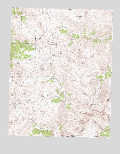
Handies Peak, CO USGS Topographic Map
Click on map above to begin viewing in our Map Viewer.

This topographic map contains these locations and features:
Feature Name Type Latitude Longitude GNIS ID View Map
Adelia MineMineN37.9433°W107.5984°1734714View Map
Alaska Number Two MineMineN37.9367°W107.6214°1734715View Map
American BasinBasinN37.9083°W107.5184°187405View Map
American FlatsFlatN37.9936°W107.5776°203389View Map
American PeakSummitN37.8994°W107.5125°2071320View Map
Animas Forks (historical)Populated PlaceN37.9311°W107.5714°187373View Map
Animas Forks MineMineN37.9314°W107.5712°1734716View Map
Annie Crook MineMineN37.9617°W107.5764°1734717View Map
Annie Wood MineMineN37.9617°W107.5789°1734718View Map
Auburn Group MineMineN37.8931°W107.5609°1734719View Map
Aztec MineMineN37.8833°W107.6173°1734720View Map
Bagley MineMineN37.9331°W107.5814°1734721View Map
Bagley TunnelTunnelN37.9328°W107.5812°196905View Map
Barnes Tunnel MineMineN37.8833°W107.6173°1734722View Map
Bear Creek TrailTrailN37.9981°W107.6228°187276View Map
Belcher Tunnel Number One MineMineN37.9239°W107.6167°1734723View Map
Belle Creole MineMineN37.9042°W107.6173°1734724View Map
Ben Butler MineMineN37.9519°W107.5826°1734725View Map
Ben Franklin MineMineN37.8944°W107.6145°1734726View Map
Bill Young Group MineMineN37.9517°W107.5956°1734727View Map
Blacksmith MineMineN37.9572°W107.5728°1734728View Map
Blanchard PlacerMineN37.9122°W107.5714°1734729View Map
Bon Homme MineMineN37.9458°W107.5003°1734795View Map
Bonanza King MineMineN37.9464°W107.6117°1734731View Map
Bonanza MineMineN37.9236°W107.6228°1734730View Map
Bonita PeakSummitN37.8969°W107.6239°187391View Map
Boston MineMineN37.9500°W107.5917°1734732View Map
Brazilian MineMineN37.9517°W107.6164°1734733View Map
British Queen MineMineN37.9600°W107.5867°1734734View Map
Burns GulchValleyN37.9055°W107.5567°187401View Map
Burrows CreekStreamN37.9456°W107.5748°187356View Map
Burrows Group MineMineN37.9333°W107.6006°1734736View Map
California GulchValleyN37.9304°W107.5854°187359View Map
California MountainSummitN37.9156°W107.6064°187383View Map
Cinnamon CreekStreamN37.9244°W107.5642°187371View Map
Cinnamon MountainSummitN37.9297°W107.5459°187374View Map
Cinnamon PassGapN37.9339°W107.5378°187380View Map
Columbus MineMineN37.9331°W107.5712°187372View Map
Como Consolidated MineMineN37.9208°W107.6195°1734737View Map
Contention MineMineN37.9825°W107.6003°1734710View Map
Crown MountainSummitN37.8803°W107.5364°187409View Map
Custer MineMineN37.9200°W107.6020°1734738View Map
Darley MountainSummitN37.9828°W107.5881°197912View Map
Denver BridgeBridgeN37.9492°W107.5734°187369View Map
Denver HillSummitN37.9514°W107.5781°187367View Map
Denver LakeReservoirN37.9523°W107.5759°187366View Map
Denver PassGapN37.9547°W107.5620°187363View Map
Detroit Hollister MineMineN37.9308°W107.5437°1734739View Map
Dewey MineMineN37.9536°W107.5420°1734701View Map
Dewitt MineMineN37.9472°W107.5887°1734740View Map
Dolly Varden MineMineN37.9856°W107.5345°1734702View Map
Dolly Varden MountainSummitN37.9922°W107.5428°187343View Map
Early Bird MineMineN37.9458°W107.5839°1734741View Map
Edith MountainSummitN37.9425°W107.5128°187379View Map
Emery PeakSummitN37.8883°W107.6212°187393View Map
Endless Chain MineMineN37.8811°W107.5601°1734742View Map
Engineer MountainSummitN37.9703°W107.5884°187341View Map
Engineer PassGapN37.9756°W107.5845°187340View Map
EurekaPopulated PlaceN37.8797°W107.5651°187402View Map
Eureka GulchValleyN37.8797°W107.5675°187394View Map
Eureka MountainSummitN37.8986°W107.5826°187400View Map
Evening Star MineMineN37.9167°W107.5923°1734743View Map
Ezra R MineMineN37.8783°W107.5667°1734909View Map
Forest Queen MineMineN37.9489°W107.6123°1734744View Map
Fredericka Group MineMineN37.9056°W107.5423°1734745View Map
Frisco Tunnel MineMineN37.9333°W107.5812°1734747View Map
George Washington MineMineN37.9000°W107.6173°1734746View Map
Golconda MineMineN37.9536°W107.5387°1734703View Map
Gold Prince MineMineN37.9083°W107.6006°1734749View Map
Gold Prince MineMineN37.9083°W107.6017°187386View Map
Golden Fleece MineMineN37.9153°W107.5767°1734748View Map
Goodwin MineMineN37.9536°W107.5445°1734704View Map
Gravel MountainSummitN37.9597°W107.5412°187351View Map
Great American MineMineN37.9569°W107.5817°1734750View Map
Grouse GulchValleyN37.9168°W107.5576°187375View Map
Handies PeakSummitN37.9131°W107.5045°187404View Map
Hanson PeakSummitN37.9081°W107.6098°187385View Map
Hermes Group MineMineN37.9417°W107.5756°1734751View Map
Hidden Treasure MineMineN37.9056°W107.6034°1734753View Map
Horseshoe BasinBasinN37.9564°W107.5303°187376View Map
Horseshoe CreekStreamN37.9494°W107.5731°187368View Map
Hough MineMineN37.9731°W107.5834°187345View Map
Houghton MountainSummitN37.9406°W107.5864°187357View Map
Hurricane BasinBasinN37.9556°W107.5481°187364View Map
Hurricane PeakSummitN37.9147°W107.6214°187381View Map
Illinois Boy MineMineN37.9428°W107.5187°1734705View Map
Independence MineMineN37.9103°W107.6037°1734754View Map
Indian Chief MineMineN37.9206°W107.6139°1734755View Map
Jones MountainSummitN37.8964°W107.5264°187407View Map
Klondyke Group MineMineN37.8883°W107.5523°1734756View Map
Kohinoor MineMineN37.9067°W107.6223°1734757View Map
Lake ComoLakeN37.9230°W107.6246°203300View Map
Lake EmmaLakeN37.9023°W107.6154°187388View Map
Little Ida MineMineN37.9297°W107.5948°1734758View Map
London MineMineN37.9492°W107.5845°187355View Map
Lucky Jack MineMineN37.9542°W107.5731°187365View Map
Maid of the Mist MineMineN37.9556°W107.6195°1734759View Map
Mammoth MineMineN37.9625°W107.5826°1734760View Map
Mammoth MineMineN37.9389°W107.5895°1735443View Map
Mastodon MineMineN37.9083°W107.6034°1734761View Map
McCarty BasinBasinN37.8850°W107.6167°187395View Map
Midway MineMineN37.9050°W107.6101°1734762View Map
Mineral PointLocaleN37.9536°W107.5976°187353View Map
Miners CreekStreamN37.9628°W107.6045°187354View Map
Mohawk MineMineN37.9750°W107.5728°1734706View Map
Molly MineMineN37.9389°W107.5895°1734711View Map
Montezuma Number One MineMineN37.8822°W107.5731°1734763View Map
Monticello MineMineN37.9444°W107.5159°1734707View Map
Mountain Eagle MineMineN37.9022°W107.6164°1734669View Map
Mountain Queen MineMineN37.9153°W107.6170°187382View Map
Niagara GulchValleyN37.8830°W107.5631°187403View Map
Niagara PeakSummitN37.8894°W107.5334°187408View Map
North Fork Animas RiverStreamN37.9314°W107.5695°187370View Map
Oro-fino Tunnels MineMineN37.9819°W107.5256°1734708View Map
Oyama MineMineN37.9556°W107.6006°1734765View Map
Palmetto GulchValleyN37.9816°W107.5592°187346View Map
Palmyra MineMineN37.9544°W107.6031°1734766View Map
Parson GulchValleyN37.8899°W107.5957°197623View Map
Parson LakeLakeN37.9024°W107.5968°187390View Map
Picayne GulchValleyN37.9113°W107.5556°187399View Map
Picket MineMineN37.9267°W107.6248°1734767View Map
Placer GulchValleyN37.9315°W107.5700°187360View Map
Plain Streak MineMineN37.8797°W107.5748°1734768View Map
Red Cloud MineMineN37.9453°W107.5917°1734770View Map
Redcloud GulchValleyN37.9776°W107.5544°187347View Map
Rollo MineMineN37.9222°W107.6201°1734771View Map
Rose CabinLocaleN37.9764°W107.5384°187350View Map
Ross Basin MineMineN37.9047°W107.6245°1734889View Map
San Antonio MineMineN37.9350°W107.5756°1734772View Map
San Juan Chief MineMineN37.9578°W107.5889°1734774View Map
San Juan Queen MineMineN37.9122°W107.5751°1734775View Map
Santiago MineMineN37.9136°W107.5706°1734773View Map
Schafer BasinBasinN37.9614°W107.5067°187352View Map
Schafer GulchValleyN37.9757°W107.5428°187348View Map
Scotia MineMineN37.9150°W107.5778°1734776View Map
Seigal MountainSummitN37.9572°W107.5639°187362View Map
Sewell MineMineN37.9419°W107.5909°1734779View Map
Silver Chord MineMineN37.9239°W107.6148°1734780View Map
Silver Coin MineMineN37.9292°W107.5720°1734781View Map
Silver Queen MineMineN37.9078°W107.5973°187387View Map
Silver Wing MineMineN37.9058°W107.5539°1734713View Map
Sixteen-to-one MineMineN37.9439°W107.6245°1734782View Map
Slagle BasinBasinN37.8797°W107.6195°187396View Map
Sloan LakeLakeN37.9038°W107.5129°187406View Map
Sound Democrat MineMineN37.9083°W107.5942°1734783View Map
South Fork Animas RiverStreamN37.8786°W107.5662°187397View Map
Sunnyside MineMineN37.9031°W107.6120°187389View Map
Sunnyside SaddleGapN37.9064°W107.6184°187384View Map
Sunshine MountainSummitN37.9956°W107.5087°203365View Map
Syracuse Pride MineMineN37.9636°W107.5756°1734785View Map
Tempest MineMineN37.9367°W107.6109°1734786View Map
Terry Tunnel MineMineN37.8928°W107.6042°1734787View Map
Toltec MineMineN37.9103°W107.5567°1734788View Map
Tom Moore MineMineN37.9028°W107.5534°1734789View Map
Treasure MountainSummitN37.9147°W107.5837°187398View Map
Treasure Mountain MineMineN37.9139°W107.5701°196906View Map
Tuttle MountainSummitN37.9339°W107.6123°187358View Map
Uncle Sam MineMineN37.9669°W107.5848°1734712View Map
Uncompahgre Chief MineMineN37.9511°W107.5864°1734790View Map
Union MineMineN37.9431°W107.6014°1734791View Map
Vermillion Tunnel MineMineN37.9364°W107.6003°1734792View Map
Washington MineMineN37.9053°W107.6167°1734793View Map
Weed MountainSummitN37.9475°W107.5378°187377View Map
West Fork Animas RiverStreamN37.9314°W107.5695°187361View Map
White Crow MineMineN37.9436°W107.6181°1734691View Map
Zuni Group MineMineN37.9033°W107.5712°1734794View Map

Note: Coordinates in the location and feature list above are referenced to NAD83 datum.


Copyright (C) 2008-2024 Ryan Niemi / Sunset Dynamics ... All Rights Reserved