TopoQuest Logo
Do you find TopoQuest useful?
Help keep TopoQuest running and adding new maps/features by donating!
Bitcoin:  19c7KJd3qBynnjoSw5npx9KScwjBe4ifkT
Litecoin:  LXs6TkuXGGXo1vDsWCkWVdjQX94eUKd6ui
Home View Maps Find Maps Find Places Resources & Links


Silverton, Colorado Topographic Map

USGS Map Title: Silverton, CO
USGS Map MRC: 37107G6
DRG (GeoTIFF) Download: o37107g6.tif


Neighboring USGS Topographic Map Quads:


  Telluride, CO  
37107H7
 

  Ironton, CO  
37107H6
 

  Handies Peak, CO  
37107H5
 

  Ophir, CO  
37107G7
 

  Silverton, CO  
37107G6
 

  Howardsville, CO  
37107G5
 

  Engineer Mountain, CO  
37107F7
 

  Snowdon Peak, CO  
37107F6
 

  Storm King Peak, CO  
37107F5


Map MRC Location:

N38°
W108°
N38°
W107°
H8 H7 H6 H5 H4 H3 H2 H1
G8 G7 G6 G5 G4 G3 G2 G1
F8 F7 F6 F5 F4 F3 F2 F1
E8 E7 E6 E5 E4 E3 E2 E1
D8 D7 D6 D5 D4 D3 D2 D1
C8 C7 C6 C5 C4 C3 C2 C1
B8 B7 B6 B5 B4 B3 B2 B1
A8 A7 A6 A5 A4 A3 A2 A1
N37°
W108°
N37°
W107°

Silverton, CO USGS 1:24K Topographic Map Preview:
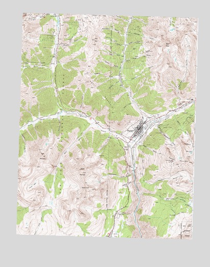
Silverton, CO USGS Topographic Map
Click on map above to begin viewing in our Map Viewer.

This topographic map contains these locations and features:
Feature Name Type Latitude Longitude GNIS ID View Map
Ajax MineMineN37.8003°W107.6753°1734852View Map
Alethea Group MineMineN37.7889°W107.6720°1734853View Map
Anglo-Saxon MineMineN37.8667°W107.6839°1734854View Map
Anvil MountainSummitN37.8378°W107.7073°187578View Map
Anvil Mountain South MineMineN37.8114°W107.6865°1734894View Map
Ariedna MineMineN37.8567°W107.6708°187568View Map
Arrastra CreekStreamN37.8269°W107.6267°187632View Map
Aspen MineMineN37.8211°W107.6314°187585View Map
Bear CreekStreamN37.8133°W107.6945°187576View Map
Bear MountainSummitN37.7947°W107.7328°187577View Map
Belcher MineMineN37.7961°W107.6926°187582View Map
Ben Franklin MineMineN37.8000°W107.6506°1734857View Map
Big Ben ClaimMineN37.8744°W107.6498°1734672View Map
Black Diamond MineMineN37.8208°W107.7340°1734858View Map
Blair GulchValleyN37.8208°W107.6413°187589View Map
Blair LakeLakeN37.7994°W107.6269°187595View Map
Blue Jay MineMineN37.7975°W107.6762°1734859View Map
Bonner MineMineN37.8442°W107.7376°187556View Map
Boston MineMineN37.8500°W107.6673°1734860View Map
Boulder GulchValleyN37.8247°W107.6335°187573View Map
Brooklyn MineMineN37.8606°W107.7153°187554View Map
Brooklyn TrailTrailN37.8617°W107.7145°187552View Map
Browns GulchValleyN37.8562°W107.7259°187553View Map
Buckeye MineMineN37.7892°W107.6342°1735956View Map
Burro BridgeBridgeN37.8506°W107.7262°187555View Map
Cascade GulchValleyN37.8659°W107.6761°187566View Map
Cataract GulchValleyN37.7812°W107.6673°187602View Map
Cement CreekStreamN37.8092°W107.6601°187337View Map
Champion MineMineN37.7897°W107.6703°187600View Map
Chattanooga (historical)Populated PlaceN37.8736°W107.7253°187550View Map
Chattanooga Hot SpringSpringN37.8644°W107.7367°1735258View Map
Chattanooga MineMineN37.8644°W107.7140°1735798View Map
Clara MineMineN37.7978°W107.6584°1734861View Map
Coming Wonder MineMineN37.8153°W107.6759°1734862View Map
Crevice MineMineN37.8697°W107.6676°1734863View Map
Dakota MineMineN37.8703°W107.6451°1734864View Map
Deadwood GulchValleyN37.7863°W107.6679°187601View Map
Deer Park CreekStreamN37.7753°W107.6642°187607View Map
Deer Park TrailTrailN37.7728°W107.6398°203310View Map
Dora MineMineN37.8111°W107.6645°1734866View Map
Empire Group MineMineN37.8000°W107.6745°1734867View Map
Fairview GulchValleyN37.8709°W107.6739°187321View Map
Fairview MineMineN37.7889°W107.6715°1734869View Map
Freda MineMineN37.8497°W107.7484°1734896View Map
Gold Finch Group MineMineN37.8722°W107.7178°1734871View Map
Gold Hub MineMineN37.8494°W107.6753°187561View Map
Graham MineMineN37.8697°W107.6676°1734872View Map
Grand TurkSummitN37.7767°W107.6956°187603View Map
Grassy GulchValleyN37.8587°W107.6760°187567View Map
Gypsy ClaimMineN37.8744°W107.6498°1734670View Map
Hancock GulchValleyN37.8377°W107.6780°187570View Map
Happy Jack MineMineN37.8036°W107.6295°187592View Map
Hawkeye MineMineN37.7975°W107.6753°1734873View Map
Henrietta GulchValleyN37.8385°W107.6790°187565View Map
Hidden Treasure MineMineN37.8681°W107.7270°1735799View Map
Hillside CemeteryCemeteryN37.8194°W107.6515°187584View Map
Hoosier Boy MineMineN37.8742°W107.6851°1734898View Map
Howardsville MineMineN37.8000°W107.6339°1734906View Map
Idaho GulchValleyN37.8027°W107.6648°187594View Map
Idaho MineMineN37.8022°W107.6598°187593View Map
Ideal PlacerMineN37.7933°W107.6703°1734875View Map
Illinois GulchValleyN37.8505°W107.6768°187569View Map
Imogene MineMineN37.8625°W107.7287°187551View Map
Irene MineMineN37.8417°W107.7023°187563View Map
Jennie Parker MineMineN37.7953°W107.6751°1734876View Map
Kansas City MineMineN37.8697°W107.6676°1734877View Map
KDRW-AM (Silverton)TowerN37.8169°W107.6559°204064View Map
Kendall Group MineMineN37.7894°W107.6353°1734878View Map
Kendall GulchValleyN37.7804°W107.6665°187606View Map
Kendall MountainSummitN37.7933°W107.6289°187596View Map
King MineMineN37.8711°W107.6451°1734879View Map
KQZZ-FM (Silverton)TowerN37.7944°W107.6420°204193View Map
KVFC-FM (Silverton)TowerN37.8050°W107.6348°204194View Map
Lackawanna MillLocaleN37.8142°W107.6523°187587View Map
Lackawanna MineMineN37.8097°W107.6487°187588View Map
Lamont MineMineN37.8522°W107.6637°187572View Map
Legal Tender MineMineN37.8186°W107.6276°187586View Map
Liberty Bond Creek MineMineN37.8417°W107.7173°1734880View Map
Little Dora MineMineN37.7978°W107.6753°1734881View Map
Lodore MineMineN37.8011°W107.6734°187581View Map
Lower Browns Gulch MineMineN37.8586°W107.7223°1734900View Map
Mabel MineMineN37.7631°W107.6378°187609View Map
Marcella MineMineN37.7958°W107.6651°1734882View Map
Mayflower MillLocaleN37.8289°W107.6276°187583View Map
Middle Fork Mineral CreekStreamN37.8439°W107.7290°187517View Map
Mighty Monarch MineMineN37.8022°W107.6584°1734883View Map
Mill CreekStreamN37.8700°W107.7242°187510View Map
Million Dollar Tunnel MineMineN37.8156°W107.6656°1734884View Map
Mineral CreekStreamN37.8189°W107.7148°187302View Map
Mineral Creek MineMineN37.8006°W107.6756°1734885View Map
Minnesota GulchValleyN37.8628°W107.6759°187558View Map
Minnesota Gulch MineMineN37.8669°W107.6890°1734897View Map
Minnesota MineMineN37.8686°W107.6876°1734902View Map
Molas MineMineN37.7631°W107.6776°187604View Map
Moly Gulch MineMineN37.8403°W107.7259°1734899View Map
Montana MineMineN37.7689°W107.6273°187608View Map
Mountain View ClaimsMineN37.8458°W107.7281°1735800View Map
Mystery Gold Group MineMineN37.7883°W107.6740°1734886View Map
Niagara GulchValleyN37.8396°W107.6795°187564View Map
North Star MineMineN37.8058°W107.6842°187580View Map
Ohio GulchValleyN37.8519°W107.6769°187560View Map
Ohio PeakSummitN37.8608°W107.6987°187557View Map
Omaha MineMineN37.8656°W107.6926°1734887View Map
Omaha MineMineN37.8539°W107.6870°1734901View Map
Porcupine GulchValleyN37.8587°W107.6767°187559View Map
Putnam BasinBasinN37.7786°W107.7384°187597View Map
Ricker Group MineMineN37.7981°W107.6753°1734888View Map
San Juan CountyCivilN37.7640°W107.6761°198171View Map
San Juan County Sheriff's OfficeBuildingN37.8149°W107.6620°2757276View Map
Saratoga MineMineN37.8283°W107.7048°1734890View Map
Scranton City MineMineN37.8028°W107.6412°187591View Map
Senior Warden MineMineN37.7631°W107.6770°1734891View Map
Silver Cloud MineMineN37.8736°W107.7473°187548View Map
Silver Crown MineMineN37.8717°W107.7442°187549View Map
Silverheel MineMineN37.8117°W107.7070°1734895View Map
SilvertonPopulated PlaceN37.8119°W107.6645°204750View Map
Silverton DivisionCivilN37.7640°W107.6761°1935567View Map
Silverton Historic DistrictParkN37.8129°W107.6628°2559512View Map
Silverton Junction HeliportAirportN37.7997°W107.6678°204580View Map
Silverton Post OfficePost OfficeN37.8122°W107.6649°2734577View Map
Silverton San Juan County Ambulance ServiceBuildingN37.8143°W107.6617°2735543View Map
Silverton Volunteer Fire DepartmentBuildingN37.8141°W107.6618°2667377View Map
Snowslide GulchValleyN37.8168°W107.7238°187574View Map
Soda GulchValleyN37.8259°W107.6682°187579View Map
South Fork Mineral CreekStreamN37.8186°W107.7148°187534View Map
Spencer PeakSummitN37.7722°W107.7028°2494559View Map
Storm PeakSummitN37.8592°W107.6476°187571View Map
Sultan CreekStreamN37.7633°W107.6667°187605View Map
Sultan MountainSummitN37.7858°W107.7040°187599View Map
Sunshine MineMineN37.8628°W107.6901°1734892View Map
Swansea GulchValleyN37.8152°W107.6534°187590View Map
Thunder Tunnel MineMineN37.7858°W107.6715°1734893View Map
Tincup ClaimMineN37.8744°W107.6498°1734671View Map
Titusville MineMineN37.7900°W107.6409°1735952View Map
Topeka GulchValleyN37.8455°W107.6788°187562View Map
Town of SilvertonCivilN37.8111°W107.6646°2413289View Map
Valley Forge MineMineN37.8389°W107.6370°1734925View Map
Victoria MineMineN37.8089°W107.6770°1734903View Map
Zinc King MineMineN37.8447°W107.7373°1734904View Map
Zuni MineMineN37.8369°W107.7040°1734905View Map

Note: Coordinates in the location and feature list above are referenced to NAD83 datum.


Copyright (C) 2008-2024 Ryan Niemi / Sunset Dynamics ... All Rights Reserved