TopoQuest Logo
Do you find TopoQuest useful?
Help keep TopoQuest running and adding new maps/features by donating!
Bitcoin:  19c7KJd3qBynnjoSw5npx9KScwjBe4ifkT
Litecoin:  LXs6TkuXGGXo1vDsWCkWVdjQX94eUKd6ui
Home View Maps Find Maps Find Places Resources & Links


Ironton, Colorado Topographic Map

USGS Map Title: Ironton, CO
USGS Map MRC: 37107H6
DRG (GeoTIFF) Download: o37107h6.tif


Neighboring USGS Topographic Map Quads:


  Mount Sneffels, CO  
38107A7
 

  Ouray, CO  
38107A6
 

  Wetterhorn Peak, CO  
38107A5
 

  Telluride, CO  
37107H7
 

  Ironton, CO  
37107H6
 

  Handies Peak, CO  
37107H5
 

  Ophir, CO  
37107G7
 

  Silverton, CO  
37107G6
 

  Howardsville, CO  
37107G5


Map MRC Location:

N38°
W108°
N38°
W107°
H8 H7 H6 H5 H4 H3 H2 H1
G8 G7 G6 G5 G4 G3 G2 G1
F8 F7 F6 F5 F4 F3 F2 F1
E8 E7 E6 E5 E4 E3 E2 E1
D8 D7 D6 D5 D4 D3 D2 D1
C8 C7 C6 C5 C4 C3 C2 C1
B8 B7 B6 B5 B4 B3 B2 B1
A8 A7 A6 A5 A4 A3 A2 A1
N37°
W108°
N37°
W107°

Ironton, CO USGS 1:24K Topographic Map Preview:
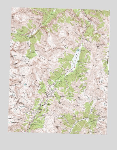
Ironton, CO USGS Topographic Map
Click on map above to begin viewing in our Map Viewer.

This topographic map contains these locations and features:
Feature Name Type Latitude Longitude GNIS ID View Map
Abrams MountainSummitN37.9622°W107.6406°187290View Map
Acapulco MineMineN37.9303°W107.6301°1734651View Map
Adams MineMineN37.9003°W107.6420°187325View Map
Ajax MineMineN37.9283°W107.7381°1734693View Map
Alabama MineMineN37.9450°W107.6262°1734652View Map
Alaska BasinBasinN37.9303°W107.6334°187250View Map
Alaska MineMineN37.9342°W107.6312°1734653View Map
Albany GulchValleyN37.9463°W107.6646°187242View Map
Albany MineMineN37.9464°W107.6626°1734576View Map
Alma MineMineN37.9483°W107.6564°1734577View Map
Amador MineMineN37.9367°W107.6270°1734654View Map
American Girl MineMineN37.9225°W107.6914°187235View Map
American Tunnel MineMineN37.8908°W107.6489°1734649View Map
Andrus MineMineN37.9103°W107.7412°187293View Map
Atlantic Tunnel MineMineN37.8997°W107.7301°1734578View Map
Avarado GulchValleyN37.9420°W107.6660°187244View Map
Bailey Shaft MineMineN37.9094°W107.6956°1734579View Map
Bankers TunnelMineN37.9572°W107.7187°187202View Map
Barhoff MineMineN37.9911°W107.6767°1734580View Map
Barstow MineMineN37.9208°W107.7139°187219View Map
Barstow Number Two MineMineN37.9206°W107.7128°1734581View Map
Bear CreekStreamN37.9992°W107.6609°187255View Map
Bear Creek FallsFallsN37.9999°W107.6602°187278View Map
Beaver and Belfast MineMineN37.9381°W107.6787°187226View Map
Belle of the West MineMineN37.9911°W107.6737°1734582View Map
Bi-metallist MineMineN37.9805°W107.7364°1734583View Map
Big Colorado MineMineN37.8769°W107.6470°187332View Map
Big Horn GulchValleyN37.8805°W107.7219°187301View Map
Bimettalist MineMineN37.9805°W107.7364°187200View Map
Black Bear MineMineN37.9222°W107.7423°1734694View Map
Black Bear MineMineN37.9219°W107.7401°187218View Map
Black Hawk MineMineN37.8822°W107.6356°187331View Map
Blackhawk MineMineN37.8822°W107.6356°1734655View Map
Brooklyn GulchValleyN37.9442°W107.6658°187243View Map
Brown MountainSummitN37.9208°W107.6378°187240View Map
Brown Mountain MineMineN37.9194°W107.6626°1734584View Map
Buck Run MineMineN37.9156°W107.6448°1734585View Map
Bullion King LakeLakeN37.8851°W107.7458°187300View Map
Burns Group MineMineN37.8975°W107.6653°1734735View Map
Camp BirdPopulated PlaceN37.9728°W107.7264°187260View Map
Camp Bird Number 14 LevelMineN37.9703°W107.7262°187261View Map
Camp Bird Number 2 LevelMineN37.9436°W107.7276°187212View Map
Camp Bird Number 3 LevelMineN37.9478°W107.7309°187211View Map
Carbon Lake MineMineN37.8919°W107.7048°1734688View Map
Carbonate King MineMineN37.9125°W107.6737°187306View Map
Champion BasinBasinN37.9067°W107.6864°187312View Map
Champion GulchValleyN37.9224°W107.6946°187307View Map
Charter Oak MineMineN37.9022°W107.7009°1734586View Map
Chicago PeakSummitN37.9428°W107.7442°187213View Map
Chicago TunnelMineN37.9472°W107.7378°187209View Map
Climax CreekStreamN37.9867°W107.6476°187282View Map
Colorado Boy MineMineN37.9308°W107.6848°1734587View Map
Columbia MineMineN37.9156°W107.6309°1734656View Map
Comet MineMineN37.9403°W107.7317°1734588View Map
Commodore GulchValleyN37.9226°W107.6949°187220View Map
Congress MineMineN37.8919°W107.7053°1734657View Map
Copper King MineMineN37.9058°W107.6998°1734589View Map
Cora Belle MineMineN37.9189°W107.6917°187236View Map
Corkscrew GulchValleyN37.9319°W107.6803°187239View Map
Crystal LakeReservoirN37.9586°W107.6645°187288View Map
Curran GulchValleyN37.9715°W107.6578°187284View Map
Dawn of Day MineMineN37.8878°W107.6570°1734658View Map
Delano MineMineN37.8856°W107.6820°1734865View Map
Dixie Girl MineMineN37.9403°W107.7317°1734590View Map
Donald MineMineN37.9372°W107.7415°1734695View Map
Double Standard MineMineN37.9403°W107.7317°1734591View Map
Dry GulchValleyN37.8870°W107.6640°187336View Map
Dunmore MineMineN37.9814°W107.6578°1734592View Map
Dutton Gibson MineMineN37.9361°W107.6517°1734593View Map
East Riverside SlideValleyN37.9703°W107.6580°187285View Map
Elk MineMineN37.8831°W107.6726°1734660View Map
Enterprise MineMineN37.9000°W107.7023°1734594View Map
Estel Crosscut MineMineN37.9086°W107.7362°1734697View Map
Evaline MineMineN37.8850°W107.6626°1734868View Map
Evening Star MineMineN37.9403°W107.7317°1734595View Map
Evening Star MineMineN37.9278°W107.6270°1734661View Map
Excelsior MineMineN37.9911°W107.6767°1734596View Map
Fall CreekStreamN37.9844°W107.7081°187269View Map
First Chance MineMineN37.8881°W107.6581°1734662View Map
Fourteen MineMineN37.9458°W107.6312°1734663View Map
Free Gold MineMineN37.9531°W107.6312°1734664View Map
Full Moon DamDamN37.9600°W107.6656°198740View Map
Full Moon GulchValleyN37.9489°W107.6714°187221View Map
Galena Lion GulchValleyN37.9268°W107.6909°187231View Map
Galena Queen MineMineN37.8917°W107.6889°1734665View Map
Galfy Boy MineMineN37.8917°W107.6659°196908View Map
Galty Boy MineMineN37.8919°W107.6656°187330View Map
Genessee MineMineN37.9117°W107.6962°187303View Map
Georgia GulchValleyN37.8758°W107.6722°187319View Map
Gladstone (historical)Populated PlaceN37.8903°W107.6503°187328View Map
Gladstone MineMineN37.8856°W107.6431°1734870View Map
Gold Dollar MineMineN37.8911°W107.6598°1734666View Map
Gold King MineMineN37.8906°W107.6484°187329View Map
Gold King MineMineN37.8947°W107.6384°1734667View Map
Governor GulchValleyN37.9223°W107.6962°187233View Map
Grand View MineMineN37.9597°W107.6298°1734668View Map
Gray Copper FallsFallsN37.9223°W107.6568°187252View Map
Gray Copper Falls MineMineN37.9211°W107.6570°1734597View Map
Gray Copper GulchValleyN37.9387°W107.6683°187251View Map
Great Western MineMineN37.9194°W107.6512°1734598View Map
Greyhound MineMineN37.9397°W107.7017°187228View Map
Greyhound Pack TrailTrailN37.9381°W107.6939°187230View Map
Grizzly Bear MineMineN37.9981°W107.6384°187277View Map
Guadaloupe MineMineN37.9586°W107.6481°1734599View Map
Guston (historical)Populated PlaceN37.9164°W107.6903°187238View Map
Guston Number Five MineMineN37.9150°W107.6917°1734600View Map
Half Moon BasinBasinN37.9619°W107.6803°187271View Map
Hawkeye MineMineN37.9783°W107.7398°1734601View Map
Hayden MountainSummitN37.9544°W107.7026°187270View Map
Hendrick GulchValleyN37.9645°W107.6594°187286View Map
Henrietta MineMineN37.8875°W107.6753°1734673View Map
Hero MineMineN37.9028°W107.7065°187311View Map
Hesperian MineMineN37.9256°W107.6276°1734752View Map
Hidden Treasure MineMineN37.9500°W107.7331°187207View Map
High Tide MineMineN37.9403°W107.7317°1734602View Map
Homestake MineMineN37.9919°W107.6426°1734603View Map
Hoosier MineMineN37.8808°W107.6964°1734874View Map
Hudson MineMineN37.8981°W107.6995°187314View Map
Idarado MineMineN37.9139°W107.7009°187305View Map
Imogene BasinBasinN37.9439°W107.7278°187210View Map
Imogene CreekStreamN37.9717°W107.7273°187262View Map
Imogene PassGapN37.9322°W107.7362°187214View Map
Imogene Tunnel MineMineN37.9267°W107.7117°1734604View Map
Ingram BasinBasinN37.9183°W107.7495°203295View Map
Ingram LakeLakeN37.9117°W107.7436°187292View Map
IrontonPopulated PlaceN37.9328°W107.6803°187227View Map
Ironton ParkFlatN37.9506°W107.6673°187223View Map
Jackpot MineMineN37.9917°W107.6481°1734605View Map
Jay Eye See MineMineN37.9919°W107.6426°1734606View Map
Joe and John MineMineN37.8919°W107.6789°1734674View Map
Johnnie B MineMineN37.9403°W107.7317°1734607View Map
Joker Tunnel MineMineN37.9233°W107.6937°1734608View Map
Kansas City MineMineN37.8817°W107.6856°187317View Map
Keno MineMineN37.9556°W107.6526°1734609View Map
Kentucky Giant MineMineN37.9361°W107.6567°1734610View Map
Kerr-Ouray Number Two MineMineN37.9236°W107.6776°1734611View Map
Kibbe Shaft MineMineN37.9453°W107.7462°1734698View Map
Knox Shaft MineMineN37.9108°W107.6970°1734612View Map
Koehler TunnelMineN37.8953°W107.7115°187298View Map
Lark MineMineN37.8928°W107.6809°187315View Map
Larson Brothers MineMineN37.9383°W107.6756°187225View Map
Ledge MineMineN37.9147°W107.6956°1734613View Map
Lehigh MineMineN37.9403°W107.7317°1734614View Map
Letcher CreekStreamN37.9528°W107.6278°187245View Map
Lewis CreekStreamN37.9972°W107.6978°187266View Map
Little Balm of Gilead MineMineN37.9822°W107.6539°1734615View Map
Longfellow MineMineN37.8967°W107.7109°187297View Map
Lost Day MineMineN37.9361°W107.6517°187248View Map
Lower White Bear MineMineN37.9183°W107.7401°1734696View Map
Lucky Twenty MineMineN37.9603°W107.6528°187287View Map
Magnet MineMineN37.8819°W107.7181°1734675View Map
Magnolia Shaft MineMineN37.9119°W107.6959°1734616View Map
Maud S MineMineN37.9914°W107.6653°1734617View Map
McIntyre GulchValleyN37.9293°W107.6874°187229View Map
McMillan PeakSummitN37.8803°W107.6898°187318View Map
Meldrum Tunnel MineMineN37.9269°W107.6867°1734618View Map
Michael Breen MineMineN37.9750°W107.6351°187283View Map
Middle Fork Cement CreekStreamN37.8856°W107.6481°187339View Map
Midnight MineMineN37.9169°W107.6739°187237View Map
Mineral BasinBasinN37.8983°W107.7373°187295View Map
Mineral CreekStreamN37.9650°W107.6267°187342View Map
Minnehaha BasinBasinN37.8900°W107.6295°203304View Map
Minnehaha CreekStreamN37.8881°W107.6498°187335View Map
Minnehaha MineMineN37.8875°W107.6328°1734676View Map
Minnesota MineMineN37.8869°W107.6614°1734677View Map
Mockingbird MineMineN37.8939°W107.6334°1734678View Map
Mogul MineMineN37.9100°W107.6381°187323View Map
Monarch MineMineN37.9783°W107.6464°1734620View Map
Monas Queen MineMineN37.9214°W107.6776°1734619View Map
Monument GulchValleyN37.9371°W107.6778°187224View Map
Moose CreekStreamN37.9517°W107.6278°187246View Map
Mother Cline SlideCliffN37.9828°W107.6523°187274View Map
Mountain King MineMineN37.9283°W107.6976°187232View Map
National Bell MineMineN37.9053°W107.7048°187309View Map
North Fork Cement CreekStreamN37.8953°W107.6470°187334View Map
Oak RidgeRidgeN37.9811°W107.7031°202154View Map
Old Kentucky MineMineN37.9103°W107.6912°1734621View Map
Old Lout MineMineN37.9533°W107.6253°203301View Map
Old Lout MineMineN37.9531°W107.6259°1734679View Map
Orphan Boy MineMineN37.9147°W107.6956°1734622View Map
Patsy MineMineN37.9444°W107.7431°1734623View Map
Paymaster MineMineN37.9231°W107.6876°1734624View Map
Pierson BasinBasinN37.9619°W107.7417°187263View Map
Pittsburgh MineMineN37.9000°W107.6448°1734625View Map
Plot MineMineN37.9403°W107.7317°1734626View Map
Porphyry BasinBasinN37.8872°W107.7498°203297View Map
Porphyry Basin MineMineN37.8886°W107.7426°1734687View Map
Porphyry GulchValleyN37.8830°W107.7215°187299View Map
Potosi PeakSummitN37.9897°W107.7495°187198View Map
Poughkeepsie GulchValleyN37.9647°W107.6261°187201View Map
Poughkeepsie MineMineN37.9403°W107.6253°1734769View Map
Pride of Bonita MineMineN37.9036°W107.6412°187324View Map
Prospect GulchValleyN37.8824°W107.6676°187316View Map
Ptarmigan LakeLakeN37.9229°W107.7305°187217View Map
Queen Anne MineMineN37.9139°W107.6362°1734650View Map
Rainbow Tunnel MineMineN37.9103°W107.6962°1734627View Map
Ralston CreekStreamN37.9992°W107.6614°187272View Map
Reckless MineMineN37.9403°W107.7317°1734628View Map
Red and Bonita MineMineN37.8972°W107.6437°187326View Map
Red Creek MineMineN37.9000°W107.7187°1734629View Map
Red MountainLocaleN37.9036°W107.7026°187310View Map
Red Mountain CreekStreamN37.9881°W107.6539°187281View Map
Red Mountain MineMineN37.9000°W107.6673°1734680View Map
Red Mountain Number 1SummitN37.9103°W107.6623°187322View Map
Red Mountain Number 2SummitN37.9128°W107.6826°187308View Map
Red Mountain Number 3SummitN37.9017°W107.6892°187313View Map
Red Mountain PassGapN37.8989°W107.7120°187296View Map
Red Rogers MineMineN37.9239°W107.6278°1734681View Map
Reed Tunnel MineMineN37.8817°W107.6589°1734682View Map
Revenue MineMineN37.9742°W107.7473°187257View Map
Richmond BasinBasinN37.9511°W107.7123°187204View Map
Richmond CreekStreamN37.9575°W107.7245°187205View Map
Richmond PassGapN37.9472°W107.7026°187222View Map
Robert E Lee Tunnel MineMineN37.8997°W107.7301°1734630View Map
Robinson MineMineN37.9161°W107.6928°1734631View Map
Rock LakeLakeN37.9515°W107.7450°187206View Map
Rose MineMineN37.9150°W107.6370°1734683View Map
Ross BasinBasinN37.9058°W107.6276°203303View Map
Saint Germain FoundationLocaleN37.9581°W107.6609°187289View Map
Saint Lawrence MineMineN37.8983°W107.7006°1734641View Map
Saint Paul MineMineN37.8908°W107.7053°1734686View Map
San Antonio MineMineN37.9019°W107.7190°1734632View Map
San Bernadino MineMineN37.9275°W107.6884°1734633View Map
San Pedro MineMineN37.9647°W107.7451°1734634View Map
Sarah MineMineN37.9144°W107.6306°1734684View Map
Saratoga MineMineN37.9461°W107.6606°1734635View Map
Saratoga SmelterLocaleN37.9467°W107.6639°187241View Map
Saxon MineMineN37.9911°W107.6742°1734636View Map
Senator Beck MineMineN37.9136°W107.7276°187291View Map
Senator GulchValleyN37.9839°W107.7081°187197View Map
Serrano MineMineN37.9256°W107.6276°1734777View Map
Silver BasinBasinN37.9630°W107.7487°203293View Map
Silver Bell MineMineN37.9272°W107.6876°187234View Map
Silver CreekStreamN37.9436°W107.6270°187247View Map
Silver GulchValleyN37.9817°W107.6560°187273View Map
Silver Islet MineMineN37.9403°W107.7317°1734637View Map
Silver King MineMineN37.9194°W107.6626°1734638View Map
Silver Ledge MineMineN37.8767°W107.6428°187333View Map
Silver Mountain MineMineN37.9331°W107.6606°187249View Map
Sneffels (historical)Populated PlaceN37.9753°W107.7498°187256View Map
Sneffels CreekStreamN37.9717°W107.7273°187098View Map
Snowdrift MineMineN37.9144°W107.6306°1734685View Map
Snowshoe MineMineN37.9478°W107.6492°1734639View Map
South Dakota MineMineN37.9239°W107.6606°1734640View Map
South Fork Cement CreekStreamN37.8897°W107.6537°187338View Map
Spirit GulchValleyN37.9200°W107.7012°187215View Map
Star of the West MineMineN37.9333°W107.6251°1734784View Map
Sunshine MineMineN37.9000°W107.6673°1734659View Map
Sutton MillLocaleN37.9989°W107.6587°187279View Map
Telluride PeakSummitN37.9247°W107.7356°187216View Map
ThistledownPopulated PlaceN37.9936°W107.6998°187267View Map
Thistledown CreekStreamN37.9964°W107.6981°187268View Map
Tiger GulchValleyN37.8774°W107.6703°187320View Map
Topeka Number One MineMineN37.9364°W107.6634°1734642View Map
Topeka Number Two MineMineN37.9350°W107.6634°1734643View Map
Treasure Trove ClaimsMineN37.9161°W107.7170°1734575View Map
Treasury TunnelMineN37.9142°W107.7031°187304View Map
Treasury Tunnel MineMineN37.9142°W107.7028°1734692View Map
Trico PeakSummitN37.9056°W107.7384°187294View Map
U S BasinBasinN37.8778°W107.7020°203302View Map
United States MountainSummitN37.9567°W107.7392°187264View Map
Upper Camp BirdLocaleN37.9494°W107.7298°187208View Map
Upper Chieftain MineMineN37.9189°W107.7401°1734699View Map
Upper Gold King MineMineN37.8950°W107.6387°187327View Map
Upper White Bear MineMineN37.9189°W107.7401°1734700View Map
Vanderbilt MineMineN37.9103°W107.6962°1734644View Map
Vernon MineMineN37.9172°W107.6556°187253View Map
Victory MineMineN37.9431°W107.6278°1734689View Map
Waterhole SlideValleyN37.9782°W107.7166°187258View Map
Webster MineMineN37.8881°W107.6537°1734690View Map
Weehawken CreekStreamN37.9928°W107.7001°187196View Map
Weehawken Pack TrailTrailN37.9978°W107.7059°203299View Map
West Riverside SlideValleyN37.9705°W107.6584°187275View Map
Wheel of Fortune MineMineN37.9733°W107.7459°1734645View Map
White Cloud MineMineN37.9228°W107.6912°1734646View Map
Yankee MineMineN37.9147°W107.6976°1734647View Map
Yellow Jacket MineMineN37.9919°W107.6426°1734648View Map
Yellow Rose MineMineN37.9547°W107.7234°187203View Map

Note: Coordinates in the location and feature list above are referenced to NAD83 datum.


Copyright (C) 2008-2024 Ryan Niemi / Sunset Dynamics ... All Rights Reserved