TopoQuest Logo
Do you find TopoQuest useful?
Help keep TopoQuest running and adding new maps/features by donating!
Bitcoin:  19c7KJd3qBynnjoSw5npx9KScwjBe4ifkT
Litecoin:  LXs6TkuXGGXo1vDsWCkWVdjQX94eUKd6ui
Home View Maps Find Maps Find Places Resources & Links


Hanna, Utah Topographic Map

USGS Map Title: Hanna, UT
USGS Map MRC: 40110D7
DRG (GeoTIFF) Download: o40110d7.tif


Neighboring USGS Topographic Map Quads:


  Iron Mine Mountain, UT  
40110E8
 

  Grandaddy Lake, UT  
40110E7
 

  Tworoose Pass, UT  
40110E6
 

  Wolf Creek, UT  
40110D8
 

  Hanna, UT  
40110D7
 

  Farm Creek Peak, UT  
40110D6
 

  Raspberry Knoll, UT  
40110C8
 

  Tabby Mountain, UT  
40110C7
 

  Tabiona, UT  
40110C6


Map MRC Location:

N41°
W111°
N41°
W110°
H8 H7 H6 H5 H4 H3 H2 H1
G8 G7 G6 G5 G4 G3 G2 G1
F8 F7 F6 F5 F4 F3 F2 F1
E8 E7 E6 E5 E4 E3 E2 E1
D8 D7 D6 D5 D4 D3 D2 D1
C8 C7 C6 C5 C4 C3 C2 C1
B8 B7 B6 B5 B4 B3 B2 B1
A8 A7 A6 A5 A4 A3 A2 A1
N40°
W111°
N40°
W110°

Hanna, UT USGS 1:24K Topographic Map Preview:
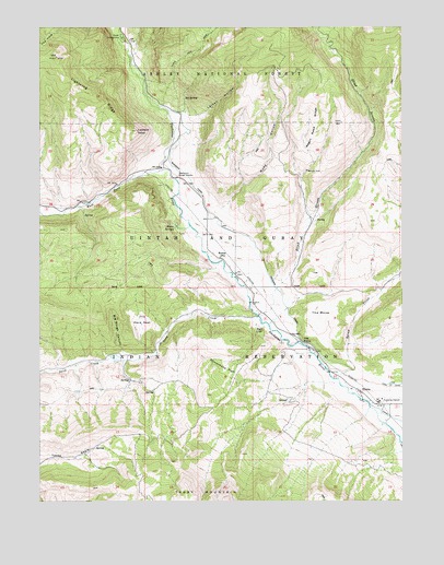
Hanna, UT USGS Topographic Map
Click on map above to begin viewing in our Map Viewer.

This topographic map contains these locations and features:
Feature Name Type Latitude Longitude GNIS ID View Map
Aspen CampgroundLocaleN40.4972°W110.8466°1437947View Map
Big Rough CanyonValleyN40.4144°W110.8471°1425540View Map
Big SpringSpringN40.4813°W110.8259°1425556View Map
Blind StreamStreamN40.4236°W110.7999°1425765View Map
Dutchmans FlatFlatN40.4097°W110.8124°1427639View Map
HannaPopulated PlaceN40.4041°W110.7652°1428509View Map
Hanna HeliportAirportN40.4033°W110.7641°1435648View Map
Hanna Post OfficePost OfficeN40.4388°W110.8127°1455143View Map
Jackass Larson SpringSpringN40.4778°W110.8278°1455337View Map
Larsen HollowValleyN40.4769°W110.8232°1429480View Map
Lookout PointCapeN40.4727°W110.8418°1429933View Map
Red CliffCliffN40.4199°W110.8010°1431630View Map
Rhoades CanalCanalN40.4505°W110.8146°1431768View Map
Rude HollowValleyN40.4530°W110.8110°1432047View Map
Sand CreekStreamN40.4238°W110.8002°1445305View Map
Squaw CreekStreamN40.4074°W110.7724°1446073View Map
Stockmore Ranger StationLocaleN40.4602°W110.8279°1432989View Map
The Hens NestBasinN40.4216°W110.8404°1433330View Map
The HoleBasinN40.4969°W110.8732°1433336View Map
The MesaSummitN40.4258°W110.7785°1433364View Map
The PointCliffN40.4177°W110.7852°1433400View Map
United States Forest Service Fire Station - Stockmore Ranger DistrictBuildingN40.4678°W110.8315°2768501View Map
Wagon Road RidgeRidgeN40.4744°W110.7802°1433915View Map
Warm SpringsSpringN40.4469°W110.8282°1433960View Map
West Fork Duchesne RiverStreamN40.4624°W110.8332°1447139View Map

Note: Coordinates in the location and feature list above are referenced to NAD83 datum.


Copyright (C) 2008-2025 Ryan Niemi / Sunset Dynamics ... All Rights Reserved