TopoQuest Logo
Do you find TopoQuest useful?
Help keep TopoQuest running and adding new maps/features by donating!
Bitcoin:  19c7KJd3qBynnjoSw5npx9KScwjBe4ifkT
Litecoin:  LXs6TkuXGGXo1vDsWCkWVdjQX94eUKd6ui
Home View Maps Find Maps Find Places Resources & Links


Harrington Creek, Oregon Topographic Map

USGS Map Title: Harrington Creek, OR
USGS Map MRC: 43122D8
DRG (GeoTIFF) Download: o43122d8.tif


Neighboring USGS Topographic Map Quads:


  Harness Mountain, OR  
43123E1
 

  Burnt Mountain, OR  
43122E8
 

  Silica Mountain, OR  
43122E7
 

  Hinkle Creek, OR  
43123D1
 

  Harrington Creek, OR  
43122D8
 

  Scaredman Creek, OR  
43122D7
 

  Glide, OR  
43123C1
 

  Old Fairview, OR  
43122C8
 

  Mace Mountain, OR  
43122C7


Map MRC Location:

N44°
W123°
N44°
W122°
H8 H7 H6 H5 H4 H3 H2 H1
G8 G7 G6 G5 G4 G3 G2 G1
F8 F7 F6 F5 F4 F3 F2 F1
E8 E7 E6 E5 E4 E3 E2 E1
D8 D7 D6 D5 D4 D3 D2 D1
C8 C7 C6 C5 C4 C3 C2 C1
B8 B7 B6 B5 B4 B3 B2 B1
A8 A7 A6 A5 A4 A3 A2 A1
N43°
W123°
N43°
W122°

Harrington Creek, OR USGS 1:24K Topographic Map Preview:
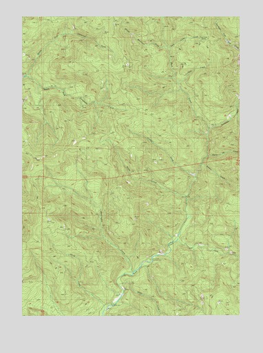
Harrington Creek, OR USGS Topographic Map
Click on map above to begin viewing in our Map Viewer.

This topographic map contains these locations and features:
Feature Name Type Latitude Longitude GNIS ID View Map
Brown MountainSummitN43.4415°W122.9883°1118130View Map
Cleft CreekStreamN43.4721°W122.9123°1162521View Map
Cobble CreekStreamN43.4332°W122.9012°1162523View Map
East Fork Rock CreekStreamN43.4062°W122.9109°1141599View Map
Harrington CreekStreamN43.3929°W122.9367°1121615View Map
Huckleberry CreekStreamN43.4854°W122.8751°1166791View Map
Hurry Up CreekStreamN43.4415°W122.8942°1162522View Map
Middle Fork Calapooya CreekStreamN43.4751°W122.9981°1124102View Map
Middle Mountain CreekStreamN43.4873°W122.9165°1162520View Map
Miller CreekStreamN43.3885°W122.9453°1146268View Map
Millpond CampgroundLocaleN43.3807°W122.9478°1132925View Map
Northeast Fork Rock CreekStreamN43.4529°W122.8934°1147077View Map
Pebble CreekStreamN43.4387°W122.8984°1162525View Map
Rock Creek Recreation SiteParkN43.3985°W122.9276°1132924View Map
Shoup CreekStreamN43.3757°W122.9537°1126931View Map
Stony CreekStreamN43.4248°W122.9067°1162524View Map
Twin Cedar CreekStreamN43.4873°W122.9165°1162519View Map
Twin Cedar SpringSpringN43.4902°W122.8969°1128341View Map

Note: Coordinates in the location and feature list above are referenced to NAD83 datum.


Copyright (C) 2008-2025 Ryan Niemi / Sunset Dynamics ... All Rights Reserved