TopoQuest Logo
Do you find TopoQuest useful?
Help keep TopoQuest running and adding new maps/features by donating!
Bitcoin:  19c7KJd3qBynnjoSw5npx9KScwjBe4ifkT
Litecoin:  LXs6TkuXGGXo1vDsWCkWVdjQX94eUKd6ui
Home View Maps Find Maps Find Places Resources & Links


Harness Mountain, Oregon Topographic Map

USGS Map Title: Harness Mountain, OR
USGS Map MRC: 43123E1
DRG (GeoTIFF) Download: o43123e1.tif


Neighboring USGS Topographic Map Quads:


  Curtin, OR  
43123F2
 

  Cottage Grove Lake, OR  
43123F1
 

  Blue Mountain, OR  
43122F8
 

  Scotts Valley, OR  
43123E2
 

  Harness Mountain, OR  
43123E1
 

  Burnt Mountain, OR  
43122E8
 

  Nonpareil, OR  
43123D2
 

  Hinkle Creek, OR  
43123D1
 

  Harrington Creek, OR  
43122D8


Map MRC Location:

N44°
W124°
N44°
W123°
H8 H7 H6 H5 H4 H3 H2 H1
G8 G7 G6 G5 G4 G3 G2 G1
F8 F7 F6 F5 F4 F3 F2 F1
E8 E7 E6 E5 E4 E3 E2 E1
D8 D7 D6 D5 D4 D3 D2 D1
C8 C7 C6 C5 C4 C3 C2 C1
B8 B7 B6 B5 B4 B3 B2 B1
A8 A7 A6 A5 A4 A3 A2 A1
N43°
W124°
N43°
W123°

Harness Mountain, OR USGS 1:24K Topographic Map Preview:
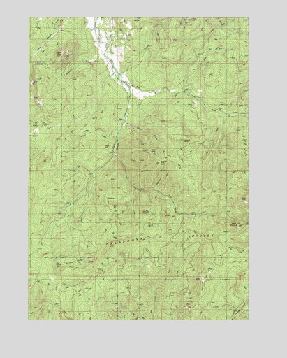
Harness Mountain, OR USGS Topographic Map
Click on map above to begin viewing in our Map Viewer.

This topographic map contains these locations and features:
Feature Name Type Latitude Longitude GNIS ID View Map
Akerson ButteSummitN43.6241°W123.0648°1135992View Map
Alton HillSummitN43.5717°W123.0837°1136000View Map
Amos (historical)Populated PlaceN43.6082°W123.0845°1133022View Map
Amos Post Office (historical)Post OfficeN43.6082°W123.0845°1164835View Map
Bald ButteSummitN43.5491°W123.0025°1117169View Map
Bar CreekStreamN43.5848°W123.0148°1117230View Map
Bemis CemeteryCemeteryN43.6153°W123.0799°1133023View Map
Big BaldySummitN43.5537°W123.0906°1136065View Map
Big RiverStreamN43.5954°W123.0676°1117659View Map
Black ButteSummitN43.5696°W123.0581°1117745View Map
Black ButtePopulated PlaceN43.5693°W123.0776°1157800View Map
Black Butte MineMineN43.5740°W123.0637°1117748View Map
Blackbutte Post Office (historical)Post OfficeN43.5685°W123.0776°1164219View Map
Blood CreekStreamN43.5760°W123.0740°1117823View Map
Carlson CreekStreamN43.5604°W123.0884°1118611View Map
Cinnabar CreekStreamN43.5540°W123.0645°1118945View Map
Cinnabar MountainSummitN43.5440°W123.0614°1136151View Map
Combs CreekStreamN43.6010°W123.0737°1119178View Map
Deer CreekStreamN43.6248°W123.0845°1133025View Map
Dennis CreekStreamN43.5821°W123.0709°1119859View Map
Drue CreekStreamN43.6162°W123.0259°1120100View Map
East Cinnabar CreekStreamN43.5526°W123.0567°1133019View Map
Garoutte CreekStreamN43.5676°W123.0762°1126608View Map
Hambrick CreekStreamN43.6098°W123.0820°1121533View Map
Harness MountainSummitN43.5255°W123.0918°1121606View Map
Hobart ButteSummitN43.6088°W123.1077°1121855View Map
Hornet ButteSummitN43.5428°W123.0491°1136393View Map
Jasper CreekStreamN43.5957°W123.0362°1122387View Map
Knob HillSummitN43.5462°W123.0781°1136449View Map
Little BaldySummitN43.5585°W123.0801°1136484View Map
Little RiverStreamN43.5957°W123.0690°1123264View Map
Louis Post Office (historical)Post OfficeN43.6054°W123.1212°1164483View Map
Martin CreekStreamN43.5940°W123.0356°1123806View Map
Murry HillSummitN43.5344°W123.0750°1136561View Map
Norman CreekStreamN43.5540°W123.0595°1133020View Map
Rouse BridgeBridgeN43.6165°W123.0854°1126339View Map
Rouse CreekStreamN43.6165°W123.0845°1133024View Map
Scorpion ButteSummitN43.5643°W123.0510°1136733View Map
Sevenmile HillSummitN43.5062°W123.0342°1126765View Map
Stennett ButteSummitN43.5748°W123.0384°1136791View Map
Trail CreekStreamN43.5643°W123.0717°1128183View Map
Weyerhaeuser CreekStreamN43.5526°W123.0526°1133021View Map
Witt ButteSummitN43.6241°W123.0352°1136920View Map

Note: Coordinates in the location and feature list above are referenced to NAD83 datum.


Copyright (C) 2008-2024 Ryan Niemi / Sunset Dynamics ... All Rights Reserved