TopoQuest Logo
Do you find TopoQuest useful?
Help keep TopoQuest running and adding new maps/features by donating!
Bitcoin:  19c7KJd3qBynnjoSw5npx9KScwjBe4ifkT
Litecoin:  LXs6TkuXGGXo1vDsWCkWVdjQX94eUKd6ui
Home View Maps Find Maps Find Places Resources & Links


Burnt Mountain, Oregon Topographic Map

USGS Map Title: Burnt Mountain, OR
USGS Map MRC: 43122E8
DRG (GeoTIFF) Download: o43122e8.tif


Neighboring USGS Topographic Map Quads:


  Cottage Grove Lake, OR  
43123F1
 

  Blue Mountain, OR  
43122F8
 

  Culp Creek, OR  
43122F7
 

  Harness Mountain, OR  
43123E1
 

  Burnt Mountain, OR  
43122E8
 

  Silica Mountain, OR  
43122E7
 

  Hinkle Creek, OR  
43123D1
 

  Harrington Creek, OR  
43122D8
 

  Scaredman Creek, OR  
43122D7


Map MRC Location:

N44°
W123°
N44°
W122°
H8 H7 H6 H5 H4 H3 H2 H1
G8 G7 G6 G5 G4 G3 G2 G1
F8 F7 F6 F5 F4 F3 F2 F1
E8 E7 E6 E5 E4 E3 E2 E1
D8 D7 D6 D5 D4 D3 D2 D1
C8 C7 C6 C5 C4 C3 C2 C1
B8 B7 B6 B5 B4 B3 B2 B1
A8 A7 A6 A5 A4 A3 A2 A1
N43°
W123°
N43°
W122°

Burnt Mountain, OR USGS 1:24K Topographic Map Preview:
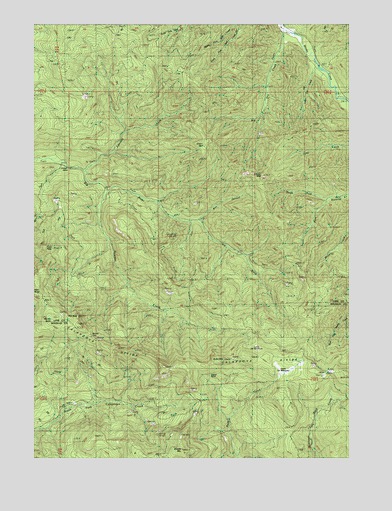
Burnt Mountain, OR USGS Topographic Map
Click on map above to begin viewing in our Map Viewer.

This topographic map contains these locations and features:
Feature Name Type Latitude Longitude GNIS ID View Map
Bark Shanty CreekStreamN43.6235°W122.9023°1117240View Map
Big Dry CreekStreamN43.6235°W122.9023°1117615View Map
Boulder CreekStreamN43.5771°W122.9715°1117971View Map
Box CanyonValleyN43.5693°W122.9359°1637948View Map
Burnt MountainSummitN43.5540°W122.9512°1130521View Map
Burnt MountainSummitN43.5284°W122.9262°1118357View Map
Cougar BendBendN43.5851°W122.9953°1119363View Map
Dahl CreekStreamN43.6035°W122.8790°1140589View Map
Edwards CreekStreamN43.5823°W122.9798°1120404View Map
Fawn PeakSummitN43.5596°W122.9934°1120649View Map
Grassy MountainSummitN43.5817°W122.9100°1121320View Map
Green MountainSummitN43.5901°W122.9337°1121382View Map
Huckleberry SpringSpringN43.5246°W122.8859°1639058View Map
Kellys BluffCliffN43.5232°W122.9315°1122676View Map
Little Dry CreekStreamN43.6137°W122.8884°1123184View Map
Lower Elk MeadowsFlatN43.5304°W122.9115°1123562View Map
Marion ButteSummitN43.5401°W122.9915°1130522View Map
Middle Fork Stell CreekStreamN43.6246°W122.9192°1124118View Map
Middle MountainSummitN43.5023°W122.9424°1136534View Map
North Fork Brownie CreekStreamN43.5748°W122.8823°1124754View Map
Pilot RockSummitN43.5409°W122.9836°1130523View Map
Rock Creek TrailTrailN43.5029°W122.8967°1126185View Map
Shirley GapGapN43.5354°W122.9784°1134632View Map
Shirley Gap LookoutLocaleN43.5310°W122.9692°1126893View Map
South Fork Brownie CreekStreamN43.5746°W122.8823°1127261View Map
South Fork Stell CreekStreamN43.6246°W122.9190°1127326View Map
Upper Elk MeadowsFlatN43.5248°W122.9051°1128449View Map

Note: Coordinates in the location and feature list above are referenced to NAD83 datum.


Copyright (C) 2008-2025 Ryan Niemi / Sunset Dynamics ... All Rights Reserved