TopoQuest Logo
Do you find TopoQuest useful?
Help keep TopoQuest running and adding new maps/features by donating!
Bitcoin:  19c7KJd3qBynnjoSw5npx9KScwjBe4ifkT
Litecoin:  LXs6TkuXGGXo1vDsWCkWVdjQX94eUKd6ui
Home View Maps Find Maps Find Places Resources & Links


Harrington Peak, Idaho Topographic Map

USGS Map Title: Harrington Peak, ID
USGS Map MRC: 42111E3
DRG (GeoTIFF) Download: o42111e3.tif


Neighboring USGS Topographic Map Quads:


  Johnson Creek, ID  
42111F4
 

  Dry Valley, ID  
42111F3
 

  Stewart Flat, ID  
42111F2
 

  Fossil Canyon, ID  
42111E4
 

  Harrington Peak, ID  
42111E3
 

  Snowdrift Mountain, ID  
42111E2
 

  Nounan, ID  
42111D4
 

  Georgetown, ID  
42111D3
 

  Meade Peak, ID  
42111D2


Map MRC Location:

N43°
W112°
N43°
W111°
H8 H7 H6 H5 H4 H3 H2 H1
G8 G7 G6 G5 G4 G3 G2 G1
F8 F7 F6 F5 F4 F3 F2 F1
E8 E7 E6 E5 E4 E3 E2 E1
D8 D7 D6 D5 D4 D3 D2 D1
C8 C7 C6 C5 C4 C3 C2 C1
B8 B7 B6 B5 B4 B3 B2 B1
A8 A7 A6 A5 A4 A3 A2 A1
N42°
W112°
N42°
W111°

Harrington Peak, ID USGS 1:24K Topographic Map Preview:
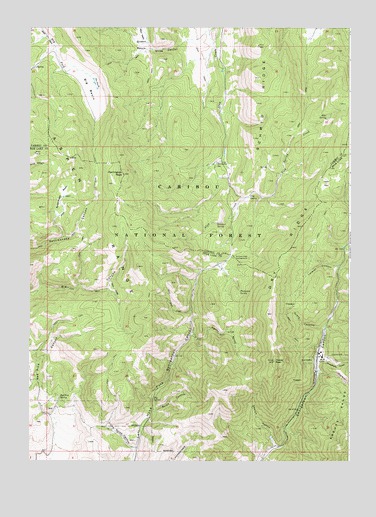
Harrington Peak, ID USGS Topographic Map
Click on map above to begin viewing in our Map Viewer.

This topographic map contains these locations and features:
Feature Name Type Latitude Longitude GNIS ID View Map
Big BasinBasinN42.6085°W111.3519°377427View Map
Big SpringSpringN42.5173°W111.3267°377591View Map
Church HollowValleyN42.5049°W111.2794°379335View Map
Cold SpringSpringN42.5760°W111.2896°2785953View Map
Cold Spring CreekStreamN42.5761°W111.2900°2785952View Map
Dry RidgeRidgeN42.5288°W111.2797°380892View Map
Dud HollowValleyN42.5288°W111.2638°395328View Map
Grant CanyonValleyN42.5388°W111.2608°382558View Map
Harrington PeakSummitN42.5827°W111.3388°382924View Map
Hawks PeakSummitN42.5288°W111.2797°382971View Map
Hawks RoostValleyN42.5363°W111.3119°382972View Map
Hess SpringSpringN42.5991°W111.2596°383127View Map
Horseshoe SpringSpringN42.5861°W111.3020°2785954View Map
Lateral CanyonValleyN42.5563°W111.2552°384464View Map
Little Rolph CanyonValleyN42.5035°W111.3344°397860View Map
Phosphoria GulchValleyN42.5296°W111.2608°388410View Map
Pritchert SpringSpringN42.5688°W111.3024°388887View Map
Rattlesnake BasinBasinN42.5769°W111.3622°389130View Map
Red Pine CanyonValleyN42.5130°W111.3663°389219View Map
Red Pine SpringSpringN42.5183°W111.3633°389225View Map
Rolph CanyonValleyN42.5149°W111.3263°389582View Map
Shale CreekStreamN42.5433°W111.3124°390141View Map
Summit View CampgroundLocaleN42.5585°W111.2960°391643View Map
The HoleBasinN42.5499°W111.3438°391966View Map
The PondsLakeN42.6090°W111.3501°391983View Map
Thompson SpringSpringN42.5488°W111.2931°392044View Map
Wilde CanyonValleyN42.6208°W111.3158°393439View Map

Note: Coordinates in the location and feature list above are referenced to NAD83 datum.


Copyright (C) 2008-2025 Ryan Niemi / Sunset Dynamics ... All Rights Reserved