TopoQuest Logo
Do you find TopoQuest useful?
Help keep TopoQuest running and adding new maps/features by donating!
Bitcoin:  19c7KJd3qBynnjoSw5npx9KScwjBe4ifkT
Litecoin:  LXs6TkuXGGXo1vDsWCkWVdjQX94eUKd6ui
Home View Maps Find Maps Find Places Resources & Links


Nounan, Idaho Topographic Map

USGS Map Title: Nounan, ID
USGS Map MRC: 42111D4
DRG (GeoTIFF) Download: o42111d4.tif


Neighboring USGS Topographic Map Quads:


  Soda Peak, ID  
42111E5
 

  Fossil Canyon, ID  
42111E4
 

  Harrington Peak, ID  
42111E3
 

  North Canyon, ID  
42111D5
 

  Nounan, ID  
42111D4
 

  Georgetown, ID  
42111D3
 

  Midnight Mountain, ID  
42111C5
 

  Ovid, ID  
42111C4
 

  Montpelier, ID  
42111C3


Map MRC Location:

N43°
W112°
N43°
W111°
H8 H7 H6 H5 H4 H3 H2 H1
G8 G7 G6 G5 G4 G3 G2 G1
F8 F7 F6 F5 F4 F3 F2 F1
E8 E7 E6 E5 E4 E3 E2 E1
D8 D7 D6 D5 D4 D3 D2 D1
C8 C7 C6 C5 C4 C3 C2 C1
B8 B7 B6 B5 B4 B3 B2 B1
A8 A7 A6 A5 A4 A3 A2 A1
N42°
W112°
N42°
W111°

Nounan, ID USGS 1:24K Topographic Map Preview:
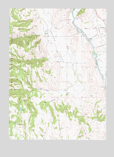
Nounan, ID USGS Topographic Map
Click on map above to begin viewing in our Map Viewer.

This topographic map contains these locations and features:
Feature Name Type Latitude Longitude GNIS ID View Map
Bartlett LakeLakeN42.4041°W111.4846°376986View Map
Bear Lake Volunteer Fire Protection District Station 11BuildingN42.4572°W111.4374°2619171View Map
Beaver CreekStreamN42.4252°W111.4638°377245View Map
Co-Op CreekStreamN42.4596°W111.4260°379460View Map
Fern CreekStreamN42.4235°W111.4688°381657View Map
Fife DamDamN42.4099°W111.4874°398771View Map
Fife ReservoirReservoirN42.4099°W111.4874°398772View Map
GeorgetownLocaleN42.4733°W111.3977°397734View Map
Georgetown CreekStreamN42.4719°W111.3969°382247View Map
Georgetown DivisionCivilN42.4976°W111.4638°1936718View Map
LindsayvillePopulated PlaceN42.4299°W111.4222°400212View Map
North CanyonValleyN42.3919°W111.4835°387624View Map
North Stauffer CreekStreamN42.4249°W111.4810°387852View Map
NounanPopulated PlaceN42.4777°W111.4510°396975View Map
Nounan CemeteryCemeteryN42.4441°W111.4331°387873View Map
NovenePopulated PlaceN42.4971°W111.4133°401693View Map
Skinner CemeteryCemeteryN42.4811°W111.4411°390521View Map
South HillSummitN42.3941°W111.3891°397190View Map
South Stauffer CreekStreamN42.4249°W111.4810°391076View Map
Spring CreekStreamN42.4408°W111.4152°391165View Map
Stauffer CreekStreamN42.4788°W111.4099°391383View Map
Threemile CreekStreamN42.4313°W111.3755°392094View Map
WooleysPopulated PlaceN42.4519°W111.3869°401700View Map

Note: Coordinates in the location and feature list above are referenced to NAD83 datum.


Copyright (C) 2008-2025 Ryan Niemi / Sunset Dynamics ... All Rights Reserved