TopoQuest Logo
Do you find TopoQuest useful?
Help keep TopoQuest running and adding new maps/features by donating!
Bitcoin:  19c7KJd3qBynnjoSw5npx9KScwjBe4ifkT
Litecoin:  LXs6TkuXGGXo1vDsWCkWVdjQX94eUKd6ui
Home View Maps Find Maps Find Places Resources & Links


Harris, California Topographic Map

USGS Map Title: Harris, CA
USGS Map MRC: 40123A6
DRG (GeoTIFF) Download: o40123a6.tif


Neighboring USGS Topographic Map Quads:


  Miranda, CA  
40123B7
 

  Fort Seward, CA  
40123B6
 

  Alderpoint, CA  
40123B5
 

  Garberville, CA  
40123A7
 

  Harris, CA  
40123A6
 

  Jewett Rock, CA  
40123A5
 

  Piercy, CA  
39123H7
 

  Noble Butte, CA  
39123H6
 

  Bell Springs, CA  
39123H5


Map MRC Location:

N41°
W124°
N41°
W123°
H8 H7 H6 H5 H4 H3 H2 H1
G8 G7 G6 G5 G4 G3 G2 G1
F8 F7 F6 F5 F4 F3 F2 F1
E8 E7 E6 E5 E4 E3 E2 E1
D8 D7 D6 D5 D4 D3 D2 D1
C8 C7 C6 C5 C4 C3 C2 C1
B8 B7 B6 B5 B4 B3 B2 B1
A8 A7 A6 A5 A4 A3 A2 A1
N40°
W124°
N40°
W123°

Harris, CA USGS 1:24K Topographic Map Preview:
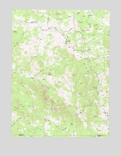
Harris, CA USGS Topographic Map
Click on map above to begin viewing in our Map Viewer.

This topographic map contains these locations and features:
Feature Name Type Latitude Longitude GNIS ID View Map
Chervimov OpeningFlatN40.0071°W123.6822°220968View Map
Drewry PitMineN40.0214°W123.6275°2677341View Map
HarrisPopulated PlaceN40.0840°W123.6586°1658716View Map
Harris CemeteryCemeteryN40.0854°W123.6560°2755374View Map
Harris Post OfficePost OfficeN40.0488°W123.6417°1662299View Map
Horse Pasture CreekStreamN40.0590°W123.7359°225617View Map
KBEY-FM (Garberville)TowerN40.1207°W123.6920°1662881View Map
KMUD-FM (Garberville)TowerN40.1207°W123.6920°1662882View Map
Lewis OpeningFlatN40.0124°W123.6750°227046View Map
Little Buck MountainSummitN40.1032°W123.7489°227204View Map
Mail RidgeRidgeN40.0801°W123.6670°234225View Map
Miller RanchLocaleN40.0243°W123.6634°228746View Map
Panther PeakSummitN40.0613°W123.7003°230309View Map
Perington CreekStreamN40.1021°W123.6275°253748View Map
Peterson OpeningGapN40.0032°W123.6706°234454View Map
Pratt MountainSummitN40.1201°W123.6920°231029View Map
Rancheria CreekStreamN40.0588°W123.7245°231212View Map
Rays CreekStreamN40.0482°W123.7064°231297View Map
Reed MountainSummitN40.0260°W123.7450°231457View Map
Spruce GroveWoodsN40.0932°W123.6797°235293View Map
Squaw CreekStreamN40.0646°W123.7395°235302View Map
Tom Long CreekStreamN40.0279°W123.6984°236433View Map

Note: Coordinates in the location and feature list above are referenced to NAD83 datum.


Copyright (C) 2008-2025 Ryan Niemi / Sunset Dynamics ... All Rights Reserved