TopoQuest Logo
Do you find TopoQuest useful?
Help keep TopoQuest running and adding new maps/features by donating!
Bitcoin:  19c7KJd3qBynnjoSw5npx9KScwjBe4ifkT
Litecoin:  LXs6TkuXGGXo1vDsWCkWVdjQX94eUKd6ui
Home View Maps Find Maps Find Places Resources & Links


Alderpoint, California Topographic Map

USGS Map Title: Alderpoint, CA
USGS Map MRC: 40123B5
DRG (GeoTIFF) Download: o40123b5.tif


Neighboring USGS Topographic Map Quads:


  Blocksburg, CA  
40123C6
 

  Black Lassic, CA  
40123C5
 

  Ruth Lake, CA  
40123C4
 

  Fort Seward, CA  
40123B6
 

  Alderpoint, CA  
40123B5
 

  Zenia, CA  
40123B4
 

  Harris, CA  
40123A6
 

  Jewett Rock, CA  
40123A5
 

  Lake Mountain, CA  
40123A4


Map MRC Location:

N41°
W124°
N41°
W123°
H8 H7 H6 H5 H4 H3 H2 H1
G8 G7 G6 G5 G4 G3 G2 G1
F8 F7 F6 F5 F4 F3 F2 F1
E8 E7 E6 E5 E4 E3 E2 E1
D8 D7 D6 D5 D4 D3 D2 D1
C8 C7 C6 C5 C4 C3 C2 C1
B8 B7 B6 B5 B4 B3 B2 B1
A8 A7 A6 A5 A4 A3 A2 A1
N40°
W124°
N40°
W123°

Alderpoint, CA USGS 1:24K Topographic Map Preview:
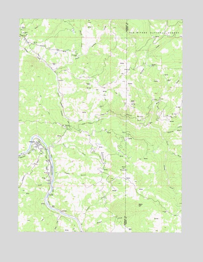
Alderpoint, CA USGS Topographic Map
Click on map above to begin viewing in our Map Viewer.

This topographic map contains these locations and features:
Feature Name Type Latitude Longitude GNIS ID View Map
AlderpointPopulated PlaceN40.1763°W123.6117°1657909View Map
Alderpoint Census Designated PlaceCensusN40.1613°W123.6157°2611374View Map
Alderpoint Post OfficePost OfficeN40.1762°W123.6101°2760059View Map
Blocksburg Ranger Station (historical)LocaleN40.1849°W123.5886°1665525View Map
Bluford CreekStreamN40.2010°W123.5220°257293View Map
Burgess CreekStreamN40.1857°W123.5053°257705View Map
Cain RockPopulated PlaceN40.1368°W123.5928°1658186View Map
Cain RockPillarN40.1396°W123.6003°257815View Map
Cain Rock CrossingBridgeN40.1468°W123.6031°1658187View Map
California Department of Forestry and Fire Protection Alderpoint StationBuildingN40.1863°W123.5913°256174View Map
Carter CreekStreamN40.1743°W123.6036°258011View Map
Casterlin Elementary SchoolSchoolN40.2415°W123.6231°258051View Map
Dobbyn Creek RanchLocaleN40.2285°W123.5817°222443View Map
Graham LakeLakeN40.2228°W123.5258°260731View Map
Hembrey CreekStreamN40.1821°W123.5170°261260View Map
Hight GulchValleyN40.1565°W123.5981°225310View Map
Hoover CreekStreamN40.2288°W123.5781°234026View Map
Jewett CreekStreamN40.1354°W123.5928°261942View Map
Jewett SchoolSchoolN40.1735°W123.6098°261943View Map
Line GulchValleyN40.1721°W123.5106°262495View Map
Mill CreekStreamN40.1524°W123.6020°263608View Map
Moody RanchLocaleN40.1268°W123.5414°263784View Map
Mud CreekStreamN40.1868°W123.5289°263923View Map
Neafus PeakSummitN40.1404°W123.5342°264012View Map
North Dobbyn CreekStreamN40.2215°W123.6028°234365View Map
Pauls PointCapeN40.2019°W123.5411°264570View Map
South Dobbyn CreekStreamN40.2213°W123.6028°267415View Map
Stewart RanchLocaleN40.2115°W123.5714°267743View Map
Stewart RanchLocaleN40.2118°W123.5720°275167View Map
Stockton RanchLocaleN40.2143°W123.5128°267760View Map
Ticknor CreekStreamN40.1293°W123.5789°268271View Map
Wool MountainSummitN40.1624°W123.5468°269312View Map
Zenia BluffsCliffN40.1929°W123.5370°269393View Map

Note: Coordinates in the location and feature list above are referenced to NAD83 datum.


Copyright (C) 2008-2024 Ryan Niemi / Sunset Dynamics ... All Rights Reserved