TopoQuest Logo
Do you find TopoQuest useful?
Help keep TopoQuest running and adding new maps/features by donating!
Bitcoin:  19c7KJd3qBynnjoSw5npx9KScwjBe4ifkT
Litecoin:  LXs6TkuXGGXo1vDsWCkWVdjQX94eUKd6ui
Home View Maps Find Maps Find Places Resources & Links


Hartford, Iowa Topographic Map

USGS Map Title: Hartford, IA
USGS Map MRC: 41093D4
DRG (GeoTIFF) Download: o41093d4.tif


Neighboring USGS Topographic Map Quads:


  Des Moines SE, IA  
41093E5
 

  Rising Sun, IA  
41093E4
 

  Runnells, IA  
41093E3
 

  Scotch Ridge, IA  
41093D5
 

  Hartford, IA  
41093D4
 

  Pleasantville, IA  
41093D3
 

  Indianola, IA  
41093C5
 

  Milo, IA  
41093C4
 

  Beech, IA  
41093C3


Map MRC Location:

N42°
W94°
N42°
W93°
H8 H7 H6 H5 H4 H3 H2 H1
G8 G7 G6 G5 G4 G3 G2 G1
F8 F7 F6 F5 F4 F3 F2 F1
E8 E7 E6 E5 E4 E3 E2 E1
D8 D7 D6 D5 D4 D3 D2 D1
C8 C7 C6 C5 C4 C3 C2 C1
B8 B7 B6 B5 B4 B3 B2 B1
A8 A7 A6 A5 A4 A3 A2 A1
N41°
W94°
N41°
W93°

Hartford, IA USGS 1:24K Topographic Map Preview:
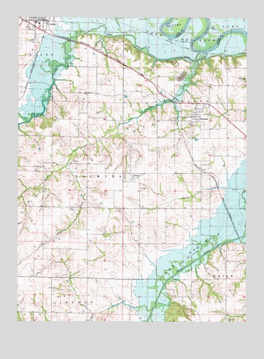
Hartford, IA USGS Topographic Map
Click on map above to begin viewing in our Map Viewer.

This topographic map contains these locations and features:
Feature Name Type Latitude Longitude GNIS ID View Map
Black CemeteryCemeteryN41.4397°W93.3995°454652View Map
Butcher CreekStreamN41.4825°W93.4019°455015View Map
CarlisleLocaleN41.4986°W93.4835°1970062View Map
Carlisle Care CenterHospitalN41.4961°W93.4933°1970073View Map
Carlisle CemeteryCemeteryN41.4898°W93.4905°455169View Map
Carlisle City Fire DepartmentBuildingN41.4994°W93.4874°1970069View Map
Carlisle Dental OfficeHospitalN41.4930°W93.4885°1970074View Map
Carlisle Elementary SchoolSchoolN41.4977°W93.4901°2719696View Map
Carlisle Family Practice ClinicHospitalN41.4986°W93.4872°1970075View Map
Carlisle High SchoolSchoolN41.4973°W93.4891°1970085View Map
Carlisle Police DepartmentBuildingN41.4994°W93.4864°1970070View Map
Carlisle Post OfficePost OfficeN41.4983°W93.4863°1970068View Map
Carlisle Public LibraryBuildingN41.4989°W93.4872°1970072View Map
Carlisle United Methodist ChurchChurchN41.4989°W93.4902°1970078View Map
City of HartfordCivilN41.4577°W93.4052°2394307View Map
Community United Presbyterian ChurchChurchN41.4594°W93.4049°1970051View Map
Fellowship Baptist ChurchChurchN41.4889°W93.4905°1970080View Map
FordPopulated PlaceN41.4850°W93.3885°464255View Map
Ford Post Office (historical)Post OfficeN41.4917°W93.3835°1969894View Map
Freel Post Office (historical)Post OfficeN41.4972°W93.3758°2047811View Map
Friends Grove Post Office (historical)Post OfficeN41.3783°W93.4724°1969891View Map
GreenbushPopulated PlaceN41.4250°W93.4516°465498View Map
Gvist Chiropractic ClinicHospitalN41.4972°W93.4863°1970076View Map
HartfordPopulated PlaceN41.4594°W93.4049°457295View Map
HartfordLocaleN41.4592°W93.4108°1970055View Map
Hartford CemeteryCemeteryN41.4565°W93.4055°1970105View Map
Hartford City HallBuildingN41.4594°W93.4049°1970054View Map
Hartford Middle SchoolSchoolN41.4631°W93.4036°1970056View Map
Hartford Mobile Home ParkPopulated PlaceN41.4594°W93.4049°1970053View Map
Hartford Post OfficePost OfficeN41.4594°W93.4049°1970052View Map
Hartford Volunteer Fire and RescueBuildingN41.4596°W93.4037°1970050View Map
Holy Cross Lutheran ChurchChurchN41.4994°W93.4991°1970081View Map
Lindhardt ParkParkN41.4903°W93.4974°1970065View Map
Middle RiverStreamN41.4856°W93.3972°459049View Map
Middle River CemeteryCemeteryN41.4681°W93.4639°1970097View Map
Middle River ChurchChurchN41.4686°W93.4635°459050View Map
Missionary Baptist ChurchChurchN41.4972°W93.4933°1970082View Map
PalmyraPopulated PlaceN41.4361°W93.4383°460003View Map
Palmyra CemeteryCemeteryN41.4390°W93.4380°1970106View Map
Palmyra Post Office (historical)Post OfficeN41.4361°W93.4383°1970014View Map
Saint Elizabeth Seton ChurchChurchN41.4972°W93.4997°1970084View Map
Sandyville CemeteryCemeteryN41.3758°W93.3852°461421View Map
Short CreekStreamN41.3797°W93.4263°461585View Map
Skinaway CreekStreamN41.4386°W93.4738°461661View Map
Sutton Post Office (historical)Post OfficeN41.4005°W93.4919°1969873View Map
Township of PalmyraCivilN41.4295°W93.4535°468496View Map
Township of RichlandCivilN41.4642°W93.3869°468616View Map
Volunteer ParkParkN41.4861°W93.4947°1970066View Map
Western Acres Mobile Home ParkPopulated PlaceN41.4936°W93.4872°1970077View Map
Wilmington Post Office (historical)Post OfficeN41.4644°W93.4572°1969871View Map

Note: Coordinates in the location and feature list above are referenced to NAD83 datum.


Copyright (C) 2008-2024 Ryan Niemi / Sunset Dynamics ... All Rights Reserved