TopoQuest Logo
Do you find TopoQuest useful?
Help keep TopoQuest running and adding new maps/features by donating!
Bitcoin:  19c7KJd3qBynnjoSw5npx9KScwjBe4ifkT
Litecoin:  LXs6TkuXGGXo1vDsWCkWVdjQX94eUKd6ui
Home View Maps Find Maps Find Places Resources & Links


Rising Sun, Iowa Topographic Map

USGS Map Title: Rising Sun, IA
USGS Map MRC: 41093E4
DRG (GeoTIFF) Download: o41093e4.tif


Neighboring USGS Topographic Map Quads:


  Des Moines NE, IA  
41093F5
 

  Altoona, IA  
41093F4
 

  Mitchellville, IA  
41093F3
 

  Des Moines SE, IA  
41093E5
 

  Rising Sun, IA  
41093E4
 

  Runnells, IA  
41093E3
 

  Scotch Ridge, IA  
41093D5
 

  Hartford, IA  
41093D4
 

  Pleasantville, IA  
41093D3


Map MRC Location:

N42°
W94°
N42°
W93°
H8 H7 H6 H5 H4 H3 H2 H1
G8 G7 G6 G5 G4 G3 G2 G1
F8 F7 F6 F5 F4 F3 F2 F1
E8 E7 E6 E5 E4 E3 E2 E1
D8 D7 D6 D5 D4 D3 D2 D1
C8 C7 C6 C5 C4 C3 C2 C1
B8 B7 B6 B5 B4 B3 B2 B1
A8 A7 A6 A5 A4 A3 A2 A1
N41°
W94°
N41°
W93°

Rising Sun, IA USGS 1:24K Topographic Map Preview:
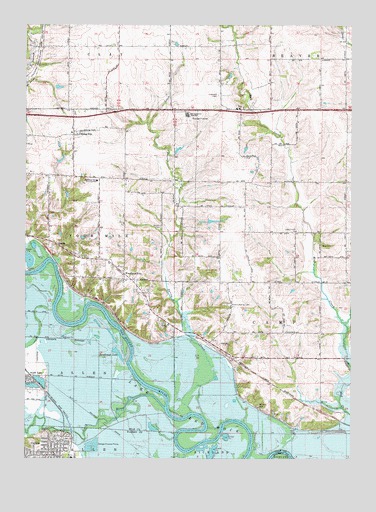
Rising Sun, IA USGS Topographic Map
Click on map above to begin viewing in our Map Viewer.

This topographic map contains these locations and features:
Feature Name Type Latitude Longitude GNIS ID View Map
AdelphiPopulated PlaceN41.5333°W93.4263°464439View Map
Adelphi (historical)LocaleN41.5333°W93.4263°2047816View Map
Adelphi Post Office (historical)Post OfficeN41.5333°W93.4263°2047817View Map
Avon LakeLakeN41.5242°W93.4991°454292View Map
Calvary ChurchChurchN41.5386°W93.4452°455093View Map
Camp Center ChurchChurchN41.5655°W93.3963°455106View Map
Camp Post Office (historical)Post OfficeN41.5667°W93.3863°2047810View Map
Canfield CemeteryCemeteryN41.6048°W93.4263°455151View Map
Carleton (historical)LocaleN41.5214°W93.4066°2047809View Map
Carleton Post Office (historical)Post OfficeN41.5214°W93.4066°2047808View Map
CarlislePopulated PlaceN41.5008°W93.4910°455166View Map
Carlisle Christian ChurchChurchN41.5011°W93.4888°1970079View Map
Carlisle City HallBuildingN41.5003°W93.4866°1970071View Map
Carlisle City ParkParkN41.5064°W93.4835°1970064View Map
Carlisle Community ChurchChurchN41.5008°W93.4910°1970083View Map
Carlisle Water Treatment PlantLocaleN41.5056°W93.4825°2728258View Map
City of CarlisleCivilN41.5118°W93.4877°2393745View Map
City of Pleasant HillCivilN41.5726°W93.4877°2396230View Map
Clarkson (historical)LocaleN41.5005°W93.4510°1969903View Map
Clarkson Post Office (historical)Post OfficeN41.5005°W93.4510°1969904View Map
Clay Elementary SchoolSchoolN41.6227°W93.4660°2719850View Map
De Louis FieldAirportN41.5490°W93.4302°2677142View Map
Four Mile Elementary SchoolSchoolN41.5801°W93.4732°461828View Map
Grace Community ChurchChurchN41.5936°W93.4827°2047600View Map
HastiePopulated PlaceN41.5628°W93.4897°464573View Map
Hastie (historical)LocaleN41.5628°W93.4897°2047815View Map
Hastie Post Office (historical)Post OfficeN41.5628°W93.4897°2047814View Map
IvyPopulated PlaceN41.6005°W93.4172°464592View Map
Ivy Centennial United Methodist ChurchChurchN41.6011°W93.4166°2047740View Map
Ivy Post Office (historical)Post OfficeN41.6005°W93.4172°2047818View Map
Midway Post Office (historical)Post OfficeN41.5722°W93.4169°2047812View Map
North RiverStreamN41.5147°W93.4466°459621View Map
Oakwood StationLocaleN41.6008°W93.4824°466115View Map
Powers - Warren CemeteryCemeteryN41.5446°W93.4224°460380View Map
Randleman LakeLakeN41.5303°W93.4647°460521View Map
Rising SunPopulated PlaceN41.5933°W93.4816°460644View Map
Rising Sun CemeteryCemeteryN41.5994°W93.4813°2047878View Map
Rising Sun Church of ChristChurchN41.5933°W93.4816°2048427View Map
Rising Sun Post Office (historical)Post OfficeN41.5933°W93.4816°2047813View Map
Southeast Polk High SchoolSchoolN41.5982°W93.4459°461829View Map
Southeast Polk Junior High SchoolSchoolN41.5990°W93.4380°2720016View Map
Spring CreekStreamN41.5133°W93.4366°461881View Map
Spry CemeteryCemeteryN41.5609°W93.3863°461929View Map
Stuart CemeteryCemeteryN41.5669°W93.4484°462042View Map
Toad Valley Public Golf CourseLocaleN41.5875°W93.4405°2047576View Map
Township of CampCivilN41.5467°W93.3818°467525View Map
Township of Four MileCivilN41.5707°W93.4780°467844View Map
Wicker CemeteryCemeteryN41.5152°W93.4109°463024View Map
Woodland HillsPopulated PlaceN41.5533°W93.4622°463187View Map
Woodland Hills Church of ChristChurchN41.5542°W93.4624°2047577View Map

Note: Coordinates in the location and feature list above are referenced to NAD83 datum.


Copyright (C) 2008-2024 Ryan Niemi / Sunset Dynamics ... All Rights Reserved