TopoQuest Logo
Do you find TopoQuest useful?
Help keep TopoQuest running and adding new maps/features by donating!
Bitcoin:  19c7KJd3qBynnjoSw5npx9KScwjBe4ifkT
Litecoin:  LXs6TkuXGGXo1vDsWCkWVdjQX94eUKd6ui
Home View Maps Find Maps Find Places Resources & Links


Scotch Ridge, Iowa Topographic Map

USGS Map Title: Scotch Ridge, IA
USGS Map MRC: 41093D5
DRG (GeoTIFF) Download: o41093d5.tif


Neighboring USGS Topographic Map Quads:


  Des Moines SW, IA  
41093E6
 

  Des Moines SE, IA  
41093E5
 

  Rising Sun, IA  
41093E4
 

  Norwalk, IA  
41093D6
 

  Scotch Ridge, IA  
41093D5
 

  Hartford, IA  
41093D4
 

  Martensdale, IA  
41093C6
 

  Indianola, IA  
41093C5
 

  Milo, IA  
41093C4


Map MRC Location:

N42°
W94°
N42°
W93°
H8 H7 H6 H5 H4 H3 H2 H1
G8 G7 G6 G5 G4 G3 G2 G1
F8 F7 F6 F5 F4 F3 F2 F1
E8 E7 E6 E5 E4 E3 E2 E1
D8 D7 D6 D5 D4 D3 D2 D1
C8 C7 C6 C5 C4 C3 C2 C1
B8 B7 B6 B5 B4 B3 B2 B1
A8 A7 A6 A5 A4 A3 A2 A1
N41°
W94°
N41°
W93°

Scotch Ridge, IA USGS 1:24K Topographic Map Preview:
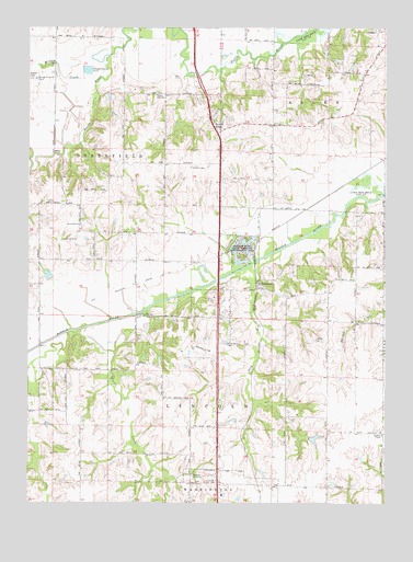
Scotch Ridge, IA USGS Topographic Map
Click on map above to begin viewing in our Map Viewer.

This topographic map contains these locations and features:
Feature Name Type Latitude Longitude GNIS ID View Map
Banner Mine State Wildlife Management AreaParkN41.4408°W93.5497°454349View Map
Carlisle Middle SchoolSchoolN41.4976°W93.5016°2719695View Map
Cavitt CreekStreamN41.4267°W93.5822°455217View Map
Farmers ChapelChurchN41.3930°W93.5010°456547View Map
Indianola Country ClubLocaleN41.3797°W93.5655°1969961View Map
Indianola Friends ChurchChurchN41.3755°W93.5658°1969951View Map
Indianola Water Pollution Control PlantLocaleN41.3867°W93.5808°2728362View Map
Laverty CemeteryCemeteryN41.4180°W93.5253°458245View Map
Laverty FieldAirportN41.4142°W93.5613°466826View Map
Loerke-Fox Run Aerodrome (historical)AirportN41.4555°W93.6016°466775View Map
Lundy AcresParkN41.4194°W93.5891°1969865View Map
National Balloon MuseumBuildingN41.3778°W93.5594°1969911View Map
North River CemeteryCemeteryN41.4476°W93.6072°1970100View Map
North River ChurchChurchN41.4483°W93.6072°459623View Map
Plug RunStreamN41.4417°W93.5372°460324View Map
Scotch RidgePopulated PlaceN41.4725°W93.5585°464736View Map
Scotch Ridge CemeteryCemeteryN41.4736°W93.5576°1970099View Map
Scotch Ridge United Presbyterian ChurchChurchN41.4733°W93.5585°1970063View Map
SummersetPopulated PlaceN41.4314°W93.5449°464766View Map
Summerset (historical)LocaleN41.4314°W93.5449°1969875View Map
Summerset Junction (historical)Populated PlaceN41.4444°W93.5444°464238View Map
Summerset Post Office (historical)Post OfficeN41.4314°W93.5449°1969874View Map
Township of AllenCivilN41.4844°W93.5137°467387View Map
Township of GreenfieldCivilN41.4615°W93.6192°467975View Map
Tuinstra AirfieldAirportN41.4351°W93.5405°2677146View Map
Wilson WoodsParkN41.4667°W93.6127°1969864View Map

Note: Coordinates in the location and feature list above are referenced to NAD83 datum.


Copyright (C) 2008-2025 Ryan Niemi / Sunset Dynamics ... All Rights Reserved