TopoQuest Logo
Do you find TopoQuest useful?
Help keep TopoQuest running and adding new maps/features by donating!
Bitcoin:  19c7KJd3qBynnjoSw5npx9KScwjBe4ifkT
Litecoin:  LXs6TkuXGGXo1vDsWCkWVdjQX94eUKd6ui
Home View Maps Find Maps Find Places Resources & Links


Hartley, Iowa Topographic Map

USGS Map Title: Hartley, IA
USGS Map MRC: 43095B4
DRG (GeoTIFF) Download: o43095b4.tif


Neighboring USGS Topographic Map Quads:


  Melvin, IA  
43095C5
 

  May City, IA  
43095C4
 

  Lake Park SE, IA  
43095C3
 

  Plessis, IA  
43095B5
 

  Hartley, IA  
43095B4
 

  Everly, IA  
43095B3
 

  Gaza, IA  
43095A5
 

  Hartley SW, IA  
43095A4
 

  Royal, IA  
43095A3


Map MRC Location:

N44°
W96°
N44°
W95°
H8 H7 H6 H5 H4 H3 H2 H1
G8 G7 G6 G5 G4 G3 G2 G1
F8 F7 F6 F5 F4 F3 F2 F1
E8 E7 E6 E5 E4 E3 E2 E1
D8 D7 D6 D5 D4 D3 D2 D1
C8 C7 C6 C5 C4 C3 C2 C1
B8 B7 B6 B5 B4 B3 B2 B1
A8 A7 A6 A5 A4 A3 A2 A1
N43°
W96°
N43°
W95°

Hartley, IA USGS 1:24K Topographic Map Preview:
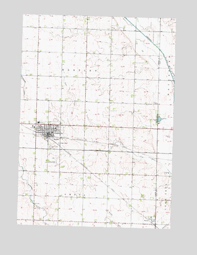
Hartley, IA USGS Topographic Map
Click on map above to begin viewing in our Map Viewer.

This topographic map contains these locations and features:
Feature Name Type Latitude Longitude GNIS ID View Map
Bruegmann ParkParkN43.1886°W95.3867°454874View Map
Bruegmann Rea AccessLocaleN43.1900°W95.3886°1906978View Map
City of HartleyCivilN43.1790°W95.4767°2394312View Map
Community Memorial Health CenterHospitalN43.1833°W95.4881°1907121View Map
Community Memorial Hospital HeliportAirportN43.1836°W95.4897°467234View Map
Dave's Sand and Gravel PitMineN43.1695°W95.3755°2740247View Map
Farmers Cooperative ElevatorLocaleN43.1780°W95.4720°1907116View Map
HartleyPopulated PlaceN43.1800°W95.4770°457297View Map
HartleyLocaleN43.1780°W95.4761°1907132View Map
Hartley - Melvin - Sanborn Elementary SchoolSchoolN43.1804°W95.4732°1907130View Map
Hartley - Melvin - Sanborn High SchoolSchoolN43.1860°W95.4847°463348View Map
Hartley Chiropractic CenterHospitalN43.1828°W95.4753°1907124View Map
Hartley ClinicHospitalN43.1853°W95.4711°1907122View Map
Hartley Emergency Fire and Ambulance Response TeamBuildingN43.1802°W95.4780°2577372View Map
Hartley Post OfficePost OfficeN43.1803°W95.4772°1907119View Map
Hartley Public LibraryBuildingN43.1797°W95.4758°1907117View Map
Hartley-Melvin-Sanborn High SchoolSchoolN43.1861°W95.4850°1907131View Map
Lambert Fechter Municipal Airport (historical)AirportN43.1625°W95.4670°467233View Map
Meadowbrook Golf and Country ClubLocaleN43.1375°W95.4850°1907115View Map
Mercy Family Care Center - HartleyHospitalN43.1833°W95.4881°1907120View Map
MonetaPopulated PlaceN43.1291°W95.3906°459169View Map
Moneta Post Office (historical)Post OfficeN43.1291°W95.3906°1906994View Map
Pleasant View CemeteryCemeteryN43.1719°W95.4758°460317View Map
Saint Joseph Catholic ChurchChurchN43.1844°W95.4767°1907126View Map
Saint Pauls Lutheran ChurchChurchN43.1822°W95.4767°1907125View Map
Sweeney Chiropractic ClinicHospitalN43.1853°W95.4711°1907123View Map
Terra International Incorporated ElevatorLocaleN43.1783°W95.4767°1907118View Map
Township of HartleyCivilN43.2129°W95.4469°468019View Map
Township of OmegaCivilN43.1273°W95.4467°468463View Map
Trinity United Church of ChristChurchN43.1828°W95.4708°1907127View Map
United Methodist ChurchChurchN43.1855°W95.4675°1907128View Map
United Methodist ChurchChurchN43.1855°W95.4870°1907129View Map

Note: Coordinates in the location and feature list above are referenced to NAD83 datum.


Copyright (C) 2008-2024 Ryan Niemi / Sunset Dynamics ... All Rights Reserved