TopoQuest Logo
Do you find TopoQuest useful?
Help keep TopoQuest running and adding new maps/features by donating!
Bitcoin:  19c7KJd3qBynnjoSw5npx9KScwjBe4ifkT
Litecoin:  LXs6TkuXGGXo1vDsWCkWVdjQX94eUKd6ui
Home View Maps Find Maps Find Places Resources & Links


Melvin, Iowa Topographic Map

USGS Map Title: Melvin, IA
USGS Map MRC: 43095C5
DRG (GeoTIFF) Download: o43095c5.tif


Neighboring USGS Topographic Map Quads:


  Sibley East, IA  
43095D6
 

  Ocheyedan, IA  
43095D5
 

  Harris, IA  
43095D4
 

  Cloverdale, IA  
43095C6
 

  Melvin, IA  
43095C5
 

  May City, IA  
43095C4
 

  Sanborn, IA  
43095B6
 

  Plessis, IA  
43095B5
 

  Hartley, IA  
43095B4


Map MRC Location:

N44°
W96°
N44°
W95°
H8 H7 H6 H5 H4 H3 H2 H1
G8 G7 G6 G5 G4 G3 G2 G1
F8 F7 F6 F5 F4 F3 F2 F1
E8 E7 E6 E5 E4 E3 E2 E1
D8 D7 D6 D5 D4 D3 D2 D1
C8 C7 C6 C5 C4 C3 C2 C1
B8 B7 B6 B5 B4 B3 B2 B1
A8 A7 A6 A5 A4 A3 A2 A1
N43°
W96°
N43°
W95°

Melvin, IA USGS 1:24K Topographic Map Preview:
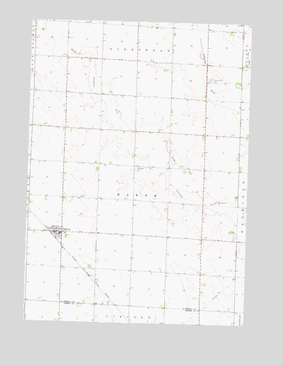
Melvin, IA USGS Topographic Map
Click on map above to begin viewing in our Map Viewer.

This topographic map contains these locations and features:
Feature Name Type Latitude Longitude GNIS ID View Map
American Lutheran ChurchChurchN43.2872°W95.6086°1907378View Map
Baker Township CemeteryCemeteryN43.3139°W95.5637°1907279View Map
City of MelvinCivilN43.2865°W95.6086°2395091View Map
Dirks Wildlife Management AreaParkN43.3541°W95.5267°1907299View Map
Hartwig FarmsLocaleN43.3425°W95.5297°2723231View Map
Judicial Ditch Number 64CanalN43.3672°W95.5017°465851View Map
K S B FarmsLocaleN43.3019°W95.5533°2723220View Map
MelvinPopulated PlaceN43.2875°W95.6092°458961View Map
Melvin (historical)LocaleN43.2869°W95.6125°1907379View Map
Melvin Arboretum ParkParkN43.2855°W95.6014°1907368View Map
Melvin Post OfficePost OfficeN43.2869°W95.6077°1907374View Map
Melvin Public LibraryBuildingN43.2872°W95.6086°1907377View Map
Methodist ChurchChurchN43.2872°W95.6086°1907376View Map
Osceola County Ambulance Service Melvin DivisionBuildingN43.2869°W95.6077°2599861View Map
Pausma FarmLocaleN43.3028°W95.5928°2723219View Map
Runyan Post Office (historical)Post OfficeN43.3422°W95.5281°1907282View Map
Rush Lake OutletStreamN43.3725°W95.5325°460857View Map
Sanborn Co-op Grain Company ElevatorLocaleN43.2872°W95.6086°1907375View Map
Thomas Pit AccessLocaleN43.3541°W95.5239°1907298View Map
Township of BakerCivilN43.3005°W95.5647°467409View Map
Van Houton FarmsLocaleN43.3300°W95.6181°2723223View Map

Note: Coordinates in the location and feature list above are referenced to NAD83 datum.


Copyright (C) 2008-2025 Ryan Niemi / Sunset Dynamics ... All Rights Reserved