TopoQuest Logo
Do you find TopoQuest useful?
Help keep TopoQuest running and adding new maps/features by donating!
Bitcoin:  19c7KJd3qBynnjoSw5npx9KScwjBe4ifkT
Litecoin:  LXs6TkuXGGXo1vDsWCkWVdjQX94eUKd6ui
Home View Maps Find Maps Find Places Resources & Links


Hartshorn, Missouri Topographic Map

USGS Map Title: Hartshorn, MO
USGS Map MRC: 37091C6
DRG (GeoTIFF) Download: o37091c6.tif


Neighboring USGS Topographic Map Quads:


  Licking, MO  
37091D7
 

  Montauk, MO  
37091D6
 

  Cedargrove, MO  
37091D5
 

  Raymondville, MO  
37091C7
 

  Hartshorn, MO  
37091C6
 

  Lewis Hollow, MO  
37091C5
 

  Eunice, MO  
37091B7
 

  Summersville, MO  
37091B6
 

  Summersville NE, MO  
37091B5


Map MRC Location:

N38°
W92°
N38°
W91°
H8 H7 H6 H5 H4 H3 H2 H1
G8 G7 G6 G5 G4 G3 G2 G1
F8 F7 F6 F5 F4 F3 F2 F1
E8 E7 E6 E5 E4 E3 E2 E1
D8 D7 D6 D5 D4 D3 D2 D1
C8 C7 C6 C5 C4 C3 C2 C1
B8 B7 B6 B5 B4 B3 B2 B1
A8 A7 A6 A5 A4 A3 A2 A1
N37°
W92°
N37°
W91°

Hartshorn, MO USGS 1:24K Topographic Map Preview:
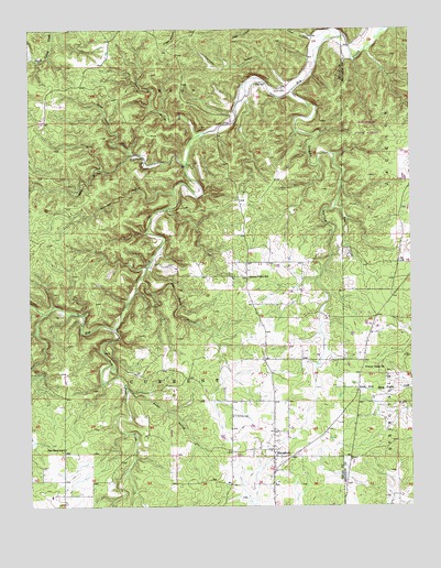
Hartshorn, MO USGS Topographic Map
Click on map above to begin viewing in our Map Viewer.

This topographic map contains these locations and features:
Feature Name Type Latitude Longitude GNIS ID View Map
Antioch CemeteryCemeteryN37.2737°W91.6832°713310View Map
Bee Rock HollowValleyN37.3400°W91.6993°713873View Map
Center Valley ChurchChurchN37.2862°W91.6404°715662View Map
Cummins HollowValleyN37.3606°W91.6649°716591View Map
Dew Pond HollowValleyN37.3095°W91.7132°716869View Map
Dry Bone CreekStreamN37.2970°W91.7218°717063View Map
Dugan HollowValleyN37.3581°W91.6629°717161View Map
HartshornPopulated PlaceN37.2648°W91.6704°719184View Map
Hay CreekStreamN37.3287°W91.6493°719248View Map
Huldy HollowValleyN37.3475°W91.6949°719982View Map
NilePopulated PlaceN37.3600°W91.6660°735334View Map
Nile SchoolSchoolN37.3609°W91.6738°723375View Map
Pine Flats SchoolSchoolN37.2650°W91.7396°724377View Map
Rebel Cave HollowValleyN37.3420°W91.7157°725147View Map
Rocky HollowValleyN37.2803°W91.7176°725514View Map
Round Valley SchoolSchoolN37.3100°W91.6782°725624View Map
Salem PlateauPlainN37.3334°W91.7499°736186View Map
Smith CemeteryCemeteryN37.3592°W91.6665°726590View Map
Township of CurrentCivilN37.2913°W91.7007°767466View Map
Watered HollowValleyN37.3323°W91.7024°728403View Map

Note: Coordinates in the location and feature list above are referenced to NAD83 datum.


Copyright (C) 2008-2025 Ryan Niemi / Sunset Dynamics ... All Rights Reserved