TopoQuest Logo
Do you find TopoQuest useful?
Help keep TopoQuest running and adding new maps/features by donating!
Bitcoin:  19c7KJd3qBynnjoSw5npx9KScwjBe4ifkT
Litecoin:  LXs6TkuXGGXo1vDsWCkWVdjQX94eUKd6ui
Home View Maps Find Maps Find Places Resources & Links


Summersville, Missouri Topographic Map

USGS Map Title: Summersville, MO
USGS Map MRC: 37091B6
DRG (GeoTIFF) Download: o37091b6.tif


Neighboring USGS Topographic Map Quads:


  Raymondville, MO  
37091C7
 

  Hartshorn, MO  
37091C6
 

  Lewis Hollow, MO  
37091C5
 

  Eunice, MO  
37091B7
 

  Summersville, MO  
37091B6
 

  Summersville NE, MO  
37091B5
 

  Clear Springs, MO  
37091A7
 

  Pine Crest, MO  
37091A6
 

  Jam Up Cave, MO  
37091A5


Map MRC Location:

N38°
W92°
N38°
W91°
H8 H7 H6 H5 H4 H3 H2 H1
G8 G7 G6 G5 G4 G3 G2 G1
F8 F7 F6 F5 F4 F3 F2 F1
E8 E7 E6 E5 E4 E3 E2 E1
D8 D7 D6 D5 D4 D3 D2 D1
C8 C7 C6 C5 C4 C3 C2 C1
B8 B7 B6 B5 B4 B3 B2 B1
A8 A7 A6 A5 A4 A3 A2 A1
N37°
W92°
N37°
W91°

Summersville, MO USGS 1:24K Topographic Map Preview:
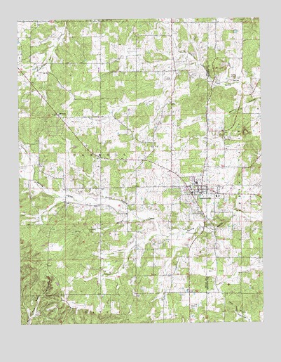
Summersville, MO USGS Topographic Map
Click on map above to begin viewing in our Map Viewer.

This topographic map contains these locations and features:
Feature Name Type Latitude Longitude GNIS ID View Map
Bell FlatsFlatN37.1462°W91.6493°713908View Map
Bethel ChurchChurchN37.1737°W91.7085°714048View Map
City of SummersvilleCivilN37.1785°W91.6577°2396002View Map
Dirt House HollowValleyN37.1681°W91.6932°716911View Map
Griffith School (historical)SchoolN37.1750°W91.7265°747762View Map
Johns SchoolSchoolN37.1401°W91.7313°747763View Map
Kell School (historical)SchoolN37.2206°W91.7079°747759View Map
Laidley School (historical)SchoolN37.2287°W91.6715°747765View Map
Leidy School (historical)SchoolN37.1953°W91.6796°747766View Map
MidvalePopulated PlaceN37.2112°W91.7299°722295View Map
Midvale ChurchChurchN37.2112°W91.7296°747760View Map
Oak Hill SchoolSchoolN37.2423°W91.6290°747764View Map
Oak Ridge School (historical)SchoolN37.2325°W91.7474°747758View Map
Pickett CemeteryCemeteryN37.2253°W91.6376°724308View Map
Riley CemeteryCemeteryN37.2250°W91.6735°725308View Map
Riley School (historical)SchoolN37.1592°W91.6754°747767View Map
SummersvillePopulated PlaceN37.1792°W91.6568°727291View Map
Summersville CemeteryCemeteryN37.1700°W91.6570°2703079View Map
Summersville Fire and RescueBuildingN37.1721°W91.6580°2621117View Map
Summersville Fire Tower (historical)TowerN37.2059°W91.7368°747761View Map
Summersville Police DepartmentBuildingN37.1795°W91.6577°2752138View Map
Summersville Post OfficePost OfficeN37.1798°W91.6565°2783021View Map
The Drop-inBasinN37.1323°W91.6585°727550View Map
Township of CarrollCivilN37.1932°W91.7076°767463View Map
Welch SchoolSchoolN37.1517°W91.6268°747768View Map

Note: Coordinates in the location and feature list above are referenced to NAD83 datum.


Copyright (C) 2008-2025 Ryan Niemi / Sunset Dynamics ... All Rights Reserved