TopoQuest Logo
Do you find TopoQuest useful?
Help keep TopoQuest running and adding new maps/features by donating!
Bitcoin:  19c7KJd3qBynnjoSw5npx9KScwjBe4ifkT
Litecoin:  LXs6TkuXGGXo1vDsWCkWVdjQX94eUKd6ui
Home View Maps Find Maps Find Places Resources & Links


Avoca, Michigan Topographic Map

USGS Map Title: Avoca, MI
USGS Map MRC: 43082A6
DRG (GeoTIFF) Download: o43082a6.tif


Neighboring USGS Topographic Map Quads:


  Yale, MI  
43082B7
 

  Roseburg, MI  
43082B6
 

  Jeddo, MI  
43082B5
 

  Brockway, MI  
43082A7
 

  Avoca, MI  
43082A6
 

  Ruby, MI  
43082A5
 

  Memphis, MI  
42082H7
 

  Goodells, MI  
42082H6
 

  Smiths Creek, MI  
42082H5


Map MRC Location:

N44°
W83°
N44°
W82°
H8 H7 H6 H5 H4 H3 H2 H1
G8 G7 G6 G5 G4 G3 G2 G1
F8 F7 F6 F5 F4 F3 F2 F1
E8 E7 E6 E5 E4 E3 E2 E1
D8 D7 D6 D5 D4 D3 D2 D1
C8 C7 C6 C5 C4 C3 C2 C1
B8 B7 B6 B5 B4 B3 B2 B1
A8 A7 A6 A5 A4 A3 A2 A1
N43°
W83°
N43°
W82°

Avoca, MI USGS 1:24K Topographic Map Preview:
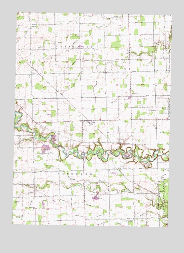
Avoca, MI USGS Topographic Map
Click on map above to begin viewing in our Map Viewer.

This topographic map contains these locations and features:
Feature Name Type Latitude Longitude GNIS ID View Map
AbbottsfordPopulated PlaceN43.0200°W82.6333°1624336View Map
Abbottsford Post Office (historical)Post OfficeN43.0200°W82.6333°2581594View Map
Abbottsford Station (historical)LocaleN43.0194°W82.6336°2582226View Map
AvocaPopulated PlaceN43.0620°W82.6910°1624359View Map
Avoca AirportAirportN43.0303°W82.6726°1624320View Map
Avoca Post OfficePost OfficeN43.0625°W82.6917°2582201View Map
Avoca Station (historical)LocaleN43.0628°W82.6917°2582202View Map
Emmett DrainStreamN43.0192°W82.7333°1624512View Map
Engles DrainCanalN43.0981°W82.6969°1624513View Map
Eves DrainStreamN43.1228°W82.6733°1624516View Map
FargoPopulated PlaceN43.1031°W82.6591°1624522View Map
Fargo Post Office (historical)Post OfficeN43.1031°W82.6592°2581505View Map
Fasel FieldAirportN43.0597°W82.6772°1624321View Map
Gleason DrainStreamN43.0514°W82.7333°1624562View Map
Greenwood CemeteryCemeteryN43.0972°W82.6730°1624581View Map
Hayes DrainStreamN43.1120°W82.6991°1624600View Map
Hyde DrainStreamN43.0220°W82.7321°1624622View Map
Jackson DrainStreamN43.1231°W82.6733°1624627View Map
Kenockee Post Office (historical)Post OfficeN43.0500°W82.6750°2581495View Map
Kenockee Township Fire Department Station 1BuildingN43.0612°W82.6903°2620055View Map
Lindsay DrainCanalN43.0056°W82.6674°1624680View Map
Pohly DrainCanalN43.0884°W82.6991°1624834View Map
Port Huron State Game AreaParkN43.0248°W82.6260°1624840View Map
Quakenbush DrainStreamN43.0211°W82.6602°1624851View Map
Spring Hill CemeteryCemeteryN43.0781°W82.6566°1624952View Map
Swamp SchoolSchoolN43.0100°W82.7321°1624970View Map
Tackaberry Airport (historical)AirportN43.0621°W82.7238°1624319View Map
Township of GreenwoodCivilN43.1187°W82.6992°1626405View Map
Township of KenockeeCivilN43.0320°W82.6936°1626557View Map
White DrainStreamN43.0595°W82.7488°1625016View Map

Note: Coordinates in the location and feature list above are referenced to NAD83 datum.


Copyright (C) 2008-2024 Ryan Niemi / Sunset Dynamics ... All Rights Reserved