TopoQuest Logo
Do you find TopoQuest useful?
Help keep TopoQuest running and adding new maps/features by donating!
Bitcoin:  19c7KJd3qBynnjoSw5npx9KScwjBe4ifkT
Litecoin:  LXs6TkuXGGXo1vDsWCkWVdjQX94eUKd6ui
Home View Maps Find Maps Find Places Resources & Links


Brockway, Michigan Topographic Map

USGS Map Title: Brockway, MI
USGS Map MRC: 43082A7
DRG (GeoTIFF) Download: o43082a7.tif


Neighboring USGS Topographic Map Quads:


  Brown City, MI  
43082B8
 

  Yale, MI  
43082B7
 

  Roseburg, MI  
43082B6
 

  Capac, MI  
43082A8
 

  Brockway, MI  
43082A7
 

  Avoca, MI  
43082A6
 

  Allenton, MI  
42082H8
 

  Memphis, MI  
42082H7
 

  Goodells, MI  
42082H6


Map MRC Location:

N44°
W83°
N44°
W82°
H8 H7 H6 H5 H4 H3 H2 H1
G8 G7 G6 G5 G4 G3 G2 G1
F8 F7 F6 F5 F4 F3 F2 F1
E8 E7 E6 E5 E4 E3 E2 E1
D8 D7 D6 D5 D4 D3 D2 D1
C8 C7 C6 C5 C4 C3 C2 C1
B8 B7 B6 B5 B4 B3 B2 B1
A8 A7 A6 A5 A4 A3 A2 A1
N43°
W83°
N43°
W82°

Brockway, MI USGS 1:24K Topographic Map Preview:
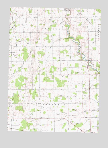
Brockway, MI USGS Topographic Map
Click on map above to begin viewing in our Map Viewer.

This topographic map contains these locations and features:
Feature Name Type Latitude Longitude GNIS ID View Map
Beehr DrainCanalN43.0150°W82.8672°1624379View Map
Benke DrainCanalN43.0595°W82.8635°1624386View Map
BrockwayPopulated PlaceN43.0745°W82.7655°1624419View Map
Brockway Post Office (historical)Post OfficeN43.0750°W82.7653°2582195View Map
Brockway Township Fire DepartmentBuildingN43.1200°W82.7906°2620101View Map
Brockway Township Fire Station OneBuildingN43.1172°W82.7917°2582196View Map
Cole ChurchChurchN43.1000°W82.8558°1624461View Map
Cole United Methodist Church Historical MarkerParkN43.1000°W82.8564°2581671View Map
Community Gospel ChapelChurchN43.0139°W82.8297°1624469View Map
Family First Health Care ClinicHospitalN43.1150°W82.7917°2582197View Map
Foley DrainCanalN43.0239°W82.7910°1624543View Map
Greater Yale Medical ClinicHospitalN43.1181°W82.7917°2582198View Map
Lovejoy DrainCanalN43.0792°W82.8713°1624697View Map
McLaren DrainCanalN43.0225°W82.8152°1624722View Map
Middleton DrainCanalN43.1245°W82.8438°1624738View Map
Moore CemeteryCemeteryN43.0875°W82.7941°1624750View Map
Popplewell DrainCanalN43.0206°W82.8372°1624838View Map
Sheehy DrainStreamN43.0961°W82.7919°1624926View Map
Sullivan DrainCanalN43.0189°W82.7924°1624968View Map
Thody DrainStreamN43.0917°W82.8130°1624982View Map
Thompson DrainStreamN43.1095°W82.7974°1624984View Map
Township of BrockwayCivilN43.1148°W82.8167°1625984View Map
Township of EmmettCivilN43.0282°W82.8111°1626240View Map
Tri - Hospital Emergency Medical Services Station 6BuildingN43.1150°W82.7902°2662129View Map
Yale AirportAirportN43.1103°W82.7905°1624334View Map
Yale Fire DepartmentBuildingN43.1198°W82.7904°2582053View Map

Note: Coordinates in the location and feature list above are referenced to NAD83 datum.


Copyright (C) 2008-2024 Ryan Niemi / Sunset Dynamics ... All Rights Reserved