TopoQuest Logo
Do you find TopoQuest useful?
Help keep TopoQuest running and adding new maps/features by donating!
Bitcoin:  19c7KJd3qBynnjoSw5npx9KScwjBe4ifkT
Litecoin:  LXs6TkuXGGXo1vDsWCkWVdjQX94eUKd6ui
Home View Maps Find Maps Find Places Resources & Links


Memphis, Michigan Topographic Map

USGS Map Title: Memphis, MI
USGS Map MRC: 42082H7
DRG (GeoTIFF) Download: o42082h7.tif


Neighboring USGS Topographic Map Quads:


  Capac, MI  
43082A8
 

  Brockway, MI  
43082A7
 

  Avoca, MI  
43082A6
 

  Allenton, MI  
42082H8
 

  Memphis, MI  
42082H7
 

  Goodells, MI  
42082H6
 

  Armada, MI  
42082G8
 

  Richmond, MI  
42082G7
 

  Adair, MI  
42082G6


Map MRC Location:

N43°
W83°
N43°
W82°
H8 H7 H6 H5 H4 H3 H2 H1
G8 G7 G6 G5 G4 G3 G2 G1
F8 F7 F6 F5 F4 F3 F2 F1
E8 E7 E6 E5 E4 E3 E2 E1
D8 D7 D6 D5 D4 D3 D2 D1
C8 C7 C6 C5 C4 C3 C2 C1
B8 B7 B6 B5 B4 B3 B2 B1
A8 A7 A6 A5 A4 A3 A2 A1
N42°
W83°
N42°
W82°

Memphis, MI USGS 1:24K Topographic Map Preview:
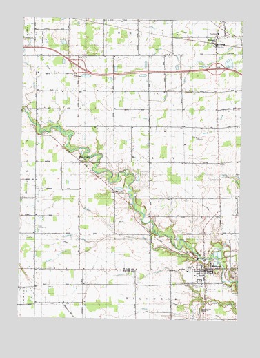
Memphis, MI USGS Topographic Map
Click on map above to begin viewing in our Map Viewer.

This topographic map contains these locations and features:
Feature Name Type Latitude Longitude GNIS ID View Map
All Saints ChurchChurchN42.8878°W82.7677°619960View Map
Beaver CreekStreamN42.8828°W82.7680°620907View Map
Belle River Golf and Country ClubLocaleN42.9281°W82.8203°2582092View Map
Burgess DrainStreamN42.9095°W82.8141°1624427View Map
City of MemphisCivilN42.8957°W82.7689°1626721View Map
Cowhy DrainCanalN42.9870°W82.7913°1624480View Map
Doyle Post Office (historical)Post OfficeN42.8956°W82.8367°2581574View Map
Doyle Station (historical)LocaleN42.8956°W82.8367°2582225View Map
EmmettPopulated PlaceN42.9906°W82.7649°1624511View Map
Emmett Fire DepartmentBuildingN42.9890°W82.7654°2582169View Map
Emmett KOA CampgroundsLocaleN42.9994°W82.8489°2582167View Map
Emmett Post OfficePost OfficeN42.9894°W82.7644°2582168View Map
Emmett StationLocaleN42.9897°W82.7647°2582238View Map
Fellowship Baptist ChurchChurchN42.8954°W82.7703°2648317View Map
First United Methodist ChurchChurchN42.8983°W82.7708°2582086View Map
Foley SchoolSchoolN42.9634°W82.7633°1624544View Map
Free Methodist ChurchChurchN42.8972°W82.7753°2582090View Map
Interchange 180CrossingN42.9806°W82.8431°2581620View Map
Interchange 184CrossingN42.9806°W82.7647°2581619View Map
John F Farrell Historical MarkerParkN42.9935°W82.7650°2581707View Map
Loomis DrainStreamN42.9095°W82.8141°1624696View Map
MemphisPopulated PlaceN42.8964°W82.7688°1624727View Map
Memphis CemeteryCemeteryN42.8797°W82.7691°632093View Map
Memphis Elementary SchoolSchoolN42.8971°W82.7776°2648319View Map
Memphis High SchoolSchoolN42.8972°W82.7778°2582091View Map
Memphis Medical CenterHospitalN42.9114°W82.7694°2582089View Map
Memphis Police DepartmentBuildingN42.8956°W82.7674°2737559View Map
Memphis Post OfficePost OfficeN42.8959°W82.7705°2648320View Map
Memphis Public LibraryBuildingN42.8954°W82.7699°2648318View Map
Memphis Station (historical)LocaleN42.9006°W82.7692°2582220View Map
Memphis Volunteer Fire DepartmentBuildingN42.8959°W82.7679°2620042View Map
Norton FieldAirportN42.9706°W82.8477°2650910View Map
Our Lady of Mount Carmel ChurchChurchN42.9933°W82.7647°2582170View Map
Our Lady of Mount Carmel Parish Historical MarkerParkN42.9935°W82.7650°2581706View Map
Parker DrainCanalN42.9709°W82.7910°1624811View Map
Riley CenterPopulated PlaceN42.9409°W82.8416°1624857View Map
Riley Center Post Office (historical)Post OfficeN42.9403°W82.8389°2582087View Map
Sage CreekStreamN42.9009°W82.7710°1624878View Map
Saint Andrew Lutheran ChurchChurchN42.9194°W82.7611°2582088View Map
Sharpe's StripAirportN42.9551°W82.7767°2650891View Map
Shaver DrainCanalN42.8920°W82.8058°637684View Map
Smith DrainCanalN42.8778°W82.8063°638148View Map
Sumner DrainStreamN42.9023°W82.8491°1624969View Map
Tallmadge DrainStreamN42.9073°W82.8302°1624977View Map
The Thing Historical MarkerParkN42.8965°W82.7642°2647831View Map
Tibbetts Road CemeteryCemeteryN42.9767°W82.8450°2581626View Map
Township of RileyCivilN42.9408°W82.8046°1626982View Map
Village of EmmettCivilN42.9934°W82.7654°2398830View Map

Note: Coordinates in the location and feature list above are referenced to NAD83 datum.


Copyright (C) 2008-2024 Ryan Niemi / Sunset Dynamics ... All Rights Reserved