TopoQuest Logo
Do you find TopoQuest useful?
Help keep TopoQuest running and adding new maps/features by donating!
Bitcoin:  19c7KJd3qBynnjoSw5npx9KScwjBe4ifkT
Litecoin:  LXs6TkuXGGXo1vDsWCkWVdjQX94eUKd6ui
Home View Maps Find Maps Find Places Resources & Links


Hat Rock, Oregon Topographic Map

USGS Map Title: Hat Rock, OR
USGS Map MRC: 45119H2
DRG (GeoTIFF) Download: o45119h2.tif


Neighboring USGS Topographic Map Quads:


  Taylor Canyon, WA  
46119A3
 

  Johnson Butte, WA  
46119A2
 

  Nine Canyon, WA  
46119A1
 

  Umatilla, OR  
45119H3
 

  Hat Rock, OR  
45119H2
 

  Juniper, OR  
45119H1
 

  Hermiston, OR  
45119G3
 

  Stanfield, OR  
45119G2
 

  Stanfield SE, OR  
45119G1


Map MRC Location:

N46°
W120°
N46°
W119°
H8 H7 H6 H5 H4 H3 H2 H1
G8 G7 G6 G5 G4 G3 G2 G1
F8 F7 F6 F5 F4 F3 F2 F1
E8 E7 E6 E5 E4 E3 E2 E1
D8 D7 D6 D5 D4 D3 D2 D1
C8 C7 C6 C5 C4 C3 C2 C1
B8 B7 B6 B5 B4 B3 B2 B1
A8 A7 A6 A5 A4 A3 A2 A1
N45°
W120°
N45°
W119°

Hat Rock, OR USGS 1:24K Topographic Map Preview:
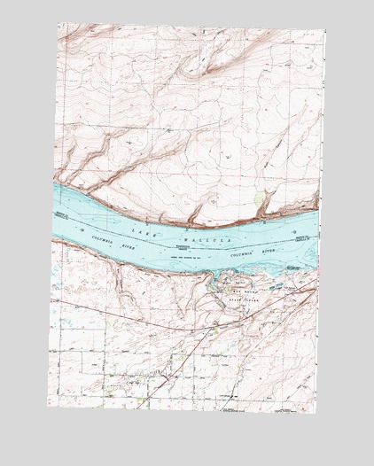
Hat Rock, OR USGS Topographic Map
Click on map above to begin viewing in our Map Viewer.

This topographic map contains these locations and features:
Feature Name Type Latitude Longitude GNIS ID View Map
Beef City FeedlotLocaleN45.8803°W119.1623°2576418View Map
BerrianLocaleN45.9474°W119.2453°1511812View Map
BerrianPopulated PlaceN45.9376°W119.1520°1510821View Map
Boat RockPillarN45.9167°W119.1626°1117884View Map
Box CanyonValleyN45.9229°W119.2186°1118002View Map
Cold SpringsPopulated PlaceN45.8785°W119.1656°1158171View Map
Cold SpringsSpringN45.9179°W119.1400°1161717View Map
Cold Springs (historical)LocaleN45.9176°W119.1456°1167756View Map
Cold Springs DrainStreamN45.8929°W119.1928°1129794View Map
Cold Springs JunctionPopulated PlaceN45.9137°W119.1381°1119123View Map
Cold Springs WashStreamN45.9193°W119.1472°1119126View Map
Dodd PondsSwampN45.9159°W119.1456°1129792View Map
Hat RockPillarN45.9170°W119.1707°1121654View Map
Hat Rock DrainStreamN45.8929°W119.1928°1129793View Map
Hat Rock State ParkParkN45.9149°W119.1650°1121655View Map
Hat Rock State Park Boat RampLocaleN45.9177°W119.1742°2700190View Map
McNary Yacht Club Boat RampLocaleN45.9201°W119.1646°2700189View Map
McNary Yacht Club MarinaHarborN45.9209°W119.1640°2700192View Map
Memaloose Island (historical)IslandN45.9221°W119.1928°1158923View Map
MottingerLocaleN45.9376°W119.1511°1514760View Map
River ViewCliffN45.9193°W119.2028°1126056View Map
Riverview (historical)LocaleN45.9193°W119.1964°1167815View Map
Rush CanyonValleyN45.9387°W119.1525°1507963View Map
T CanalCanalN45.8929°W119.2439°1127852View Map
Techumtas Island (historical)IslandN45.9332°W119.1345°1639225View Map
Warehouse Beach Recreation CenterParkN45.9201°W119.1406°1167877View Map

Note: Coordinates in the location and feature list above are referenced to NAD83 datum.


Copyright (C) 2008-2025 Ryan Niemi / Sunset Dynamics ... All Rights Reserved