TopoQuest Logo
Do you find TopoQuest useful?
Help keep TopoQuest running and adding new maps/features by donating!
Bitcoin:  19c7KJd3qBynnjoSw5npx9KScwjBe4ifkT
Litecoin:  LXs6TkuXGGXo1vDsWCkWVdjQX94eUKd6ui
Home View Maps Find Maps Find Places Resources & Links


Hat Top Mountain, New Mexico Topographic Map

USGS Map Title: Hat Top Mountain, NM
USGS Map MRC: 31108H2
DRG (GeoTIFF) Download: o31108h2.tif


Neighboring USGS Topographic Map Quads:


  The Saltys, NM  
32108A3
 

  Gage SW, NM  
32108A2
 

  Gage SE, NM  
32108A1
 

  Hachita, NM  
31108H3
 

  Hat Top Mountain, NM  
31108H2
 

  Flying W Mountain, NM  
31108H1
 

  Doyle Peak, NM  
31108G3
 

  Victorio Ranch, NM  
31108G2
 

  Victorio Ranch SE, NM  
31108G1


Map MRC Location:

N32°
W109°
N32°
W108°
H8 H7 H6 H5 H4 H3 H2 H1
G8 G7 G6 G5 G4 G3 G2 G1
F8 F7 F6 F5 F4 F3 F2 F1
E8 E7 E6 E5 E4 E3 E2 E1
D8 D7 D6 D5 D4 D3 D2 D1
C8 C7 C6 C5 C4 C3 C2 C1
B8 B7 B6 B5 B4 B3 B2 B1
A8 A7 A6 A5 A4 A3 A2 A1
N31°
W109°
N31°
W108°

Hat Top Mountain, NM USGS 1:24K Topographic Map Preview:
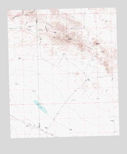
Hat Top Mountain, NM USGS Topographic Map
Click on map above to begin viewing in our Map Viewer.

This topographic map contains these locations and features:
Feature Name Type Latitude Longitude GNIS ID View Map
01640 Water WellWellN31.9768°W108.1762°930274View Map
Black TankReservoirN31.8821°W108.1824°886458View Map
Brushy TankReservoirN31.9527°W108.2393°886805View Map
CCC TankReservoirN31.9107°W108.1796°887022View Map
Cedar MountainSummitN31.9704°W108.1820°887341View Map
Cedar Mountains Wilderness Study AreaParkN31.9654°W108.1506°935828View Map
Deep WellsWellN31.9556°W108.1859°888284View Map
Deer MountainSummitN31.9965°W108.2234°888301View Map
Deer TankReservoirN31.9950°W108.2312°888305View Map
East TankReservoirN31.9836°W108.2241°888703View Map
Eaulkner RanchLocaleN31.9307°W108.1606°888762View Map
Hat Top MountainSummitN31.9654°W108.1506°889820View Map
Little WindmillLocaleN31.9493°W108.1553°891209View Map
Lucky MineMineN31.9868°W108.1381°891477View Map
Mine TankReservoirN31.9710°W108.2138°892095View Map
Mittle TankReservoirN31.9803°W108.2147°892129View Map
Mountain WellLocaleN31.9804°W108.1756°892290View Map
North Number 3 TankReservoirN31.8896°W108.1318°898075View Map
Old BaldySummitN31.9570°W108.1403°892844View Map
Puddles TankReservoirN31.9280°W108.2433°893507View Map
Railroad TankReservoirN31.8844°W108.2080°893617View Map
Snake TankReservoirN31.9773°W108.1980°894966View Map
South Number 1 TankReservoirN31.8867°W108.2327°898131View Map
The LakeLakeN31.9053°W108.2157°898173View Map
West TankReservoirN31.9208°W108.2241°896413View Map

Note: Coordinates in the location and feature list above are referenced to NAD83 datum.


Copyright (C) 2008-2024 Ryan Niemi / Sunset Dynamics ... All Rights Reserved