TopoQuest Logo
Do you find TopoQuest useful?
Help keep TopoQuest running and adding new maps/features by donating!
Bitcoin:  19c7KJd3qBynnjoSw5npx9KScwjBe4ifkT
Litecoin:  LXs6TkuXGGXo1vDsWCkWVdjQX94eUKd6ui
Home View Maps Find Maps Find Places Resources & Links


Gage SW, New Mexico Topographic Map

USGS Map Title: Gage SW, NM
USGS Map MRC: 32108A2
DRG (GeoTIFF) Download: o32108a2.tif


Neighboring USGS Topographic Map Quads:


  Separ NE, NM  
32108B3
 

  Gage NW, NM  
32108B2
 

  Gage, NM  
32108B1
 

  The Saltys, NM  
32108A3
 

  Gage SW, NM  
32108A2
 

  Gage SE, NM  
32108A1
 

  Hachita, NM  
31108H3
 

  Hat Top Mountain, NM  
31108H2
 

  Flying W Mountain, NM  
31108H1


Map MRC Location:

N33°
W109°
N33°
W108°
H8 H7 H6 H5 H4 H3 H2 H1
G8 G7 G6 G5 G4 G3 G2 G1
F8 F7 F6 F5 F4 F3 F2 F1
E8 E7 E6 E5 E4 E3 E2 E1
D8 D7 D6 D5 D4 D3 D2 D1
C8 C7 C6 C5 C4 C3 C2 C1
B8 B7 B6 B5 B4 B3 B2 B1
A8 A7 A6 A5 A4 A3 A2 A1
N32°
W109°
N32°
W108°

Gage SW, NM USGS 1:24K Topographic Map Preview:
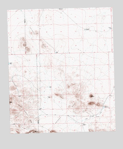
Gage SW, NM USGS Topographic Map
Click on map above to begin viewing in our Map Viewer.

This topographic map contains these locations and features:
Feature Name Type Latitude Longitude GNIS ID View Map
01431 Water WellWellN32.1248°W108.1875°923286View Map
01432 Water WellWellN32.1045°W108.1275°930196View Map
01481 Water WellWellN32.0565°W108.1425°930292View Map
01482 Water WellWellN32.0218°W108.1428°922475View Map
01484 Water WellWellN32.0074°W108.1638°922474View Map
01485 Water WellWellN32.0037°W108.1656°930283View Map
Bald Hill WindmillLocaleN32.1248°W108.1864°886014View Map
Cedar Grove (historical)Populated PlaceN32.0073°W108.1639°920027View Map
Cedar Grove DrawValleyN32.0329°W108.1323°887327View Map
Cedar Grove WindmillLocaleN32.0073°W108.1639°887328View Map
Hatcher WindmillLocaleN32.0237°W108.2153°889826View Map
Home RanchLocaleN32.0151°W108.1478°890089View Map
Honeymoon WindmillLocaleN32.1040°W108.1275°890114View Map
Klondike HillsMineN32.0273°W108.1489°916247View Map
Murray TankReservoirN32.0710°W108.2498°892352View Map
Palomas Draw Number Eight DamDamN32.0334°W108.1423°923869View Map
Palomas Draw Number Nine DamDamN32.0001°W108.1256°923870View Map
Palomas Draw Retention Dam Number 7DamN32.0304°W108.1250°898106View Map
Palomas Draw Retention Dam Number 8DamN32.0251°W108.1386°898107View Map
Rocky TankReservoirN32.0462°W108.2027°894115View Map
Round HillSummitN32.0359°W108.2014°899883View Map
Sheep MountainSummitN32.0356°W108.1537°899909View Map
Sleeper TankReservoirN32.0807°W108.1945°894918View Map
Tod Hunter ReservoirReservoirN32.1031°W108.1577°895715View Map
Turkey Knob WindmillLocaleN32.0379°W108.2398°895909View Map

Note: Coordinates in the location and feature list above are referenced to NAD83 datum.


Copyright (C) 2008-2025 Ryan Niemi / Sunset Dynamics ... All Rights Reserved