TopoQuest Logo
Do you find TopoQuest useful?
Help keep TopoQuest running and adding new maps/features by donating!
Bitcoin:  19c7KJd3qBynnjoSw5npx9KScwjBe4ifkT
Litecoin:  LXs6TkuXGGXo1vDsWCkWVdjQX94eUKd6ui
Home View Maps Find Maps Find Places Resources & Links


Flying W Mountain, New Mexico Topographic Map

USGS Map Title: Flying W Mountain, NM
USGS Map MRC: 31108H1
DRG (GeoTIFF) Download: o31108h1.tif


Neighboring USGS Topographic Map Quads:


  Gage SW, NM  
32108A2
 

  Gage SE, NM  
32108A1
 

  Bisbee Hills, NM  
32107A8
 

  Hat Top Mountain, NM  
31108H2
 

  Flying W Mountain, NM  
31108H1
 

  Hermanas NW, NM  
31107H8
 

  Victorio Ranch, NM  
31108G2
 

  Victorio Ranch SE, NM  
31108G1
 

  Hermanas, NM  
31107G8


Map MRC Location:

N32°
W109°
N32°
W108°
H8 H7 H6 H5 H4 H3 H2 H1
G8 G7 G6 G5 G4 G3 G2 G1
F8 F7 F6 F5 F4 F3 F2 F1
E8 E7 E6 E5 E4 E3 E2 E1
D8 D7 D6 D5 D4 D3 D2 D1
C8 C7 C6 C5 C4 C3 C2 C1
B8 B7 B6 B5 B4 B3 B2 B1
A8 A7 A6 A5 A4 A3 A2 A1
N31°
W109°
N31°
W108°

Flying W Mountain, NM USGS 1:24K Topographic Map Preview:
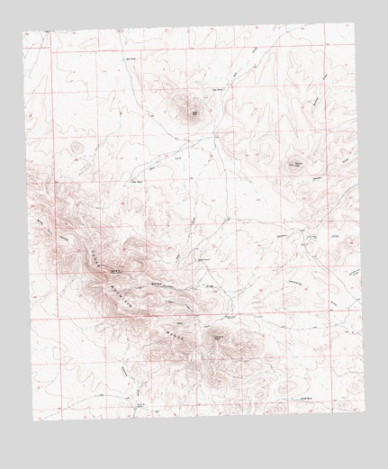
Flying W Mountain, NM USGS Topographic Map
Click on map above to begin viewing in our Map Viewer.

This topographic map contains these locations and features:
Feature Name Type Latitude Longitude GNIS ID View Map
01637 Water WellWellN31.9251°W108.0606°922504View Map
Bobs TankReservoirN31.9509°W108.0864°886561View Map
BurdickMineN31.9293°W108.0553°916185View Map
Cedar Mountain RangeRangeN31.9301°W108.1020°920574View Map
Deer CanyonValleyN31.9051°W108.0614°888287View Map
Flying W MountainSummitN31.9220°W108.0948°889121View Map
Flying W RanchLocaleN31.9251°W108.0614°889122View Map
Gap HillSummitN31.9723°W108.0620°889315View Map
Gap TankReservoirN31.9797°W108.0504°889316View Map
Indian WellsWellN31.9315°W108.0206°890332View Map
Left Fork Sacaton DrawValleyN31.9154°W108.0445°891034View Map
North TankReservoirN31.8801°W108.0250°892665View Map
Palomas Red Hill DamDamN31.9918°W108.0839°923871View Map
Red TankReservoirN31.9898°W108.0869°893791View Map
Rock TankReservoirN31.9177°W108.0795°894078View Map
Round TopSummitN31.9551°W108.0245°894190View Map
Tank Number 4 NorthReservoirN31.8787°W108.0867°898146View Map
Valiente PeakSummitN31.9004°W108.0561°896076View Map
Valiente WellWellN31.9068°W108.0495°896077View Map
West Fork Gap DrawValleyN31.9654°W108.0561°896366View Map

Note: Coordinates in the location and feature list above are referenced to NAD83 datum.


Copyright (C) 2008-2025 Ryan Niemi / Sunset Dynamics ... All Rights Reserved