TopoQuest Logo
Do you find TopoQuest useful?
Help keep TopoQuest running and adding new maps/features by donating!
Bitcoin:  19c7KJd3qBynnjoSw5npx9KScwjBe4ifkT
Litecoin:  LXs6TkuXGGXo1vDsWCkWVdjQX94eUKd6ui
Home View Maps Find Maps Find Places Resources & Links


Hatchbend, Florida Topographic Map

USGS Map Title: Hatchbend, FL
USGS Map MRC: 29082G8
DRG (GeoTIFF) Download: o29082g8.tif


Neighboring USGS Topographic Map Quads:


  Mallory Swamp NE, FL  
29083H1
 

  Branford, FL  
29082H8
 

  Hildreth, FL  
29082H7
 

  Mallory Swamp SE, FL  
29083G1
 

  Hatchbend, FL  
29082G8
 

  Bell, FL  
29082G7
 

  Cross City East, FL  
29083F1
 

  Wannee, FL  
29082F8
 

  Fourmile Lake, FL  
29082F7


Map MRC Location:

N30°
W83°
N30°
W82°
H8 H7 H6 H5 H4 H3 H2 H1
G8 G7 G6 G5 G4 G3 G2 G1
F8 F7 F6 F5 F4 F3 F2 F1
E8 E7 E6 E5 E4 E3 E2 E1
D8 D7 D6 D5 D4 D3 D2 D1
C8 C7 C6 C5 C4 C3 C2 C1
B8 B7 B6 B5 B4 B3 B2 B1
A8 A7 A6 A5 A4 A3 A2 A1
N29°
W83°
N29°
W82°

Hatchbend, FL USGS 1:24K Topographic Map Preview:
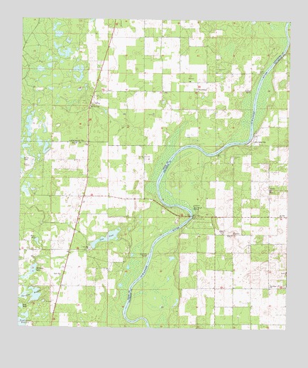
Hatchbend, FL USGS Topographic Map
Click on map above to begin viewing in our Map Viewer.

This topographic map contains these locations and features:
Feature Name Type Latitude Longitude GNIS ID View Map
Careless PrairieLakeN29.7635°W82.9921°280030View Map
Country LandingsAirportN29.7652°W82.8935°2676737View Map
Cow PondLakeN29.7864°W82.9592°280944View Map
Darrah Air Park (historical)AirportN29.7783°W82.8901°309261View Map
Fletcher SpringSpringN29.8475°W82.8943°282577View Map
Guaranto SpringSpringN29.7797°W82.9400°283476View Map
Hatch Bend Volunteer Fire DepartmentBuildingN29.8458°W82.9175°2644001View Map
HatchbendPopulated PlaceN29.8472°W82.9182°294800View Map
Little Lake CityPopulated PlaceN29.8263°W82.8918°285725View Map
McCalls ChapelChurchN29.8400°W82.9676°286570View Map
Mount Nebo ChurchChurchN29.7961°W82.8787°287242View Map
New Hope ChurchChurchN29.7672°W82.8826°287631View Map
Old Hatchbend CemeteryCemeteryN29.8563°W82.9076°288098View Map
Rock Bluff LandingLocaleN29.7947°W82.9196°295580View Map
Rock Bluff SpringSpringN29.7991°W82.9188°289808View Map
Rock Sink ChurchChurchN29.7816°W82.9671°289854View Map
Shady Bend AirportAirportN29.8124°W82.9258°309259View Map
Simms LandingLocaleN29.8544°W82.8865°295627View Map
Suwannee River Research Educational CenterSchoolN29.8216°W82.8987°300165View Map
Tomlinson PrairieLakeN29.7517°W82.9979°292341View Map
Townsend CemeteryCemeteryN29.8194°W82.9012°292386View Map
Wards CemeteryCemeteryN29.8155°W82.9960°292880View Map
Water PondLakeN29.7850°W82.9916°292925View Map
Wayfair ChurchChurchN29.8069°W82.8835°292957View Map
Williams LakeLakeN29.7735°W82.9932°293330View Map

Note: Coordinates in the location and feature list above are referenced to NAD83 datum.


Copyright (C) 2008-2025 Ryan Niemi / Sunset Dynamics ... All Rights Reserved