TopoQuest Logo
Do you find TopoQuest useful?
Help keep TopoQuest running and adding new maps/features by donating!
Bitcoin:  19c7KJd3qBynnjoSw5npx9KScwjBe4ifkT
Litecoin:  LXs6TkuXGGXo1vDsWCkWVdjQX94eUKd6ui
Home View Maps Find Maps Find Places Resources & Links


Branford, Florida Topographic Map

USGS Map Title: Branford, FL
USGS Map MRC: 29082H8
DRG (GeoTIFF) Download: o29082h8.tif


Neighboring USGS Topographic Map Quads:


  Mayo SE, FL  
30083A1
 

  O'Brien, FL  
30082A8
 

  O'Brien SE, FL  
30082A7
 

  Mallory Swamp NE, FL  
29083H1
 

  Branford, FL  
29082H8
 

  Hildreth, FL  
29082H7
 

  Mallory Swamp SE, FL  
29083G1
 

  Hatchbend, FL  
29082G8
 

  Bell, FL  
29082G7


Map MRC Location:

N30°
W83°
N30°
W82°
H8 H7 H6 H5 H4 H3 H2 H1
G8 G7 G6 G5 G4 G3 G2 G1
F8 F7 F6 F5 F4 F3 F2 F1
E8 E7 E6 E5 E4 E3 E2 E1
D8 D7 D6 D5 D4 D3 D2 D1
C8 C7 C6 C5 C4 C3 C2 C1
B8 B7 B6 B5 B4 B3 B2 B1
A8 A7 A6 A5 A4 A3 A2 A1
N29°
W83°
N29°
W82°

Branford, FL USGS 1:24K Topographic Map Preview:
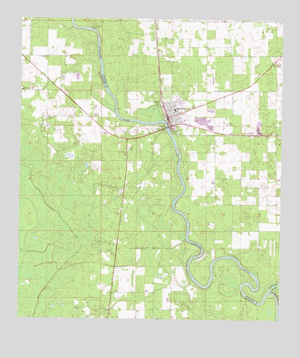
Branford, FL USGS Topographic Map
Click on map above to begin viewing in our Map Viewer.

This topographic map contains these locations and features:
Feature Name Type Latitude Longitude GNIS ID View Map
Bethel Baptist CemeteryCemeteryN29.8797°W82.9696°278526View Map
BranfordPopulated PlaceN29.9591°W82.9282°279335View Map
Branford Church of GodChurchN29.9561°W82.9258°2555765View Map
Branford Church of God by FaithChurchN29.9653°W82.9350°2555763View Map
Branford High SchoolSchoolN29.9626°W82.9256°299218View Map
Branford High School StadiumLocaleN29.9644°W82.9228°2555644View Map
Branford Post OfficePost OfficeN29.9592°W82.9299°2447906View Map
Branford Presbyterian ChurchChurchN29.9600°W82.9283°2555764View Map
Branford Public LibraryBuildingN29.9630°W82.9304°2447905View Map
Branford Town HallBuildingN29.9628°W82.9311°2555683View Map
Branford United Methodist ChurchChurchN29.9619°W82.9283°2555662View Map
Branford Volunteer Fire DepartmentBuildingN29.9598°W82.9280°2644321View Map
Byrd CemeteryCemeteryN29.9583°W82.9867°2555782View Map
Byrd Church (historical)ChurchN29.9586°W82.9860°279777View Map
Ephesus Advent Christian ChurchChurchN29.9702°W82.9987°282235View Map
First Baptist Church of BranfordChurchN29.9624°W82.9306°2447908View Map
GradyPopulated PlaceN29.9541°W82.9321°295319View Map
Hal Adams BridgeBridgeN29.9558°W82.9610°303664View Map
Hall Farm Airport (historical)AirportN29.9200°W82.9023°309293View Map
Hatch ParkParkN29.9583°W82.9214°2555642View Map
Hatchbend Apostolic ChurchChurchN29.8755°W82.9340°300038View Map
Hatchbend CemeteryCemeteryN29.8758°W82.9344°2555822View Map
Hunts CemeteryCemeteryN29.9516°W82.8754°301121View Map
Lazyboy AirportAirportN29.9737°W82.9073°309291View Map
Little River SpringsSpringN29.9967°W82.9664°285787View Map
Living Springs Family Worship CenterChurchN29.9681°W82.9047°2555622View Map
Macedonia Baptist Purity ChurchChurchN29.9586°W82.9864°2555802View Map
Mount Paran Baptist ChurchChurchN29.9838°W82.9874°287281View Map
Oak Grove CemeteryCemeteryN29.9569°W82.9001°287939View Map
Peace Baptist ChurchChurchN29.9528°W82.9064°2555624View Map
San Juan Catholic MissionChurchN29.9608°W82.9236°2555643View Map
Santa Fe RiverStreamN29.8875°W82.8793°290658View Map
Suwannee Point Ranch Airport (historical)AirportN29.9416°W82.9135°309289View Map
Town of BranfordCivilN29.9622°W82.9256°2405314View Map
Vineyard of Grace MinistriesChurchN29.9656°W82.9317°2555682View Map
Wachitokha (historical)Populated PlaceN29.9502°W82.8998°294530View Map
Walker Creek Baptist CemeteryCemeteryN29.8800°W82.9564°2555842View Map
Walker Creek Bethel Baptist ChurchChurchN29.8788°W82.9560°278539View Map
WanamakePopulated PlaceN29.8850°W82.8754°300161View Map
White FieldAirportN29.9726°W82.9252°2787326View Map

Note: Coordinates in the location and feature list above are referenced to NAD83 datum.


Copyright (C) 2008-2025 Ryan Niemi / Sunset Dynamics ... All Rights Reserved