TopoQuest Logo
Do you find TopoQuest useful?
Help keep TopoQuest running and adding new maps/features by donating!
Bitcoin:  19c7KJd3qBynnjoSw5npx9KScwjBe4ifkT
Litecoin:  LXs6TkuXGGXo1vDsWCkWVdjQX94eUKd6ui
Home View Maps Find Maps Find Places Resources & Links


Hildreth, Florida Topographic Map

USGS Map Title: Hildreth, FL
USGS Map MRC: 29082H7
DRG (GeoTIFF) Download: o29082h7.tif


Neighboring USGS Topographic Map Quads:


  O'Brien, FL  
30082A8
 

  O'Brien SE, FL  
30082A7
 

  Columbia, FL  
30082A6
 

  Branford, FL  
29082H8
 

  Hildreth, FL  
29082H7
 

  Fort White, FL  
29082H6
 

  Hatchbend, FL  
29082G8
 

  Bell, FL  
29082G7
 

  High Springs SW, FL  
29082G6


Map MRC Location:

N30°
W83°
N30°
W82°
H8 H7 H6 H5 H4 H3 H2 H1
G8 G7 G6 G5 G4 G3 G2 G1
F8 F7 F6 F5 F4 F3 F2 F1
E8 E7 E6 E5 E4 E3 E2 E1
D8 D7 D6 D5 D4 D3 D2 D1
C8 C7 C6 C5 C4 C3 C2 C1
B8 B7 B6 B5 B4 B3 B2 B1
A8 A7 A6 A5 A4 A3 A2 A1
N29°
W83°
N29°
W82°

Hildreth, FL USGS 1:24K Topographic Map Preview:
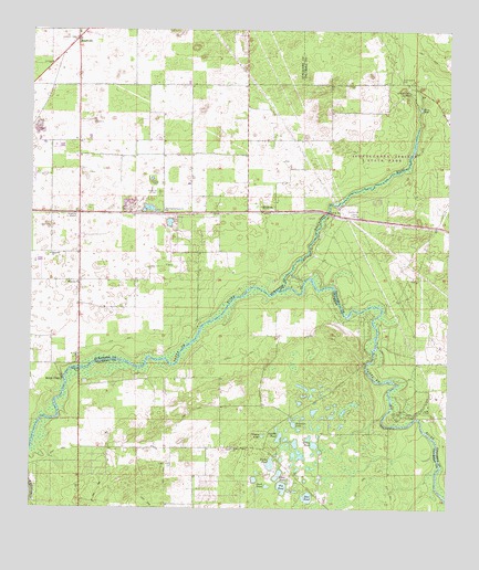
Hildreth, FL USGS Topographic Map
Click on map above to begin viewing in our Map Viewer.

This topographic map contains these locations and features:
Feature Name Type Latitude Longitude GNIS ID View Map
BeachvillePopulated PlaceN29.9980°W82.8612°278265View Map
Beachville Advent Christian ChurchChurchN29.9994°W82.8610°301117View Map
Beachville Fire TowerTowerN29.9972°W82.8621°301116View Map
Blue HoleSpringN29.9800°W82.7585°279025View Map
Burlington Santa Fe Church of ChristChurchN29.9530°W82.8348°279694View Map
Casson PondLakeN29.8942°W82.8052°280121View Map
Clear PondLakeN29.8840°W82.8005°280538View Map
Deer PondLakeN29.8781°W82.7916°281454View Map
Double PondLakeN29.8939°W82.8001°281704View Map
Duck PondLakeN29.8810°W82.8038°281822View Map
Flying C Farm AirportAirportN29.9631°W82.8738°2676703View Map
Fort White (historical)MilitaryN29.9333°W82.8000°307417View Map
Fort White LibraryBuildingN29.9132°W82.7589°2449096View Map
Fort White Progress Energy Radio TowerTowerN29.9525°W82.7792°2555222View Map
Fort White Progress Energy SubstationBuildingN29.9531°W82.7800°2555223View Map
Fox FieldAirportN29.8892°W82.7986°309292View Map
Fox PondLakeN29.8808°W82.7992°282398View Map
Gilchrist County Fire and Rescue Station 2BuildingN29.8914°W82.8168°2644258View Map
Grass PondLakeN29.8919°W82.7896°283302View Map
HildrethPopulated PlaceN29.9527°W82.8054°294805View Map
Icheetucknee River Baptist ChurchChurchN29.9819°W82.8111°2555225View Map
Ichetucknee CemeteryCemeteryN29.9880°W82.7646°284455View Map
Ichetucknee RiverStreamN29.9325°W82.8001°284456View Map
Ichetucknee SpringsSpringN29.9838°W82.7618°284457View Map
Ichetucknee Springs State ParkParkN29.9677°W82.7654°301119View Map
Landmark Baptist ChurchChurchN29.9350°W82.8611°2556142View Map
Lanier Railroad StationLocaleN29.9519°W82.8476°301118View Map
Lebanon Baptist ChurchChurchN29.9414°W82.8694°2556164View Map
Magnolia Church (historical)ChurchN29.9344°W82.8607°286292View Map
Magnolia Church (historical)ChurchN29.9413°W82.8690°286293View Map
New Grove ChurchChurchN29.9333°W82.7590°301070View Map
Pleasant Grove ChurchChurchN29.8908°W82.8140°289049View Map
Ranchette Volunteer Fire DepartmentBuildingN29.9608°W82.8611°2555243View Map
River Run CampgroundPopulated PlaceN29.9539°W82.7975°2555224View Map
Sampson LakeLakeN29.8973°W82.7958°290458View Map
Sandy PointPopulated PlaceN29.9091°W82.8654°295597View Map
Sandy Point Trailer ParkPopulated PlaceN29.9086°W82.8657°2447907View Map
Santa Fe CemeteryCemeteryN29.9574°W82.8362°290654View Map
Suwannee County Fire Rescue Station 3BuildingN29.9977°W82.8624°2555762View Map
Suwannee Valley Electric Cooperative Walker SubstationBuildingN29.9589°W82.8358°2555242View Map
Thompson AirfieldAirportN29.9819°W82.8345°2676639View Map
True Life Apostolic ChurchChurchN29.9677°W82.8614°2447909View Map
Tusset PondLakeN29.8868°W82.8027°292586View Map

Note: Coordinates in the location and feature list above are referenced to NAD83 datum.


Copyright (C) 2008-2025 Ryan Niemi / Sunset Dynamics ... All Rights Reserved