TopoQuest Logo
Do you find TopoQuest useful?
Help keep TopoQuest running and adding new maps/features by donating!
Bitcoin:  19c7KJd3qBynnjoSw5npx9KScwjBe4ifkT
Litecoin:  LXs6TkuXGGXo1vDsWCkWVdjQX94eUKd6ui
Home View Maps Find Maps Find Places Resources & Links


Hawkinsville, California Topographic Map

USGS Map Title: Hawkinsville, CA
USGS Map MRC: 41122G5
DRG (GeoTIFF) Download: o41122g5.tif


Neighboring USGS Topographic Map Quads:


  Cottonwood Peak, CA  
41122H6
 

  Hornbrook, CA  
41122H5
 

  Iron Gate Reservoir, CA  
41122H4
 

  Badger Mountain, CA  
41122G6
 

  Hawkinsville, CA  
41122G5
 

  Bogus Mountain, CA  
41122G4
 

  Yreka, CA  
41122F6
 

  Montague, CA  
41122F5
 

  Little Shasta, CA  
41122F4


Map MRC Location:

N42°
W123°
N42°
W122°
H8 H7 H6 H5 H4 H3 H2 H1
G8 G7 G6 G5 G4 G3 G2 G1
F8 F7 F6 F5 F4 F3 F2 F1
E8 E7 E6 E5 E4 E3 E2 E1
D8 D7 D6 D5 D4 D3 D2 D1
C8 C7 C6 C5 C4 C3 C2 C1
B8 B7 B6 B5 B4 B3 B2 B1
A8 A7 A6 A5 A4 A3 A2 A1
N41°
W123°
N41°
W122°

Hawkinsville, CA USGS 1:24K Topographic Map Preview:
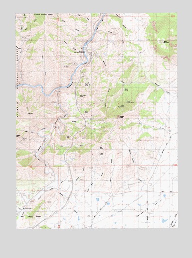
Hawkinsville, CA USGS Topographic Map
Click on map above to begin viewing in our Map Viewer.

This topographic map contains these locations and features:
Feature Name Type Latitude Longitude GNIS ID View Map
Ash CreekStreamN41.8338°W122.6192°266391View Map
Bunton Hollow CreekStreamN41.7657°W122.5357°266517View Map
Carson GulchValleyN41.8646°W122.5617°266538View Map
Cooley GulchValleyN41.8054°W122.6092°1657590View Map
Dry GulchValleyN41.8021°W122.5984°266660View Map
Dutch GulchValleyN41.8671°W122.5645°1657598View Map
Gold Leaf MineMineN41.8024°W122.6211°266757View Map
HawkinsvillePopulated PlaceN41.7607°W122.6220°1659733View Map
High Grade MineMineN41.8446°W122.5847°266806View Map
Indian Girl MineMineN41.8349°W122.6209°266849View Map
Iron Trough SpringSpringN41.8277°W122.5755°1657631View Map
Jail GulchValleyN41.8388°W122.5797°266855View Map
Jims CampPopulated PlaceN41.8329°W122.5859°1682306View Map
Lake Suzanne 1186 DamDamN41.7515°W122.5145°1664256View Map
Long GulchValleyN41.8343°W122.6034°266943View Map
Lower Maple SpringSpringN41.8233°W122.5390°266952View Map
Maple GulchValleyN41.8713°W122.6197°266968View Map
Maple SpringSpringN41.8334°W122.5686°1657650View Map
Modoc GulchValleyN41.8113°W122.5889°1657657View Map
Mud SpringSpringN41.7974°W122.5618°1657659View Map
Mutton GulchValleyN41.7721°W122.5528°267053View Map
Negro Boy MineMineN41.8615°W122.6120°267054View Map
Osburger GulchValleyN41.8746°W122.5539°267099View Map
Paradise CraggySummitN41.8146°W122.5470°267109View Map
Pioneer BridgeBridgeN41.8090°W122.5936°267130View Map
Printer GulchValleyN41.8654°W122.5656°267144View Map
Randolf Collier Safety Roadside Rest AreaParkN41.8521°W122.5714°1657671View Map
Rattlesnake GulchValleyN41.8699°W122.6214°234541View Map
RiverviewSummitN41.8168°W122.6175°267182View Map
Rocky GulchValleyN41.7629°W122.6234°267188View Map
Shake GulchValleyN41.8538°W122.6225°267224View Map
Sharps GulchValleyN41.8468°W122.5736°1657678View Map
Shasta RiverStreamN41.8307°W122.5942°267231View Map
Shasta River School (historical)SchoolN41.7526°W122.5672°1682322View Map
Shelley GulchValleyN41.7701°W122.5875°1657679View Map
Silvas SpringSpringN41.8175°W122.5732°1657680View Map
Stiffneck GulchValleyN41.8721°W122.5711°1657686View Map
Swabs SpringSpringN41.8305°W122.5409°1657687View Map
Union MineMineN41.8038°W122.5839°268588View Map
Upper Maple SpringSpringN41.8208°W122.5412°268625View Map
White RockPillarN41.7932°W122.5611°1657695View Map
White Rock GulchValleyN41.7651°W122.5784°1657696View Map
Williams CreekStreamN41.8557°W122.5717°269117View Map
Wood GulchValleyN41.8371°W122.5506°269280View Map
Yreka CreekStreamN41.7760°W122.5945°269378View Map

Note: Coordinates in the location and feature list above are referenced to NAD83 datum.


Copyright (C) 2008-2024 Ryan Niemi / Sunset Dynamics ... All Rights Reserved