TopoQuest Logo
Do you find TopoQuest useful?
Help keep TopoQuest running and adding new maps/features by donating!
Bitcoin:  19c7KJd3qBynnjoSw5npx9KScwjBe4ifkT
Litecoin:  LXs6TkuXGGXo1vDsWCkWVdjQX94eUKd6ui
Home View Maps Find Maps Find Places Resources & Links


Hornbrook, California Topographic Map

USGS Map Title: Hornbrook, CA
USGS Map MRC: 41122H5
DRG (GeoTIFF) Download: o41122h5.tif


Neighboring USGS Topographic Map Quads:


  Mount Ashland, OR  
42122A6
 

  Siskiyou Pass, OR  
42122A5
 

  Soda Mountain, OR  
42122A4
 

  Cottonwood Peak, CA  
41122H6
 

  Hornbrook, CA  
41122H5
 

  Iron Gate Reservoir, CA  
41122H4
 

  Badger Mountain, CA  
41122G6
 

  Hawkinsville, CA  
41122G5
 

  Bogus Mountain, CA  
41122G4


Map MRC Location:

N42°
W123°
N42°
W122°
H8 H7 H6 H5 H4 H3 H2 H1
G8 G7 G6 G5 G4 G3 G2 G1
F8 F7 F6 F5 F4 F3 F2 F1
E8 E7 E6 E5 E4 E3 E2 E1
D8 D7 D6 D5 D4 D3 D2 D1
C8 C7 C6 C5 C4 C3 C2 C1
B8 B7 B6 B5 B4 B3 B2 B1
A8 A7 A6 A5 A4 A3 A2 A1
N41°
W123°
N41°
W122°

Hornbrook, CA USGS 1:24K Topographic Map Preview:
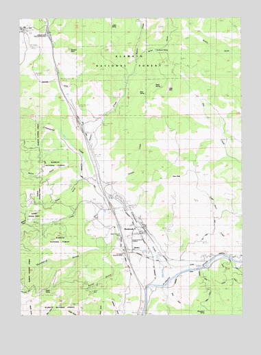
Hornbrook, CA USGS Topographic Map
Click on map above to begin viewing in our Map Viewer.

This topographic map contains these locations and features:
Feature Name Type Latitude Longitude GNIS ID View Map
Alden Historical MarkerParkN41.9265°W122.5786°266395View Map
Andersons SpringSpringN41.9862°W122.5494°1657565View Map
B R Alden Historical MarkerParkN41.9010°W122.5678°1657567View Map
Bailey HillSummitN41.9865°W122.5970°266401View Map
Beartrap GulchValleyN41.9146°W122.6222°1657570View Map
Blue GulchValleyN41.8851°W122.5409°266467View Map
Bushy GulchValleyN41.9318°W122.5928°1657584View Map
California Department of Forestry and Fire Protection HornbrookBuildingN41.9036°W122.5685°2622042View Map
Camp Lowe (historical)LocaleN41.8865°W122.5539°1682289View Map
Cape Horn CreekStreamN41.8999°W122.5095°266533View Map
Colestin Rural Fire District Station 2BuildingN41.9970°W122.6218°2622228View Map
Collins SpringSpringN41.9961°W122.5742°266588View Map
Cottonwood CreekStreamN41.8888°W122.5439°266601View Map
Ditch CreekStreamN41.9254°W122.5711°266647View Map
Hazel MineMineN41.9024°W122.5742°266801View Map
HenleyPopulated PlaceN41.9021°W122.5634°1659734View Map
Henley and Hornbrook CemeteryCemeteryN41.9063°W122.5642°1657620View Map
HiltPopulated PlaceN41.9949°W122.6234°266807View Map
Horn PeakSummitN41.9332°W122.5406°266819View Map
HornbrookPopulated PlaceN41.9101°W122.5559°266820View Map
Hornbrook Census Designated PlaceCensusN41.9080°W122.5596°2408401View Map
Hornbrook Elementary SchoolSchoolN41.9110°W122.5614°1701871View Map
Hornbrook Post OfficePost OfficeN41.9078°W122.5581°1701872View Map
Hornbrook Volunteer Fire StationBuildingN41.9122°W122.5578°2622140View Map
Hutton CreekStreamN41.9300°W122.5814°266843View Map
Jefferson Davis Historical MonumentParkN41.9904°W122.6072°266856View Map
Jilson MineMineN41.8849°W122.5859°266860View Map
KlamathonLocaleN41.8999°W122.5050°266888View Map
Klamathon SpringSpringN41.8768°W122.5212°266889View Map
Little PilotSummitN41.9699°W122.5422°266923View Map
Maple SpringSpringN41.9746°W122.5550°266969View Map
Maple SpringSpringN41.8851°W122.6093°1657649View Map
McCavick MineMineN41.8774°W122.5686°266984View Map
Miller GulchValleyN41.9826°W122.5597°1657654View Map
Moore GulchValleyN41.9418°W122.5945°1657658View Map
Mud SpringSpringN41.9685°W122.5585°267045View Map
Olsen MineMineN41.8785°W122.5764°267094View Map
Rancheria GulchValleyN41.9104°W122.5567°267158View Map
Rocky GulchValleyN41.8965°W122.5586°267187View Map
Shelton CreekStreamN41.9282°W122.5739°267236View Map

Note: Coordinates in the location and feature list above are referenced to NAD83 datum.


Copyright (C) 2008-2025 Ryan Niemi / Sunset Dynamics ... All Rights Reserved