TopoQuest Logo
Do you find TopoQuest useful?
Help keep TopoQuest running and adding new maps/features by donating!
Bitcoin:  19c7KJd3qBynnjoSw5npx9KScwjBe4ifkT
Litecoin:  LXs6TkuXGGXo1vDsWCkWVdjQX94eUKd6ui
Home View Maps Find Maps Find Places Resources & Links


Cottonwood Peak, California Topographic Map

USGS Map Title: Cottonwood Peak, CA
USGS Map MRC: 41122H6
DRG (GeoTIFF) Download: o41122h6.tif


Neighboring USGS Topographic Map Quads:


  Siskiyou Peak, OR  
42122A7
 

  Mount Ashland, OR  
42122A6
 

  Siskiyou Pass, OR  
42122A5
 

  Buckhorn Bally, CA  
41122H7
 

  Cottonwood Peak, CA  
41122H6
 

  Hornbrook, CA  
41122H5
 

  McKinley Mountain, CA  
41122G7
 

  Badger Mountain, CA  
41122G6
 

  Hawkinsville, CA  
41122G5


Map MRC Location:

N42°
W123°
N42°
W122°
H8 H7 H6 H5 H4 H3 H2 H1
G8 G7 G6 G5 G4 G3 G2 G1
F8 F7 F6 F5 F4 F3 F2 F1
E8 E7 E6 E5 E4 E3 E2 E1
D8 D7 D6 D5 D4 D3 D2 D1
C8 C7 C6 C5 C4 C3 C2 C1
B8 B7 B6 B5 B4 B3 B2 B1
A8 A7 A6 A5 A4 A3 A2 A1
N41°
W123°
N41°
W122°

Cottonwood Peak, CA USGS 1:24K Topographic Map Preview:
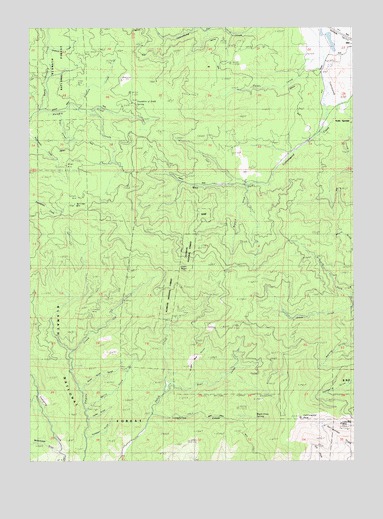
Cottonwood Peak, CA USGS Topographic Map
Click on map above to begin viewing in our Map Viewer.

This topographic map contains these locations and features:
Feature Name Type Latitude Longitude GNIS ID View Map
Arastra CreekStreamN41.9768°W122.7325°266384View Map
Bear CreekStreamN41.8949°W122.6981°266424View Map
Bear Creek TrailTrailN41.8874°W122.6723°266428View Map
Bluejay MineMineN41.9329°W122.7428°266472View Map
Bogard GulchValleyN41.9532°W122.6664°266474View Map
Bullion MountainSummitN41.9487°W122.7328°266512View Map
Bumblebee MineMineN41.9468°W122.7331°266514View Map
Cinnabar CampLocaleN41.9112°W122.7281°266565View Map
Cinnabar MineMineN41.9174°W122.7259°266566View Map
Clay MineMineN41.9890°W122.7348°266573View Map
Copper TrailTrailN41.9174°W122.6950°266598View Map
Corbett MineMineN41.9535°W122.7323°266599View Map
Cottonwood PeakSummitN41.8871°W122.6464°266603View Map
Devils GulchValleyN41.8904°W122.7281°266639View Map
Fountain of Youth SpringSpringN41.9783°W122.7100°266721View Map
Graham CreekStreamN41.9935°W122.7431°266762View Map
Hornbrook-Hilt DivisionCivilN41.9366°W122.6377°1935139View Map
Hungry Creek LookoutLocaleN41.9985°W122.7225°266838View Map
Hunts CreekStreamN41.9882°W122.6370°266842View Map
Last Chance MineMineN41.9949°W122.7325°266899View Map
Longfellow CreekStreamN41.8879°W122.7045°266945View Map
Lucky Boy MineMineN41.8843°W122.6309°266955View Map
Maple Grove SpringSpringN41.8876°W122.6633°266967View Map
New Year MineMineN41.9368°W122.7411°267060View Map
North Fork Ditch CreekStreamN41.9190°W122.6259°267072View Map
North Hungry CreekStreamN41.9758°W122.7464°267082View Map
Paul GulchValleyN41.9749°W122.7386°267111View Map
Rocky Point GulchValleyN41.8960°W122.7306°267189View Map
Shaft RockPillarN41.9304°W122.6898°267223View Map
Soda SpringSpringN41.9726°W122.6278°267373View Map
Sterling MineMineN41.9671°W122.7370°267724View Map
Sundown GulchValleyN41.8812°W122.7289°267955View Map
West Cottonwood CreekStreamN41.9774°W122.6292°268881View Map
Wiegel MineMineN41.9599°W122.7361°269064View Map
Woodchopper GulchValleyN41.8776°W122.7403°269286View Map
Yonka GulchValleyN41.8871°W122.7278°269364View Map

Note: Coordinates in the location and feature list above are referenced to NAD83 datum.


Copyright (C) 2008-2025 Ryan Niemi / Sunset Dynamics ... All Rights Reserved