TopoQuest Logo
Do you find TopoQuest useful?
Help keep TopoQuest running and adding new maps/features by donating!
Bitcoin:  19c7KJd3qBynnjoSw5npx9KScwjBe4ifkT
Litecoin:  LXs6TkuXGGXo1vDsWCkWVdjQX94eUKd6ui
Home View Maps Find Maps Find Places Resources & Links


Hay Mesa, New Mexico Topographic Map

USGS Map Title: Hay Mesa, NM
USGS Map MRC: 33107A8
DRG (GeoTIFF) Download: o33107a8.tif


Neighboring USGS Topographic Map Quads:


  Middle Mesa, NM  
33108B1
 

  Bonner Canyon, NM  
33107B8
 

  Reeds Peak, NM  
33107B7
 

  North Star Mesa, NM  
33108A1
 

  Hay Mesa, NM  
33107A8
 

  Victorio Park, NM  
33107A7
 

  Allie Canyon, NM  
32108H1
 

  Hendricks Peak, NM  
32107H8
 

  Hillsboro Peak, NM  
32107H7


Map MRC Location:

N34°
W108°
N34°
W107°
H8 H7 H6 H5 H4 H3 H2 H1
G8 G7 G6 G5 G4 G3 G2 G1
F8 F7 F6 F5 F4 F3 F2 F1
E8 E7 E6 E5 E4 E3 E2 E1
D8 D7 D6 D5 D4 D3 D2 D1
C8 C7 C6 C5 C4 C3 C2 C1
B8 B7 B6 B5 B4 B3 B2 B1
A8 A7 A6 A5 A4 A3 A2 A1
N33°
W108°
N33°
W107°

Hay Mesa, NM USGS 1:24K Topographic Map Preview:
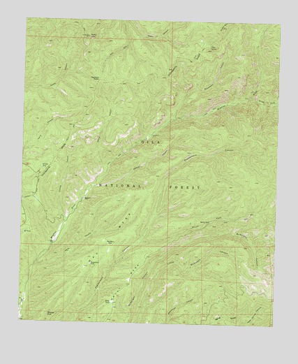
Hay Mesa, NM USGS Topographic Map
Click on map above to begin viewing in our Map Viewer.

This topographic map contains these locations and features:
Feature Name Type Latitude Longitude GNIS ID View Map
Aspen MountainSummitN33.1226°W107.9037°903450View Map
Aspen SpringSpringN33.1151°W107.9095°903454View Map
Bloodgood PlaceLocaleN33.0515°W107.9698°920567View Map
Cabin SpringSpringN33.0017°W107.9550°898954View Map
Cabin WellWellN33.0009°W107.9470°899292View Map
Cooney CanyonValleyN33.0434°W107.9792°905304View Map
Cooney PlaceLocaleN33.0334°W107.9848°2038413View Map
Corral CanyonValleyN33.0615°W107.9600°905363View Map
Corral Number 9LocaleN33.0778°W107.9375°905374View Map
E T CanyonValleyN33.0087°W107.9995°905925View Map
E T TankReservoirN33.0368°W107.9992°905926View Map
Hay MesaRidgeN33.0362°W107.9525°906886View Map
Hay Mesa CorralLocaleN33.0551°W107.9387°898956View Map
Hay Mesa TankReservoirN33.0329°W107.9576°906887View Map
Hay Number Two TankReservoirN33.0616°W107.9331°898955View Map
Hay TankReservoirN33.0441°W107.9414°898972View Map
Heffner CanyonValleyN33.0567°W107.9653°906898View Map
Hells CanyonValleyN33.0240°W107.9923°906911View Map
Ingersoll TankReservoirN33.0004°W107.9800°898952View Map
Kelly MesaSummitN33.0148°W107.9492°907527View Map
Kelly TankReservoirN33.0085°W107.9557°907529View Map
Lincoln TankReservoirN33.0640°W107.9909°907971View Map
Middle TankReservoirN33.0163°W107.9749°898950View Map
Mimbres WellWellN33.0110°W107.9981°898951View Map
Monument CanyonValleyN33.0845°W107.9267°908869View Map
Monument SpringSpringN33.1070°W107.9123°936730View Map
North Fork McKnight CanyonValleyN33.0378°W107.8961°936537View Map
North TankReservoirN33.0501°W107.9930°898949View Map
Outlaw SpringSpringN33.0165°W107.8800°936729View Map
Pit TankReservoirN33.0525°W107.9492°898971View Map
Powderhorn TankReservoirN33.0243°W107.9660°909827View Map
Rocky PointSummitN33.1181°W107.9695°910410View Map
Signboard SaddleGapN33.1006°W107.9637°911052View Map
South Fork Mimbres RiverStreamN33.0937°W107.8903°911235View Map
South Fork Powderhorn CanyonValleyN33.0345°W107.9417°911243View Map
Spring TankReservoirN33.0425°W107.9077°911338View Map
Thompson TankReservoirN33.0031°W107.9864°911670View Map
Thompson Tank Number TwentyReservoirN33.0062°W107.9701°898953View Map
Yates SpringSpringN33.0003°W107.8884°936728View Map

Note: Coordinates in the location and feature list above are referenced to NAD83 datum.


Copyright (C) 2008-2024 Ryan Niemi / Sunset Dynamics ... All Rights Reserved