TopoQuest Logo
Do you find TopoQuest useful?
Help keep TopoQuest running and adding new maps/features by donating!
Bitcoin:  19c7KJd3qBynnjoSw5npx9KScwjBe4ifkT
Litecoin:  LXs6TkuXGGXo1vDsWCkWVdjQX94eUKd6ui
Home View Maps Find Maps Find Places Resources & Links


Allie Canyon, New Mexico Topographic Map

USGS Map Title: Allie Canyon, NM
USGS Map MRC: 32108H1
DRG (GeoTIFF) Download: o32108h1.tif


Neighboring USGS Topographic Map Quads:


  Copperas Peak, NM  
33108A2
 

  North Star Mesa, NM  
33108A1
 

  Hay Mesa, NM  
33107A8
 

  Twin Sisters, NM  
32108H2
 

  Allie Canyon, NM  
32108H1
 

  Hendricks Peak, NM  
32107H8
 

  Fort Bayard, NM  
32108G2
 

  Santa Rita Mine, NM  
32108G1
 

  San Lorenzo, NM  
32107G8


Map MRC Location:

N33°
W109°
N33°
W108°
H8 H7 H6 H5 H4 H3 H2 H1
G8 G7 G6 G5 G4 G3 G2 G1
F8 F7 F6 F5 F4 F3 F2 F1
E8 E7 E6 E5 E4 E3 E2 E1
D8 D7 D6 D5 D4 D3 D2 D1
C8 C7 C6 C5 C4 C3 C2 C1
B8 B7 B6 B5 B4 B3 B2 B1
A8 A7 A6 A5 A4 A3 A2 A1
N32°
W109°
N32°
W108°

Allie Canyon, NM USGS 1:24K Topographic Map Preview:
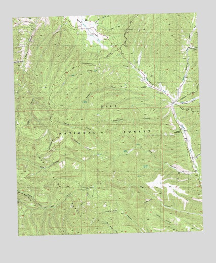
Allie Canyon, NM USGS Topographic Map
Click on map above to begin viewing in our Map Viewer.

This topographic map contains these locations and features:
Feature Name Type Latitude Longitude GNIS ID View Map
00009 Water WellWellN32.9179°W108.0056°919554View Map
00010 Water WellWellN32.9173°W108.0059°919555View Map
00011 Water WellWellN32.9176°W108.0050°919553View Map
00012 Water WellWellN32.9101°W108.0039°919564View Map
Allie CanyonValleyN32.9084°W108.0067°903107View Map
Allie WellWellN32.9089°W108.0147°900230View Map
B and P TankReservoirN32.8979°W108.0284°2038355View Map
Brushy Basin TankReservoirN32.8795°W108.0362°899153View Map
Cabin SpringSpringN32.9220°W108.0502°900235View Map
Camp Thunder Bird Upper Mimbres Substation 2BuildingN32.9585°W108.0337°2658198View Map
Camp ThunderbirdLocaleN32.9587°W108.0362°900237View Map
Camp Thunderbird CampgroundLocaleN32.9595°W108.0381°899147View Map
Circle WellWellN32.9790°W108.0378°936769View Map
Continental TankReservoirN32.9773°W108.0540°899141View Map
Corner SpringSpringN32.9542°W108.1120°899145View Map
Cottonwood CanyonValleyN32.9420°W108.0189°905397View Map
Cottonwood TankReservoirN32.9436°W108.0699°899150View Map
Deadman CanyonValleyN32.8915°W108.1095°905644View Map
Deemer CanyonValleyN32.9184°W108.0673°899149View Map
Divide WellWellN32.9717°W108.0414°936767View Map
Divide WellWellN32.9732°W108.0420°2038441View Map
East Fork Mimbres RiverStreamN32.9484°W108.0178°905966View Map
Elk Pasture TankReservoirN32.9776°W108.1067°899144View Map
First Water SpringSpringN32.9709°W108.0625°936768View Map
G O S RanchLocaleN32.9970°W108.0762°906664View Map
Gattons ParkFlatN32.9967°W108.0753°906499View Map
Gooseman TankReservoirN32.8977°W108.0475°898883View Map
Gos Organizational SiteLocaleN32.9912°W108.0667°899140View Map
Hicks CemeteryCemeteryN32.9103°W108.0050°906946View Map
Hightower CanyonValleyN32.9206°W108.0773°900244View Map
Jackass CanyonValleyN32.8948°W108.0337°900245View Map
Laney SpringSpringN32.9567°W108.0278°914311View Map
Lincoln CanyonValleyN32.9959°W108.0720°907969View Map
Little Bear SpringSpringN32.9123°W108.0393°900246View Map
Lower Elk TankReservoirN32.9834°W108.0931°2038553View Map
McCoy TankReservoirN32.9165°W108.0117°2038565View Map
McKnight CanyonValleyN32.9484°W108.0162°908535View Map
Mesa TankReservoirN32.9033°W108.0329°898882View Map
Mimbres CanyonValleyN32.9506°W108.0159°908771View Map
Mimbres District Ranger StationLocaleN32.9331°W108.0142°908568View Map
Mitchell TankReservoirN32.8994°W108.0200°898884View Map
NMBS RG ST Water WellWellN32.9323°W108.0129°918948View Map
Oscar TankReservoirN32.8762°W108.0334°2038599View Map
Powderhorn CanyonValleyN32.9795°W108.0062°909826View Map
Redgate CorralLocaleN32.9006°W108.0803°899151View Map
Shingle TankReservoirN32.8814°W108.0131°899152View Map
Slash TankReservoirN32.9816°W108.0378°899142View Map
Soldier SpringSpringN32.9512°W108.0792°936770View Map
Soldiers CanyonValleyN32.9487°W108.0206°911200View Map
Spring CanyonValleyN32.9009°W108.0789°900252View Map
Steer TankReservoirN32.9600°W108.0503°899146View Map
T-Eleven TankReservoirN32.9778°W108.1092°899143View Map
Telephone TankReservoirN32.9033°W108.0283°898885View Map
Three Circle CanyonValleyN32.9501°W108.0312°911676View Map
Unknown TankReservoirN32.9567°W108.0507°899148View Map
Upper Cottonwood SpringSpringN32.9395°W108.0534°936771View Map
Water CanyonValleyN32.9170°W108.0039°912177View Map
West Fork Mimbres RiverStreamN32.9484°W108.0178°912235View Map
West Skates CanyonValleyN32.9748°W108.1192°912259View Map

Note: Coordinates in the location and feature list above are referenced to NAD83 datum.


Copyright (C) 2008-2025 Ryan Niemi / Sunset Dynamics ... All Rights Reserved