TopoQuest Logo
Do you find TopoQuest useful?
Help keep TopoQuest running and adding new maps/features by donating!
Bitcoin:  19c7KJd3qBynnjoSw5npx9KScwjBe4ifkT
Litecoin:  LXs6TkuXGGXo1vDsWCkWVdjQX94eUKd6ui
Home View Maps Find Maps Find Places Resources & Links


Hillsboro Peak, New Mexico Topographic Map

USGS Map Title: Hillsboro Peak, NM
USGS Map MRC: 32107H7
DRG (GeoTIFF) Download: o32107h7.tif


Neighboring USGS Topographic Map Quads:


  Hay Mesa, NM  
33107A8
 

  Victorio Park, NM  
33107A7
 

  Apache Peak, NM  
33107A6
 

  Hendricks Peak, NM  
32107H8
 

  Hillsboro Peak, NM  
32107H7
 

  Kingston, NM  
32107H6
 

  San Lorenzo, NM  
32107G8
 

  Maverick Mountain, NM  
32107G7
 

  P A Mountain, NM  
32107G6


Map MRC Location:

N33°
W108°
N33°
W107°
H8 H7 H6 H5 H4 H3 H2 H1
G8 G7 G6 G5 G4 G3 G2 G1
F8 F7 F6 F5 F4 F3 F2 F1
E8 E7 E6 E5 E4 E3 E2 E1
D8 D7 D6 D5 D4 D3 D2 D1
C8 C7 C6 C5 C4 C3 C2 C1
B8 B7 B6 B5 B4 B3 B2 B1
A8 A7 A6 A5 A4 A3 A2 A1
N32°
W108°
N32°
W107°

Hillsboro Peak, NM USGS 1:24K Topographic Map Preview:
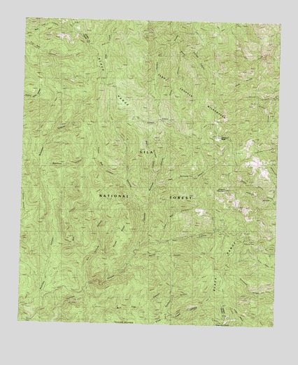
Hillsboro Peak, NM USGS Topographic Map
Click on map above to begin viewing in our Map Viewer.

This topographic map contains these locations and features:
Feature Name Type Latitude Longitude GNIS ID View Map
Bear CanyonValleyN32.9059°W107.8600°903622View Map
Cross-O MountainSummitN32.9312°W107.7750°905524View Map
Deadman CanyonValleyN32.9376°W107.8675°905641View Map
Dry Gallinas CanyonValleyN32.8912°W107.8423°905879View Map
East Railroad CanyonValleyN32.9317°W107.8117°905985View Map
Emory PassGapN32.9101°W107.7667°906157View Map
Emory Pass Historical MarkerParkN32.9101°W107.7667°931709View Map
Emory Pass Vista CampgroundLocaleN32.9104°W107.7642°898891View Map
Gallinas Recreation AreaLocaleN32.8870°W107.8445°898895View Map
Grandview MinesMineN32.8770°W107.8014°906684View Map
HillsboroSummitN32.9526°W107.7795°906988View Map
Hillsboro Peak LookooutLocaleN32.9529°W107.7789°898890View Map
Indian CanyonValleyN32.9862°W107.8000°907190View Map
Iron CreekStreamN32.9067°W107.8181°907249View Map
Iron Creek CampgroundLocaleN32.9090°W107.8059°898893View Map
Little Bear CanyonValleyN32.9098°W107.8073°907984View Map
Mineral Mountain MineMineN32.8873°W107.8014°908793View Map
Old Government TrailTrailN32.9498°W107.7895°902912View Map
Railroad CampgroundLocaleN32.9090°W107.8167°936723View Map
Railroad CanyonValleyN32.9234°W107.8161°909959View Map
Rustlers CanyonValleyN32.8790°W107.8053°910482View Map
Sawyers PeakSummitN32.8759°W107.7795°910864View Map
South Animas CanyonValleyN32.9917°W107.8011°911215View Map
Spring CanyonValleyN32.9026°W107.8206°911311View Map
Thumb RidgeRidgeN32.9117°W107.8278°911691View Map
Turkey Run CanyonValleyN32.9340°W107.8250°911889View Map
Upper Gallinas CampgroundLocaleN32.9001°W107.8231°898894View Map
West Railroad CanyonValleyN32.9376°W107.8100°912254View Map
Wrights Cabin CampgroundLocaleN32.9131°W107.7806°898892View Map

Note: Coordinates in the location and feature list above are referenced to NAD83 datum.


Copyright (C) 2008-2025 Ryan Niemi / Sunset Dynamics ... All Rights Reserved