TopoQuest Logo
Do you find TopoQuest useful?
Help keep TopoQuest running and adding new maps/features by donating!
Bitcoin:  19c7KJd3qBynnjoSw5npx9KScwjBe4ifkT
Litecoin:  LXs6TkuXGGXo1vDsWCkWVdjQX94eUKd6ui
Home View Maps Find Maps Find Places Resources & Links


Hayden Gulch, Colorado Topographic Map

USGS Map Title: Hayden Gulch, CO
USGS Map MRC: 40107C3
DRG (GeoTIFF) Download: o40107c3.tif


Neighboring USGS Topographic Map Quads:


  Breeze Mountain, CO  
40107D4
 

  Hayden, CO  
40107D3
 

  Mount Harris, CO  
40107D2
 

  Pagoda, CO  
40107C4
 

  Hayden Gulch, CO  
40107C3
 

  Dunckley, CO  
40107C2
 

  Slide Creek, CO  
40107B4
 

  Pagoda Peak, CO  
40107B3
 

  Dunckley Pass, CO  
40107B2


Map MRC Location:

N41°
W108°
N41°
W107°
H8 H7 H6 H5 H4 H3 H2 H1
G8 G7 G6 G5 G4 G3 G2 G1
F8 F7 F6 F5 F4 F3 F2 F1
E8 E7 E6 E5 E4 E3 E2 E1
D8 D7 D6 D5 D4 D3 D2 D1
C8 C7 C6 C5 C4 C3 C2 C1
B8 B7 B6 B5 B4 B3 B2 B1
A8 A7 A6 A5 A4 A3 A2 A1
N40°
W108°
N40°
W107°

Hayden Gulch, CO USGS 1:24K Topographic Map Preview:
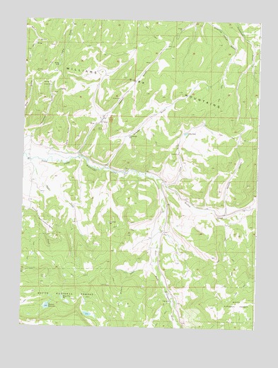
Hayden Gulch, CO USGS Topographic Map
Click on map above to begin viewing in our Map Viewer.

This topographic map contains these locations and features:
Feature Name Type Latitude Longitude GNIS ID View Map
Barton MineMineN40.3325°W107.3348°1683242View Map
Butler ReservoirReservoirN40.2666°W107.3673°200595View Map
Butler Reservoir DamDamN40.2666°W107.3673°200594View Map
Card GulchValleyN40.3204°W107.3529°171472View Map
Denton Strip MineMineN40.3125°W107.3339°1683241View Map
Detwiller ReservoirReservoirN40.2924°W107.3287°171463View Map
Dillabaugh ReservoirReservoirN40.3278°W107.3193°171460View Map
Dowden GulchValleyN40.3150°W107.3303°171470View Map
Dunstan GulchValleyN40.3210°W107.3724°171473View Map
Flattop DamDamN40.2583°W107.3623°200760View Map
Hayden GulchValleyN40.3354°W107.3330°171471View Map
Knife Edge DamDamN40.2550°W107.3370°200640View Map
Knife Edge ReservoirReservoirN40.2551°W107.3393°197382View Map
Lone GulchValleyN40.3075°W107.2986°171469View Map
Maud Wise ReservoirReservoirN40.2539°W107.3537°171464View Map
Millers GulchValleyN40.2757°W107.3053°171467View Map
Mills PondReservoirN40.3291°W107.2889°171462View Map
Moody LakeLakeN40.3566°W107.3569°171461View Map
Rice MineMineN40.3314°W107.3326°1683243View Map
Sand CreekStreamN40.3214°W107.3723°171466View Map
Second CanyonValleyN40.2963°W107.2667°171468View Map
Sedimentation Pond HG-1 DamDamN40.3516°W107.3139°201632View Map
Sedimentation Pond HG-1 ReservoirReservoirN40.3516°W107.3139°201633View Map
Sedimentation Pond HG-3 DamDamN40.3583°W107.2956°201660View Map
Sedimentation Pond HG-3 ReservoirReservoirN40.3583°W107.2956°201661View Map
Sedimentation Pond HG-4 DamDamN40.3533°W107.2956°201634View Map
Sedimentation Pond HG-4 ReservoirReservoirN40.3533°W107.2956°201635View Map
Sedimentation Pond HG-5 DamDamN40.3466°W107.3039°201636View Map
Sedimentation Pond HG-5 ReservoirReservoirN40.3466°W107.3039°201637View Map
Sun MineMineN40.3328°W107.3373°1683240View Map
Willow CreekStreamN40.3108°W107.3048°171474View Map
Wyman ReservoirReservoirN40.2581°W107.3612°171465View Map

Note: Coordinates in the location and feature list above are referenced to NAD83 datum.


Copyright (C) 2008-2024 Ryan Niemi / Sunset Dynamics ... All Rights Reserved