TopoQuest Logo
Do you find TopoQuest useful?
Help keep TopoQuest running and adding new maps/features by donating!
Bitcoin:  19c7KJd3qBynnjoSw5npx9KScwjBe4ifkT
Litecoin:  LXs6TkuXGGXo1vDsWCkWVdjQX94eUKd6ui
Home View Maps Find Maps Find Places Resources & Links


Mount Harris, Colorado Topographic Map

USGS Map Title: Mount Harris, CO
USGS Map MRC: 40107D2
DRG (GeoTIFF) Download: o40107d2.tif


Neighboring USGS Topographic Map Quads:


  Rock Spring Gulch, CO  
40107E3
 

  Hooker Mountain, CO  
40107E2
 

  Wolf Mountain, CO  
40107E1
 

  Hayden, CO  
40107D3
 

  Mount Harris, CO  
40107D2
 

  Milner, CO  
40107D1
 

  Hayden Gulch, CO  
40107C3
 

  Dunckley, CO  
40107C2
 

  Rattlesnake Butte, CO  
40107C1


Map MRC Location:

N41°
W108°
N41°
W107°
H8 H7 H6 H5 H4 H3 H2 H1
G8 G7 G6 G5 G4 G3 G2 G1
F8 F7 F6 F5 F4 F3 F2 F1
E8 E7 E6 E5 E4 E3 E2 E1
D8 D7 D6 D5 D4 D3 D2 D1
C8 C7 C6 C5 C4 C3 C2 C1
B8 B7 B6 B5 B4 B3 B2 B1
A8 A7 A6 A5 A4 A3 A2 A1
N40°
W108°
N40°
W107°

Mount Harris, CO USGS 1:24K Topographic Map Preview:
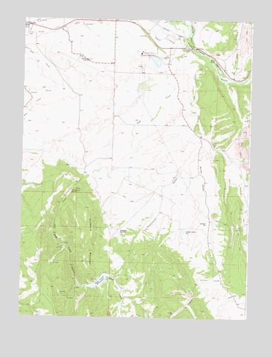
Mount Harris, CO USGS Topographic Map
Click on map above to begin viewing in our Map Viewer.

This topographic map contains these locations and features:
Feature Name Type Latitude Longitude GNIS ID View Map
Ashponds Hayden StationReservoirN40.4829°W107.1775°200007View Map
Bruce Walter MineMineN40.4505°W107.1331°1683220View Map
Grassy CreekStreamN40.4830°W107.1398°171356View Map
Grassy GapGapN40.3847°W107.1326°171346View Map
Hayden CemeteryCemeteryN40.4930°W107.2472°2400531View Map
Hayden Plant Evaporation PondReservoirN40.4900°W107.1873°201411View Map
Hayden Plant Evaporation Pond DamDamN40.4900°W107.1873°201410View Map
Hayden Plant Recycled Water DamDamN40.4883°W107.1856°201412View Map
Hayden Plant Recycled Water ReservoirReservoirN40.4883°W107.1856°201413View Map
Hayden Police DepartmentBuildingN40.4946°W107.2449°2757247View Map
Hayden StationLocaleN40.4861°W107.1856°171344View Map
Hayden Station Ash DamDamN40.4833°W107.1773°200006View Map
Hendricks MineMineN40.4269°W107.2306°1683222View Map
Hillberry MountainSummitN40.4091°W107.2148°171350View Map
J B Dawson Number One ReservoirReservoirN40.4274°W107.2235°171342View Map
KKMX-AM (Hayden)TowerN40.4991°W107.2059°204032View Map
KKMX-AM (Hayden)TowerN40.4991°W107.1967°204033View Map
Marshall Roberts DitchCanalN40.4897°W107.1673°201985View Map
Mount HarrisPopulated PlaceN40.4836°W107.1448°171343View Map
Mount Harris MineMineN40.4789°W107.1364°1683221View Map
Nofstger DamDamN40.4158°W107.1473°201042View Map
Nofstger ReservoirReservoirN40.4143°W107.1478°171347View Map
Nofstger Zeigler ReservoirReservoirN40.4115°W107.1610°171348View Map
Nofstger-Zeigler DamDamN40.4125°W107.1609°199790View Map
Peabody PitMineN40.4486°W107.1289°1683223View Map
Sage CreekStreamN40.4897°W107.1609°171355View Map
Sage Creek CanyonValleyN40.4341°W107.2153°171353View Map
Sage Creek DamDamN40.3900°W107.2062°200008View Map
Sage Creek ReservoirReservoirN40.3901°W107.2063°171354View Map
Scotchmans GulchValleyN40.4455°W107.1446°171352View Map
Shelton DitchCanalN40.4972°W107.2467°201983View Map
Stokes GulchValleyN40.4706°W107.2312°171381View Map
Town of HaydenCivilN40.4852°W107.2423°2412740View Map
Walker DitchCanalN40.4972°W107.2284°201984View Map
Walrod DamDamN40.4933°W107.2006°201386View Map
Walrod ReservoirReservoirN40.4934°W107.2001°201387View Map
Whetstone Number 3 DamDamN40.4111°W107.1959°201088View Map
Whetstone Reservoir Number 3ReservoirN40.4107°W107.1965°171349View Map
Wolf CreekStreamN40.4747°W107.1345°171268View Map
Yampa Valley AirportAirportN40.4846°W107.2209°204440View Map
Yampa Valley Regional Airport Fire DepartmentBuildingN40.4808°W107.2234°2666978View Map

Note: Coordinates in the location and feature list above are referenced to NAD83 datum.


Copyright (C) 2008-2024 Ryan Niemi / Sunset Dynamics ... All Rights Reserved