TopoQuest Logo
Do you find TopoQuest useful?
Help keep TopoQuest running and adding new maps/features by donating!
Bitcoin:  19c7KJd3qBynnjoSw5npx9KScwjBe4ifkT
Litecoin:  LXs6TkuXGGXo1vDsWCkWVdjQX94eUKd6ui
Home View Maps Find Maps Find Places Resources & Links


Hays, Montana Topographic Map

USGS Map Title: Hays, MT
USGS Map MRC: 47108H6
DRG (GeoTIFF) Download: o47108h6.tif


Neighboring USGS Topographic Map Quads:


  Lake Seventeen East, MT  
48108A7
 

  Stiffarm Coulee, MT  
48108A6
 

  Lodge Pole, MT  
48108A5
 

  Crazyman Coulee, MT  
47108H7
 

  Hays, MT  
47108H6
 

  Zortman, MT  
47108H5
 

  Shetland Divide, MT  
47108G7
 

  D Y Junction, MT  
47108G6
 

  Hays SE, MT  
47108G5


Map MRC Location:

N48°
W109°
N48°
W108°
H8 H7 H6 H5 H4 H3 H2 H1
G8 G7 G6 G5 G4 G3 G2 G1
F8 F7 F6 F5 F4 F3 F2 F1
E8 E7 E6 E5 E4 E3 E2 E1
D8 D7 D6 D5 D4 D3 D2 D1
C8 C7 C6 C5 C4 C3 C2 C1
B8 B7 B6 B5 B4 B3 B2 B1
A8 A7 A6 A5 A4 A3 A2 A1
N47°
W109°
N47°
W108°

Hays, MT USGS 1:24K Topographic Map Preview:
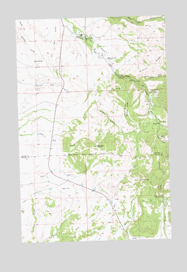
Hays, MT USGS Topographic Map
Click on map above to begin viewing in our Map Viewer.

This topographic map contains these locations and features:
Feature Name Type Latitude Longitude GNIS ID View Map
25N23E10CDDB01 WellWellN47.9311°W108.7485°825223View Map
25N24E04CDDD01 WellWellN47.9447°W108.6396°825250View Map
25N24E04CDDD02 WellWellN47.9444°W108.6393°825249View Map
25N24E09ADBC01 SpringSpringN47.9397°W108.6328°825241View Map
25N24E32DABC01 SpringSpringN47.8765°W108.6580°825144View Map
26N23E23AAD_01 WellWellN47.9997°W108.7146°825438View Map
26N23E23AAD_02 WellWellN47.9997°W108.7138°825437View Map
26N23E23ACAB01 WellWellN47.9975°W108.7210°825429View Map
26N23E23ACAD01 WellWellN47.9969°W108.7188°825418View Map
26N23E23ACAD02 WellWellN47.9969°W108.7190°825419View Map
26N23E23DCAD01 WellWellN47.9903°W108.7202°825390View Map
26N23E23DCAD02 WellWellN47.9903°W108.7193°825389View Map
26N23E23DCBA01 WellWellN47.9900°W108.7193°825384View Map
26N23E23DCBA02 WellWellN47.9897°W108.7190°825382View Map
26N23E24ACC_01 WellWellN47.9955°W108.7027°825411View Map
26N23E24BBC_01 WellWellN47.9997°W108.7127°825436View Map
26N23E24BBDD01 WellWellN47.9992°W108.7093°825434View Map
26N23E24BDB_01 WellWellN47.9969°W108.7060°825417View Map
26N23E24BDBB01 WellWellN47.9980°W108.7074°825430View Map
26N23E24BDC_01 WellWellN47.9955°W108.7068°825412View Map
26N23E24CADD01 WellWellN47.9917°W108.7035°825394View Map
26N23E24DAB_01 WellWellN47.9930°W108.6954°825396View Map
26N23E24DBA_01 WellWellN47.9933°W108.6993°825397View Map
26N23E24DBBC01 WellWellN47.9936°W108.7024°825399View Map
26N23E24DBD_01 WellWellN47.9919°W108.6988°825395View Map
26N23E24DBD_02 WellWellN47.9914°W108.6993°825393View Map
26N23E24DDA_01 WellWellN47.9894°W108.6938°825379View Map
26N23E24DDB_01 WellWellN47.9903°W108.6965°825388View Map
26N23E24DDDB01 WellWellN47.9886°W108.6935°825373View Map
26N23E24DDDB02 WellWellN47.9886°W108.6940°825374View Map
26N23E25AAA_01 WellWellN47.9869°W108.6946°825364View Map
26N23E25AAA_02 WellWellN47.9869°W108.6946°825363View Map
26N23E25AADA01 WellWellN47.9880°W108.6924°825371View Map
26N23E26ACDC01 WellWellN47.9805°W108.7202°825341View Map
26N23E34DABD01 WellWellN47.9642°W108.7379°825293View Map
26N23E35CBDA01 WellWellN47.9636°W108.7299°825290View Map
26N24E04BAAA01 SpringSpringN47.9585°W108.6387°825283View Map
26N24E19AACA01 WellWellN47.9939°W108.6735°825405View Map
26N24E19AACA02 WellWellN47.9939°W108.6735°825406View Map
26N24E19BDCC01 WellWellN47.9958°W108.6860°825414View Map
26N24E19CCB_01 WellWellN47.9900°W108.6915°825383View Map
26N24E19CCB_02 WellWellN47.9903°W108.6918°825386View Map
26N24E19CCB_03 WellWellN47.9903°W108.6921°825387View Map
26N24E19CCD_01 WellWellN47.9883°W108.6879°825372View Map
26N24E19CDC_01 WellWellN47.9880°W108.6857°825370View Map
26N24E19CDC_02 WellWellN47.9897°W108.6854°825381View Map
26N24E19CDC_03 WellWellN47.9880°W108.6854°825369View Map
26N24E19CDC_04 WellWellN47.9878°W108.6857°825367View Map
26N24E20BBBC01 WellWellN47.9997°W108.6696°825435View Map
26N24E30ACB_01 WellWellN47.9833°W108.6790°825354View Map
26N24E30ADC_01 WellWellN47.9814°W108.6757°825344View Map
26N24E30BAC_01 WellWellN47.9858°W108.6852°825361View Map
26N24E30BADB01 WellWellN47.9855°W108.6832°825360View Map
26N24E30BBD_01 WellWellN47.9847°W108.6882°825359View Map
26N24E30BCD_01 WellWellN47.9811°W108.6882°825343View Map
26N24E30BDAC01 WellWellN47.9830°W108.6838°825352View Map
26N24E30BDAC02 WellWellN47.9830°W108.6838°825353View Map
26N24E30BDB_01 WellWellN47.9825°W108.6854°825348View Map
26N24E30BDB_02 WellWellN47.9825°W108.6854°825349View Map
26N24E30BDBA01 WellWellN47.9833°W108.6843°825355View Map
26N24E30BDCB01 WellWellN47.9817°W108.6860°825345View Map
26N24E30CBAA01 WellWellN47.9803°W108.6877°825338View Map
26N24E30CBAA02 WellWellN47.9803°W108.6874°825337View Map
26N24E30CBAC01 WellWellN47.9789°W108.6893°825333View Map
26N24E30CBAD01 WellWellN47.9783°W108.6871°825330View Map
26N24E30CBC_01 WellWellN47.9778°W108.6907°825327View Map
26N24E30CDA_01 WellWellN47.9764°W108.6824°825322View Map
26N24E30DAB_01 WellWellN47.9805°W108.6749°825340View Map
26N24E30DADC01 WellWellN47.9769°W108.6729°825324View Map
26N24E30DADC02 WellWellN47.9769°W108.6729°825325View Map
26N24E30DBB_01 WellWellN47.9789°W108.6788°825332View Map
26N24E30DBC_01 WellWellN47.9783°W108.6790°825329View Map
26N24E30DBD_02 WellWellN47.9783°W108.6763°825328View Map
26N24E30DDAB01 WellWellN47.9764°W108.6721°825321View Map
26N24E31AAAA01 WellWellN47.9730°W108.6718°825317View Map
26N24E31AAD_01 WellWellN47.9705°W108.6718°825311View Map
26N24E31AAD_02 WellWellN47.9705°W108.6715°825310View Map
26N24E31BADC01 WellWellN47.9700°W108.6838°825309View Map
26N24E31BDDC01 WellWellN47.9664°W108.6840°825297View Map
26N24E32BCBA01 WellWellN47.9697°W108.6682°825307View Map
26N24E32DACB01 SpringSpringN47.9639°W108.6538°825291View Map
Abbot FlatFlatN47.9047°W108.7124°768101View Map
Alliance Bible ChurchChurchN47.9878°W108.6910°1722221View Map
Bone SpringSpringN47.9586°W108.6385°769097View Map
Bradley CanyonValleyN47.9522°W108.6857°769181View Map
Eagle Child MountainSummitN47.9275°W108.6857°770952View Map
Fort Belknap Volunteer Fire Department HaysBuildingN47.9904°W108.6959°2546534View Map
Fort Belknap Youth CampLocaleN47.9567°W108.6402°771508View Map
Gannon RidgeRidgeN47.8883°W108.7377°771696View Map
HaysPopulated PlaceN47.9892°W108.6943°772273View Map
Hays CemeteryCemeteryN47.9894°W108.7126°1722219View Map
Hays Post OfficePost OfficeN47.9884°W108.6912°1722380View Map
Hays-Lodge Pole SchoolSchoolN47.9903°W108.6960°1722308View Map
Indian PeakSummitN47.9083°W108.6485°772697View Map
King CreekStreamN47.9394°W108.6324°773044View Map
King SpringSpringN47.9397°W108.6327°773051View Map
Landusky CemeteryCemeteryN47.8958°W108.6302°773212View Map
Macmeal RidgeRidgeN47.9486°W108.6602°773792View Map
McConnell CemeteryCemeteryN47.9608°W108.7340°1722220View Map
Mission CanyonValleyN47.9680°W108.6674°774282View Map
Mission RidgeRidgeN47.9789°W108.6279°774295View Map
Montana GulchValleyN47.8969°W108.6318°774345View Map
Montana Gulch CampgroundLocaleN47.8983°W108.6327°774346View Map
North Fork Little Peoples CreekStreamN47.9642°W108.6529°774774View Map
Pine GrovePopulated PlaceN47.9994°W108.6813°1722426View Map
Saint Pauls MissionChurchN47.9769°W108.6732°1722213View Map
Saint Pauls MissionSchoolN47.9772°W108.6727°776129View Map
Saint Pauls Mission CemeteryCemeteryN47.9736°W108.6713°1722222View Map
Saint Pauls Post Office (historical)Post OfficeN47.9772°W108.6727°1722418View Map
South Big Horn CreekStreamN47.9508°W108.6393°776756View Map
South Fork Little Peoples CreekStreamN47.9639°W108.6529°776845View Map
Warneke SpringSpringN47.9765°W108.7290°778119View Map
White Cow CanyonValleyN47.9997°W108.6668°778372View Map
Wilson ParkFlatN47.9519°W108.6399°778571View Map

Note: Coordinates in the location and feature list above are referenced to NAD83 datum.


Copyright (C) 2008-2025 Ryan Niemi / Sunset Dynamics ... All Rights Reserved