TopoQuest Logo
Do you find TopoQuest useful?
Help keep TopoQuest running and adding new maps/features by donating!
Bitcoin:  19c7KJd3qBynnjoSw5npx9KScwjBe4ifkT
Litecoin:  LXs6TkuXGGXo1vDsWCkWVdjQX94eUKd6ui
Home View Maps Find Maps Find Places Resources & Links


Axehandle Butte, Oregon Topographic Map

USGS Map Title: Axehandle Butte, OR
USGS Map MRC: 44120F6
DRG (GeoTIFF) Download: o44120f6.tif


Neighboring USGS Topographic Map Quads:


  Degner Canyon, OR  
44120G7
 

  Donnybrook, OR  
44120G6
 

  Arrastra Butte, OR  
44120G5
 

  Ashwood, OR  
44120F7
 

  Axehandle Butte, OR  
44120F6
 

  Horse Heaven Creek, OR  
44120F5
 

  Foley Butte, OR  
44120E7
 

  Dutchman Creek, OR  
44120E6
 

  Opal Mountain, OR  
44120E5


Map MRC Location:

N45°
W121°
N45°
W120°
H8 H7 H6 H5 H4 H3 H2 H1
G8 G7 G6 G5 G4 G3 G2 G1
F8 F7 F6 F5 F4 F3 F2 F1
E8 E7 E6 E5 E4 E3 E2 E1
D8 D7 D6 D5 D4 D3 D2 D1
C8 C7 C6 C5 C4 C3 C2 C1
B8 B7 B6 B5 B4 B3 B2 B1
A8 A7 A6 A5 A4 A3 A2 A1
N44°
W121°
N44°
W120°

Axehandle Butte, OR USGS 1:24K Topographic Map Preview:
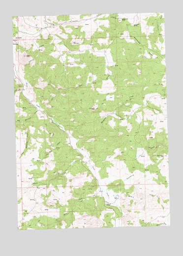
Axehandle Butte, OR USGS Topographic Map
Click on map above to begin viewing in our Map Viewer.

This topographic map contains these locations and features:
Feature Name Type Latitude Longitude GNIS ID View Map
Amity CreekStreamN44.6379°W120.6720°1116918View Map
Ash ButteSummitN44.7365°W120.7473°1136015View Map
Axehandle ButteSummitN44.7460°W120.6620°1117106View Map
Axehandle MineMineN44.7471°W120.6667°1117107View Map
Axehandle RidgeRidgeN44.7201°W120.6306°1117108View Map
Axehandle SpringSpringN44.7427°W120.6518°1117109View Map
Beaver CreekStreamN44.6471°W120.6806°1137821View Map
Big Whetstone CreekStreamN44.6960°W120.7309°1117689View Map
Calf GulchValleyN44.6962°W120.7284°1118462View Map
Clover CreekStreamN44.6704°W120.6986°1119034View Map
Cultus CreekStreamN44.7071°W120.7439°1119620View Map
Fools HollowValleyN44.7226°W120.7467°1120868View Map
Gooseberry CreekStreamN44.6457°W120.6800°1121251View Map
Gooseberry MountainSummitN44.6657°W120.6298°1121252View Map
Grater ButteSummitN44.7262°W120.7409°1121328View Map
Iron MountainSummitN44.7335°W120.7025°1122277View Map
Little Whetstone CreekStreamN44.6887°W120.7436°1123309View Map
Norton RanchLocaleN44.6415°W120.6686°1124853View Map
Rufus Elementary School (historical)SchoolN44.6935°W120.7386°1161818View Map
Thompson CreekStreamN44.6715°W120.7006°1128028View Map
Thompson PeakSummitN44.6946°W120.6850°1128031View Map
Tin Can DrawValleyN44.6754°W120.7061°1128117View Map
Tompkins ButteSummitN44.7112°W120.6268°1131065View Map

Note: Coordinates in the location and feature list above are referenced to NAD83 datum.


Copyright (C) 2008-2024 Ryan Niemi / Sunset Dynamics ... All Rights Reserved