TopoQuest Logo
Do you find TopoQuest useful?
Help keep TopoQuest running and adding new maps/features by donating!
Bitcoin:  19c7KJd3qBynnjoSw5npx9KScwjBe4ifkT
Litecoin:  LXs6TkuXGGXo1vDsWCkWVdjQX94eUKd6ui
Home View Maps Find Maps Find Places Resources & Links


Ellendale, Minnesota Topographic Map

USGS Map Title: Ellendale, MN
USGS Map MRC: 43093G3
DRG (GeoTIFF) Download: o43093g3.tif


Neighboring USGS Topographic Map Quads:


  New Richland, MN  
43093H4
 

  Hope, MN  
43093H3
 

  Steele Center, MN  
43093H2
 

  Hartland, MN  
43093G4
 

  Ellendale, MN  
43093G3
 

  Hollandale, MN  
43093G2
 

  Albert Lea West, MN  
43093F4
 

  Albert Lea East, MN  
43093F3
 

  Hayward, MN  
43093F2


Map MRC Location:

N44°
W94°
N44°
W93°
H8 H7 H6 H5 H4 H3 H2 H1
G8 G7 G6 G5 G4 G3 G2 G1
F8 F7 F6 F5 F4 F3 F2 F1
E8 E7 E6 E5 E4 E3 E2 E1
D8 D7 D6 D5 D4 D3 D2 D1
C8 C7 C6 C5 C4 C3 C2 C1
B8 B7 B6 B5 B4 B3 B2 B1
A8 A7 A6 A5 A4 A3 A2 A1
N43°
W94°
N43°
W93°

Ellendale, MN USGS 1:24K Topographic Map Preview:
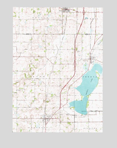
Ellendale, MN USGS Topographic Map
Click on map above to begin viewing in our Map Viewer.

This topographic map contains these locations and features:
Feature Name Type Latitude Longitude GNIS ID View Map
Assembly of God ChurchChurchN43.8708°W93.3024°2051364View Map
City of Clarks GroveCivilN43.7619°W93.3291°2393539View Map
City of EllendaleCivilN43.8724°W93.2968°2394661View Map
City of GenevaCivilN43.8219°W93.2681°2394876View Map
Clarks GrovePopulated PlaceN43.7638°W93.3291°641253View Map
Clarks GroveLocaleN43.7619°W93.3322°2049865View Map
Clarks Grove - Waseca ClinicHospitalN43.7638°W93.3291°2049864View Map
Clarks Grove CemeteryCemeteryN43.7677°W93.3099°641254View Map
Clarks Grove City HallBuildingN43.7638°W93.3291°2049863View Map
Clarks Grove Post OfficePost OfficeN43.7638°W93.3291°2049860View Map
Clarks Grove Volunteer Fire DepartmentBuildingN43.7644°W93.3297°2666327View Map
Community Lutheran ChurchChurchN43.8200°W93.2666°2049837View Map
County Ditch Number EightCanalN43.8180°W93.3285°642317View Map
County Ditch Number FortysixCanalN43.8291°W93.3605°642119View Map
County Ditch Number SixtyfourCanalN43.8363°W93.2677°642247View Map
County Ditch Number SixtythreeCanalN43.7663°W93.3713°642242View Map
County Ditch Number ThirtyCanalN43.7652°W93.2852°641937View Map
EllendalePopulated PlaceN43.8727°W93.3013°643279View Map
EllendaleLocaleN43.8722°W93.3002°2051361View Map
Ellendale Ambulance ServiceBuildingN43.8724°W93.3018°2721383View Map
Ellendale Post OfficePost OfficeN43.8722°W93.3007°2051359View Map
Ellendale Public SchoolSchoolN43.8713°W93.2974°2051365View Map
Ellendale Volunteer Fire DepartmentBuildingN43.8724°W93.3004°2051360View Map
First Baptist ChurchChurchN43.7638°W93.3291°2049862View Map
First Lutheran CemeteryCemeteryN43.8619°W93.3058°2051366View Map
First Lutheran ChurchChurchN43.8719°W93.3047°2051363View Map
GenevaPopulated PlaceN43.8233°W93.2677°644066View Map
Geneva CemeteryCemeteryN43.8300°W93.2685°2049892View Map
Geneva City HallBuildingN43.8233°W93.2677°2049838View Map
Geneva Fire DepartmentBuildingN43.8237°W93.2669°2049840View Map
Geneva LakeReservoirN43.7713°W93.2719°644068View Map
Geneva Lake DamDamN43.7713°W93.2719°1776493View Map
Geneva Post OfficePost OfficeN43.8213°W93.2674°2049836View Map
Hillcrest Mobile Home ParkPopulated PlaceN43.7638°W93.3291°2049861View Map
Interchange 18CrossingN43.7638°W93.3213°2049875View Map
Interchange 22CrossingN43.8180°W93.2885°2049874View Map
Interchange 26CrossingN43.8700°W93.2766°2051411View Map
Judicial Ditch Number TwentythreeCanalN43.8411°W93.2516°645858View Map
KRGR-FM (Albert Lea)TowerN43.8677°W93.2713°663278View Map
North Freeborn ChurchChurchN43.7916°W93.3649°648644View Map
Township of BathCivilN43.8047°W93.3494°663520View Map
United Methodist ChurchChurchN43.8736°W93.3035°2051362View Map

Note: Coordinates in the location and feature list above are referenced to NAD83 datum.


Copyright (C) 2008-2024 Ryan Niemi / Sunset Dynamics ... All Rights Reserved