TopoQuest Logo
Do you find TopoQuest useful?
Help keep TopoQuest running and adding new maps/features by donating!
Bitcoin:  19c7KJd3qBynnjoSw5npx9KScwjBe4ifkT
Litecoin:  LXs6TkuXGGXo1vDsWCkWVdjQX94eUKd6ui
Home View Maps Find Maps Find Places Resources & Links


Hazens Notch, Vermont Topographic Map

USGS Map Title: Hazens Notch, VT
USGS Map MRC: 44072G5
DRG (GeoTIFF) Download: o44072g5.tif


Neighboring USGS Topographic Map Quads:


  Richford, VT  
44072H6
 

  Jay Peak, VT  
44072H5
 

  North Troy, VT  
44072H4
 

  Cold Hollow Mountains, VT  
44072G6
 

  Hazens Notch, VT  
44072G5
 

  Lowell, VT  
44072G4
 

  Johnson, VT  
44072F6
 

  Eden, VT  
44072F5
 

  Albany, VT  
44072F4


Map MRC Location:

N45°
W73°
N45°
W72°
H8 H7 H6 H5 H4 H3 H2 H1
G8 G7 G6 G5 G4 G3 G2 G1
F8 F7 F6 F5 F4 F3 F2 F1
E8 E7 E6 E5 E4 E3 E2 E1
D8 D7 D6 D5 D4 D3 D2 D1
C8 C7 C6 C5 C4 C3 C2 C1
B8 B7 B6 B5 B4 B3 B2 B1
A8 A7 A6 A5 A4 A3 A2 A1
N44°
W73°
N44°
W72°

Hazens Notch, VT USGS 1:24K Topographic Map Preview:
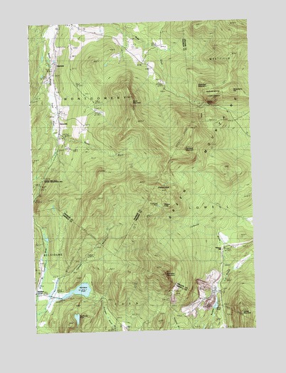
Hazens Notch, VT USGS Topographic Map
Click on map above to begin viewing in our Map Viewer.

This topographic map contains these locations and features:
Feature Name Type Latitude Longitude GNIS ID View Map
Averys Gore State Wildlife Management AreaParkN44.8120°W72.6218°1920525View Map
Bayley Hazen Military Road TrailTrailN44.8400°W72.5301°1921677View Map
Belvidere MountainSummitN44.7734°W72.5515°1456387View Map
Belvidere PondLakeN44.7670°W72.5994°1456389View Map
Belyidere CornersLocaleN44.7664°W72.6240°1456388View Map
Big Muddy PondLakeN44.7559°W72.6013°1456417View Map
Burnt MountainSummitN44.8417°W72.5665°1456676View Map
Burroughs CemeteryCemeteryN44.7726°W72.6118°1918293View Map
Calavale BrookStreamN44.7606°W72.6171°1456717View Map
Corez PondLakeN44.7594°W72.5226°1457021View Map
Hadley MountainSummitN44.7548°W72.5054°1457681View Map
Haystack MountainSummitN44.8253°W72.5384°1457778View Map
Hazens NotchGapN44.8409°W72.5232°1920017View Map
Hazens Notch State ForestForestN44.8445°W72.5204°1920018View Map
Hazens Notch State Forest ParkParkN44.8412°W72.5148°1457781View Map
HectorvillePopulated PlaceN44.8384°W72.6085°1457789View Map
Hectorville Covered BridgeBridgeN44.8587°W72.6121°1920638View Map
HutchinsPopulated PlaceN44.8595°W72.6098°1457949View Map
Hutchins Covered BridgeBridgeN44.8534°W72.6129°1920660View Map
Lockwood BrookStreamN44.7753°W72.5073°1458258View Map
Lockwood PondReservoirN44.8009°W72.5535°1920050View Map
Montgomery Free LibraryBuildingN44.8748°W72.6007°1920819View Map
Pacific BrookStreamN44.8303°W72.6098°1458871View Map
Roegan Road CemeteryCemeteryN44.8378°W72.5926°1920734View Map
Roegan Road CemeteryCemeteryN44.8496°W72.5982°1920735View Map
Strawberry HillSummitN44.8442°W72.5004°1459752View Map
Sugarloaf MountainSummitN44.8445°W72.5212°1459773View Map
Tamarack BrookStreamN44.8520°W72.6135°1459819View Map
Tillotson CampLocaleN44.8003°W72.5496°1459906View Map
Tillotson MillPopulated PlaceN44.7820°W72.5176°1460464View Map
Tillotson PeakSummitN44.8056°W72.5509°1459907View Map
Town of MontgomeryCivilN44.8597°W72.6044°1462151View Map

Note: Coordinates in the location and feature list above are referenced to NAD83 datum.


Copyright (C) 2008-2025 Ryan Niemi / Sunset Dynamics ... All Rights Reserved