TopoQuest Logo
Do you find TopoQuest useful?
Help keep TopoQuest running and adding new maps/features by donating!
Bitcoin:  19c7KJd3qBynnjoSw5npx9KScwjBe4ifkT
Litecoin:  LXs6TkuXGGXo1vDsWCkWVdjQX94eUKd6ui
Home View Maps Find Maps Find Places Resources & Links


Lowell, Vermont Topographic Map

USGS Map Title: Lowell, VT
USGS Map MRC: 44072G4
DRG (GeoTIFF) Download: o44072g4.tif


Neighboring USGS Topographic Map Quads:


  Jay Peak, VT  
44072H5
 

  North Troy, VT  
44072H4
 

  Newport Center, VT  
44072H3
 

  Hazens Notch, VT  
44072G5
 

  Lowell, VT  
44072G4
 

  Irasburg, VT  
44072G3
 

  Eden, VT  
44072F5
 

  Albany, VT  
44072F4
 

  Craftsbury, VT  
44072F3


Map MRC Location:

N45°
W73°
N45°
W72°
H8 H7 H6 H5 H4 H3 H2 H1
G8 G7 G6 G5 G4 G3 G2 G1
F8 F7 F6 F5 F4 F3 F2 F1
E8 E7 E6 E5 E4 E3 E2 E1
D8 D7 D6 D5 D4 D3 D2 D1
C8 C7 C6 C5 C4 C3 C2 C1
B8 B7 B6 B5 B4 B3 B2 B1
A8 A7 A6 A5 A4 A3 A2 A1
N44°
W73°
N44°
W72°

Lowell, VT USGS 1:24K Topographic Map Preview:
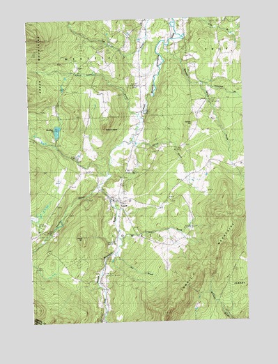
Lowell, VT USGS Topographic Map
Click on map above to begin viewing in our Map Viewer.

This topographic map contains these locations and features:
Feature Name Type Latitude Longitude GNIS ID View Map
Ace BrookStreamN44.7784°W72.4512°1456105View Map
Browns LedgesSummitN44.8309°W72.4546°1456609View Map
Burgess BranchStreamN44.8064°W72.4601°1456656View Map
East Branch Missisquoi RiverStreamN44.8070°W72.4590°1457255View Map
Evergreen CemeteryCemeteryN44.8563°W72.4021°1919997View Map
Farman HillSummitN44.8323°W72.4043°1457410View Map
Federated ChurchChurchN44.8012°W72.4479°1919999View Map
Hitchcock SchoolSchoolN44.8495°W72.3976°1457845View Map
Le Clair BrookStreamN44.8250°W72.4384°1458178View Map
Leland HillSummitN44.7864°W72.4679°1458193View Map
LowellPopulated PlaceN44.7992°W72.4482°1458296View Map
Lowell Census Designated PlaceCensusN44.7952°W72.4449°2586642View Map
Lowell Graded SchoolSchoolN44.8054°W72.4487°1920056View Map
Lowell MountainsRangeN44.7767°W72.3912°1458297View Map
Lowell Municipal ForestForestN44.7728°W72.3876°1920053View Map
Lowell PlainLocaleN44.8006°W72.4473°1920054View Map
Lowell Post OfficePost OfficeN44.8011°W72.4529°2760008View Map
Lowell Post Office (historical)Post OfficeN44.8014°W72.4543°1920055View Map
Lowell Volunteer Fire DepartmentBuildingN44.8008°W72.4484°2121428View Map
McAllister PondReservoirN44.8293°W72.4832°1458388View Map
Mineral Spring BrookStreamN44.8642°W72.4182°1458488View Map
Mountainview CemeteryCemeteryN44.8003°W72.4459°1920070View Map
Old Catholic CemeteryCemeteryN44.7992°W72.4508°1920085View Map
Saint Ignatius CemeteryCemeteryN44.8090°W72.4458°1459712View Map
Shortsleve Mink Farm (historical)LocaleN44.7753°W72.4579°1920116View Map
Snider BrookStreamN44.8356°W72.4348°1459552View Map
Tamarack BrookStreamN44.8495°W72.3976°1459818View Map
Town of LowellCivilN44.7915°W72.4568°1462137View Map
Truland BrookStreamN44.7842°W72.4490°1459959View Map

Note: Coordinates in the location and feature list above are referenced to NAD83 datum.


Copyright (C) 2008-2024 Ryan Niemi / Sunset Dynamics ... All Rights Reserved