TopoQuest Logo
Do you find TopoQuest useful?
Help keep TopoQuest running and adding new maps/features by donating!
Bitcoin:  19c7KJd3qBynnjoSw5npx9KScwjBe4ifkT
Litecoin:  LXs6TkuXGGXo1vDsWCkWVdjQX94eUKd6ui
Home View Maps Find Maps Find Places Resources & Links


Johnson, Vermont Topographic Map

USGS Map Title: Johnson, VT
USGS Map MRC: 44072F6
DRG (GeoTIFF) Download: o44072f6.tif


Neighboring USGS Topographic Map Quads:


  Bakersfield, VT  
44072G7
 

  Cold Hollow Mountains, VT  
44072G6
 

  Hazens Notch, VT  
44072G5
 

  Jeffersonville, VT  
44072F7
 

  Johnson, VT  
44072F6
 

  Eden, VT  
44072F5
 

  Mount Mansfield, VT  
44072E7
 

  Sterling Mountain, VT  
44072E6
 

  Morrisville, VT  
44072E5


Map MRC Location:

N45°
W73°
N45°
W72°
H8 H7 H6 H5 H4 H3 H2 H1
G8 G7 G6 G5 G4 G3 G2 G1
F8 F7 F6 F5 F4 F3 F2 F1
E8 E7 E6 E5 E4 E3 E2 E1
D8 D7 D6 D5 D4 D3 D2 D1
C8 C7 C6 C5 C4 C3 C2 C1
B8 B7 B6 B5 B4 B3 B2 B1
A8 A7 A6 A5 A4 A3 A2 A1
N44°
W73°
N44°
W72°

Johnson, VT USGS 1:24K Topographic Map Preview:
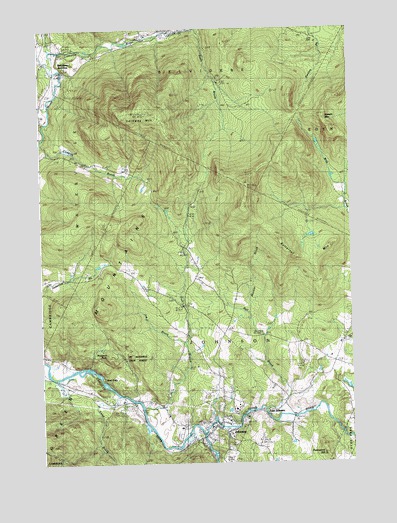
Johnson, VT USGS Topographic Map
Click on map above to begin viewing in our Map Viewer.

This topographic map contains these locations and features:
Feature Name Type Latitude Longitude GNIS ID View Map
Barrows CampLocaleN44.6895°W72.7243°1456277View Map
Basin BrookStreamN44.7498°W72.6846°1456289View Map
Bell BrookStreamN44.6459°W72.6507°1456378View Map
Belvidere Center CemeteryCemeteryN44.7478°W72.7007°1918286View Map
Belvidere Elementary SchoolSchoolN44.7471°W72.7015°1918289View Map
Belvidere JunctionPopulated PlaceN44.7370°W72.7426°1456385View Map
Bowen MountainSummitN44.7203°W72.6332°1456531View Map
Butternut MountainSummitN44.6895°W72.6526°1456699View Map
Center CemeteryCemeteryN44.7487°W72.6973°1456817View Map
Christy SchoolSchoolN44.6548°W72.6318°1456889View Map
Clark Family CemeteryCemeteryN44.6317°W72.6476°1918312View Map
East JohnsonPopulated PlaceN44.6401°W72.6615°1457295View Map
Evergreen Ledge CemeteryCemeteryN44.6445°W72.7282°1918330View Map
Fields of Harvest MinistriesSchoolN44.6358°W72.6804°2427366View Map
Foot BrookStreamN44.6414°W72.7098°1457468View Map
Gihon RiverStreamN44.6339°W72.6848°1457539View Map
Hillside SchoolSchoolN44.6626°W72.6923°1457837View Map
Hyde Park DamDamN44.6317°W72.6262°1766652View Map
Ithiel FallsPopulated PlaceN44.6492°W72.7246°1460426View Map
Joe BrookStreamN44.6595°W72.6923°1458014View Map
John Dewey LibraryBuildingN44.6398°W72.6726°1918372View Map
JohnsonPopulated PlaceN44.6356°W72.6804°1458021View Map
Johnson Elementary SchoolSchoolN44.6371°W72.6751°1918373View Map
Johnson Fire DepartmentBuildingN44.6361°W72.6840°2121417View Map
Johnson Post OfficePost OfficeN44.6354°W72.6816°1918374View Map
Johnson Shopping CenterLocaleN44.6353°W72.6823°1918376View Map
Johnson State CollegeSchoolN44.6411°W72.6717°1459685View Map
Lamoille County Grammar School (historical)SchoolN44.6431°W72.6723°1918383View Map
Lamoille View CemeteryCemeteryN44.6323°W72.6807°1918387View Map
Laraway MountainSummitN44.7270°W72.7107°1458167View Map
Laraway SchoolSchoolN44.6368°W72.6762°2427372View Map
Locke SchoolSchoolN44.7337°W72.7451°1458257View Map
Masonic TempleChurchN44.6367°W72.6779°1918394View Map
Mill Covered BridgeBridgeN44.7439°W72.7410°1918396View Map
Morgan Covered BridgeBridgeN44.7434°W72.7279°1918398View Map
Muckler BrookStreamN44.6673°W72.6654°1458593View Map
North Fork North Branch Lamoille RiverStreamN44.7478°W72.7037°1458734View Map
Northern Emergency Medical ServicesBuildingN44.6534°W72.6308°2578081View Map
Parker CampLocaleN44.7103°W72.6826°1458893View Map
Plot CemeteryCemeteryN44.6655°W72.6814°1459012View Map
Power House Covered BridgeBridgeN44.6362°W72.6710°1918436View Map
Prospect RockSummitN44.6556°W72.7218°1459089View Map
Saint Johns Catholic ChurchChurchN44.6328°W72.6737°1918442View Map
Scribner Covered BridgeBridgeN44.6381°W72.6482°1918447View Map
Smith BrookStreamN44.6445°W72.7187°1459538View Map
Streeter BrookStreamN44.7420°W72.7440°1459755View Map
The Church of Jesus Christ of Latter Day SaintsChurchN44.6364°W72.6810°1918309View Map
Town of JohnsonCivilN44.6484°W72.6845°1462129View Map
United Church of JohnsonChurchN44.6356°W72.6801°1918476View Map
Vermont Studio SchoolSchoolN44.6348°W72.6782°1918477View Map
Vermont Studio School Lecture HallBuildingN44.6359°W72.6782°1918479View Map
Village of JohnsonCivilN44.6366°W72.6786°2378311View Map
Waterville Elementary SchoolSchoolN44.7269°W72.7484°1918484View Map
Whitting Hill CemeteryCemeteryN44.6342°W72.6758°1918491View Map
WJSC-FM (Johnson)TowerN44.6414°W72.6718°1461891View Map

Note: Coordinates in the location and feature list above are referenced to NAD83 datum.


Copyright (C) 2008-2024 Ryan Niemi / Sunset Dynamics ... All Rights Reserved