TopoQuest Logo
Do you find TopoQuest useful?
Help keep TopoQuest running and adding new maps/features by donating!
Bitcoin:  19c7KJd3qBynnjoSw5npx9KScwjBe4ifkT
Litecoin:  LXs6TkuXGGXo1vDsWCkWVdjQX94eUKd6ui
Home View Maps Find Maps Find Places Resources & Links


Headlight Butte, Montana Topographic Map

USGS Map Title: Headlight Butte, MT
USGS Map MRC: 48112G3
DRG (GeoTIFF) Download: o48112g3.tif


Neighboring USGS Topographic Map Quads:


  Headlight Butte NW, MT  
48112H4
 

  Headlight Butte NE, MT  
48112H3
 

  Fitzpatrick Lake, MT  
48112H2
 

  Dead Indian Spring, MT  
48112G4
 

  Headlight Butte, MT  
48112G3
 

  Glacier Colony, MT  
48112G2
 

  Gunsight, MT  
48112F4
 

  Cut Bank, MT  
48112F3
 

  Ethridge NW, MT  
48112F2


Map MRC Location:

N49°
W113°
N49°
W112°
H8 H7 H6 H5 H4 H3 H2 H1
G8 G7 G6 G5 G4 G3 G2 G1
F8 F7 F6 F5 F4 F3 F2 F1
E8 E7 E6 E5 E4 E3 E2 E1
D8 D7 D6 D5 D4 D3 D2 D1
C8 C7 C6 C5 C4 C3 C2 C1
B8 B7 B6 B5 B4 B3 B2 B1
A8 A7 A6 A5 A4 A3 A2 A1
N48°
W113°
N48°
W112°

Headlight Butte, MT USGS 1:24K Topographic Map Preview:
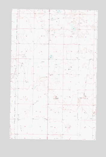
Headlight Butte, MT USGS Topographic Map
Click on map above to begin viewing in our Map Viewer.

This topographic map contains these locations and features:
Feature Name Type Latitude Longitude GNIS ID View Map
35N05W04AA__01 WellWellN48.8250°W112.2570°1636732View Map
35N05W05AD__01 WellWellN48.8214°W112.2787°1636710View Map
35N05W05DD__01 WellWellN48.8142°W112.2787°1636678View Map
35N05W05DDD_01 WellWellN48.8136°W112.2787°1636673View Map
35N05W07BB__01 WellWellN48.8105°W112.3167°1636662View Map
35N05W07CC__01 WellWellN48.7997°W112.3167°1636604View Map
35N05W16AC__01 WellWellN48.7925°W112.2623°1636563View Map
35N05W19CB__01 WellWellN48.7742°W112.3167°1636477View Map
35N05W20BB__01 WellWellN48.7814°W112.2951°1636516View Map
35N05W20BB__02 WellWellN48.7814°W112.2951°1636517View Map
35N05W20DC__01 WellWellN48.7705°W112.2839°1636454View Map
35N05W21DA__01 WellWellN48.7742°W112.2570°1636476View Map
35N05W22CB__01 WellWellN48.7742°W112.2514°1636474View Map
35N05W22CB__02 WellWellN48.7742°W112.2514°1636475View Map
35N05W27CC__01 WellWellN48.7561°W112.2514°1636384View Map
35N05W30AD__01 WellWellN48.7633°W112.3003°1636418View Map
35N05W34BB__01 WellWellN48.7525°W112.2514°1636377View Map
35N05W34BB__02 WellWellN48.7525°W112.2514°1636378View Map
35N06W02AA__01 WellWellN48.8247°W112.3448°1636729View Map
35N06W02DD__01 WellWellN48.8139°W112.3448°1636674View Map
35N06W11CB__01 WellWellN48.8030°W112.3612°1636620View Map
35N06W12CC__01 WellWellN48.7994°W112.3392°1636602View Map
35N06W14CB__01 WellWellN48.7886°W112.3612°1636545View Map
35N06W23CD__01 WellWellN48.7703°W112.3556°1636453View Map
35N06W26CD__01 WellWellN48.7558°W112.3556°1636383View Map
36N05W19BC__01 WellWellN48.8667°W112.3173°1636865View Map
36N05W31BC__01 WellWellN48.8378°W112.3173°1636775View Map
36N05W32BC__01 WellWellN48.8378°W112.2956°1636774View Map
36N05W33BC__01 WellWellN48.8378°W112.2739°1636773View Map
36N05W33CBBC01 WellWellN48.8330°W112.2762°1636753View Map
36N06W25DD__01 WellWellN48.8442°W112.3239°1636800View Map
36N06W34DD__01 WellWellN48.8297°W112.3673°1636745View Map
36N06W35DA__01 WellWellN48.8333°W112.3456°1636754View Map
36N06W35DC__01 WellWellN48.8297°W112.3509°1636744View Map
Cut Bank DivisionCivilN48.7613°W112.2716°1940594View Map
Headlight ButteSummitN48.7897°W112.3101°772288View Map
Omicron DamDamN48.8567°W112.2842°798489View Map
Tipville (historical)Populated PlaceN48.8514°W112.3203°1750411View Map
Whetstone CampLocaleN48.7694°W112.3642°778343View Map

Note: Coordinates in the location and feature list above are referenced to NAD83 datum.


Copyright (C) 2008-2025 Ryan Niemi / Sunset Dynamics ... All Rights Reserved