TopoQuest Logo
Do you find TopoQuest useful?
Help keep TopoQuest running and adding new maps/features by donating!
Bitcoin:  19c7KJd3qBynnjoSw5npx9KScwjBe4ifkT
Litecoin:  LXs6TkuXGGXo1vDsWCkWVdjQX94eUKd6ui
Home View Maps Find Maps Find Places Resources & Links


Headlight Butte NE, Montana Topographic Map

USGS Map Title: Headlight Butte NE, MT
USGS Map MRC: 48112H3
DRG (GeoTIFF) Download: o48112h3.tif


Neighboring USGS Topographic Map Quads:


  Headlight Butte NW, MT  
48112H4
 

  Headlight Butte NE, MT  
48112H3
 

  Fitzpatrick Lake, MT  
48112H2
 

  Dead Indian Spring, MT  
48112G4
 

  Headlight Butte, MT  
48112G3
 

  Glacier Colony, MT  
48112G2


Map MRC Location:

N49°
W113°
N49°
W112°
H8 H7 H6 H5 H4 H3 H2 H1
G8 G7 G6 G5 G4 G3 G2 G1
F8 F7 F6 F5 F4 F3 F2 F1
E8 E7 E6 E5 E4 E3 E2 E1
D8 D7 D6 D5 D4 D3 D2 D1
C8 C7 C6 C5 C4 C3 C2 C1
B8 B7 B6 B5 B4 B3 B2 B1
A8 A7 A6 A5 A4 A3 A2 A1
N48°
W113°
N48°
W112°

Headlight Butte NE, MT USGS 1:24K Topographic Map Preview:
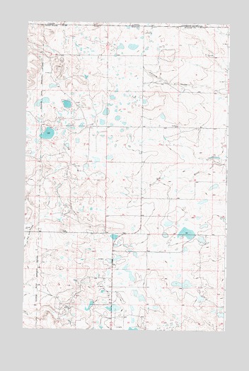
Headlight Butte NE, MT USGS Topographic Map
Click on map above to begin viewing in our Map Viewer.

This topographic map contains these locations and features:
Feature Name Type Latitude Longitude GNIS ID View Map
36N05W04AB__01 WellWellN48.9133°W112.2628°1637025View Map
36N05W04DB__01 WellWellN48.9061°W112.2628°1636999View Map
36N05W09BC__01 WellWellN48.8958°W112.2737°1636958View Map
36N05W17BA__01 WellWellN48.8844°W112.2901°1636929View Map
36N06W02DA__01 WellWellN48.9058°W112.3456°1636996View Map
36N06W12AC__01 WellWellN48.8950°W112.3292°1636952View Map
36N06W12BC__01 WellWellN48.8950°W112.3401°1636953View Map
36N06W13AA__01 WellWellN48.8842°W112.3239°1636923View Map
36N06W14BA__01 WellWellN48.8842°W112.3564°1636924View Map
37N05W06CB__01 WellWellN48.9914°W112.3212°1637332View Map
37N05W07AD__01 WellWellN48.9805°W112.3048°1637282View Map
37N05W08DD__01 WellWellN48.9733°W112.2828°1637250View Map
37N05W19DA__01 WellWellN48.9478°W112.3048°1637152View Map
37N05W20DC__01 WellWellN48.9442°W112.2884°1637137View Map
37N05W21AB__01 WellWellN48.9550°W112.2664°1637178View Map
37N05W29DD__01 WellWellN48.9297°W112.2828°1637079View Map
37N05W30DD__01 WellWellN48.9297°W112.3048°1637080View Map
37N06W01CB__01 WellWellN48.9914°W112.3448°1637333View Map
37N06W03DA__01 WellWellN48.9914°W112.3723°1637334View Map
37N06W24AB__01 WellWellN48.9550°W112.3339°1637179View Map
37N06W24CD__01 WellWellN48.9442°W112.3392°1637138View Map
37N06W24CD__02 WellWellN48.9442°W112.3392°1637139View Map
37N06W26AC__01 WellWellN48.9369°W112.3559°1637108View Map
37N06W35CB__01 WellWellN48.9189°W112.3667°1637049View Map
37N06W36DD__01 WellWellN48.9153°W112.3284°1637036View Map
Korner (historical)Populated PlaceN48.9111°W112.3203°1750465View Map
Korner Post Office (historical)Post OfficeN48.9111°W112.3203°1750464View Map
Lukins LakeLakeN48.9542°W112.3615°1750584View Map
Red River School (historical)SchoolN48.9578°W112.2809°775655View Map
Tsadi DamDamN48.8833°W112.3209°798488View Map
Upsilon DamDamN48.8850°W112.3326°798487View Map
Vasboe DamDamN48.9450°W112.2576°798542View Map

Note: Coordinates in the location and feature list above are referenced to NAD83 datum.


Copyright (C) 2008-2025 Ryan Niemi / Sunset Dynamics ... All Rights Reserved